-
Welcome to this forum . We are a worldwide group with a common interest in Birmingham and its history. While here, please follow a few simple rules. We ask that you respect other members, thank those who have helped you and please keep your contributions on-topic with the thread.
We do hope you enjoy your visit. BHF Admin Team
You are using an out of date browser. It may not display this or other websites correctly.
You should upgrade or use an alternative browser.
You should upgrade or use an alternative browser.
Calthorpe Park
- Thread starter chucka
- Start date
Phil
Gone, but not forgotten.
chucka
Its a little early for me, but I remember the toilets were the other side of the bridge, which must be in front of the photo, As I do remember a sort of shelter in the centre of the grassed area of the park, but there again I remember a large mound which would have been to the left of the photo that was close to Edward Rd and was an air raid shelter entrance.
Most of the parks in the area in those days had large elaborate round shelters. I don't ever remember a café or tea rooms. I do remember the miniature steam train that used to run from one end of the park to the other alongside the Rea culvert. It was my favourite part of the park.
Phil
Pomgolian
Kiwi Brummie
I do know that around 1955ish there must have been somewhere where you could buy Icecream, becouse my two friends an I were offered one by a chap in the park one hot day.
I was always told not to take things from strangers and refused and so did one of my friends, the other of my friends said yes and got one.
However she offered us to share it with her, which we did and really enjoyed it.
I was always told not to take things from strangers and refused and so did one of my friends, the other of my friends said yes and got one.
However she offered us to share it with her, which we did and really enjoyed it.
Phil
Gone, but not forgotten.
Pom
The ice cream might have been from one of the local shops, or even from one of those vendors with a bike with a coolbox on the front. I remember plenty of those outside the park gates back then, I don't think they were allowed inside the park.
The only proper building I remember was the Park Keeper house on the Pershore Rd entrance by Speedwell Rd. I was sure I had a photo somewhere but I can't seem to locate it. I'll have to take a proper look.
Phil
Phil
I think this is what you were looking for, taken about 1920. According to "Edgebaston, a history" by Terry Slater, there was originally an octangonal rereshments pavilion (which is shown in the map about 1913). Lord Calthorpe, full of good works, at first leased the park to the council for £3 /annum, but originally insisted on it not opening on sundays, when those it was mostly aimed at would be able to use it. He also originally insisted on no dogs or smoking in the park. These restrictions were removed and the rent increased to £5/annum. It was opened in 1st June 1857 and in 1871 it was given to the council , apparently after much argument because the council had allowed the crime of bicycling in the park.
Mike

Phil
Gone, but not forgotten.
Thats exactly the photo I have somewhere Mike, and the OS map is just perfect. I know you won't mind so I've nicked a copy. Any idea what that is in the lower right hand quadrant of the map. Is it a mound or is it a pond.
All I remember on that side of the bridge are the toilets, the swings and roundabouts and the miniature steam train and all the rest was covered in black ash for football & games of that sort.
Phil
All I remember on that side of the bridge are the toilets, the swings and roundabouts and the miniature steam train and all the rest was covered in black ash for football & games of that sort.
Phil
Phil
Gone, but not forgotten.
Mike
No not the urinals I remember those, they were surrounded by trees and bushes if you didn't see the sign you wouldn't have known they were there. I think the other urinal in the main part of the park were gone in my times as I don't remember them.
No what I refer to is the vaguely oblong shape towards the fence at Cheddar Rd. It looks like a mound, but I have no memory of it. It must have been removed before the 50's.
Phil
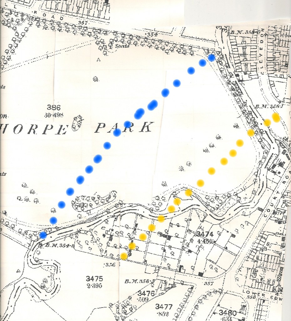
Went back to the 1890 map (online) to see if there was anything corresponding to the mound. Because of the differences i tried to draw in the new Rea channel (blue) and Cheddar rd (yellow). I might be slightly out with the channel and the mound might be the remains of the silt build up on the bend of the river, but I don't think so, and i think it is probably its just an earth mound remaining from the rechannelling
Mike
the silver fox
master brummie
One Urinal was near the bridge at the Edward Road end of the Black Patch; it also had a lock-up that housed the little steam train and its rolling stock when it functioned parrallel with the fence by the Rea. Urinal number two was in the middle, on top of the Elan Valley Pipeline (just think what we were drinking!). There was a mound of earth giving some landscaping around the building, not very high and obviously the spoil from the digging out for the footings of the building.
I would guess it was the late fifties when the elm planked (octagonal?) shelter was built between urinal 2 and the statues, all along the line of the EVP and at the crossroads of the two paths. I believe the shelter replaced an earlier building.
Ted
I would guess it was the late fifties when the elm planked (octagonal?) shelter was built between urinal 2 and the statues, all along the line of the EVP and at the crossroads of the two paths. I believe the shelter replaced an earlier building.
Ted
ellbrown
ell brown on Flickr
A few shots of Calthorpe Park from today
The Gatehouse at the corner of Speedwell Road / Pershore Road
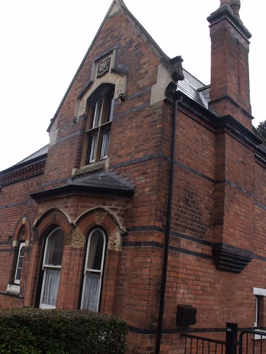
Calthorpe Park, Edgbaston - Gatehouse by ell brown, on Flickr
Empty plinth of Robert Peel
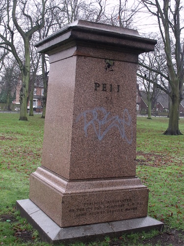
Calthorpe Park, Edgbaston - plinth of the Robert Peel statue by ell brown, on Flickr
Was the band stand here?
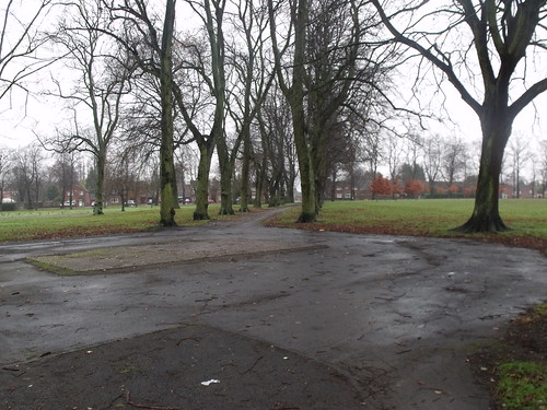
Calthorpe Park, Edgbaston - paths - band stand site by ell brown, on Flickr
Advertisement cylinder not in use at the moment
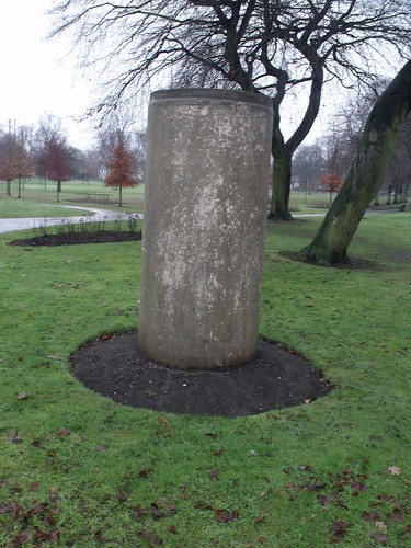
Calthorpe Park, Edgbaston - former city advert cylinder by ell brown, on Flickr
Path with potholes - needs repairing?

Calthorpe Park, Edgbaston - paths by ell brown, on Flickr
The Gatehouse at the corner of Speedwell Road / Pershore Road

Calthorpe Park, Edgbaston - Gatehouse by ell brown, on Flickr
Empty plinth of Robert Peel

Calthorpe Park, Edgbaston - plinth of the Robert Peel statue by ell brown, on Flickr
Was the band stand here?

Calthorpe Park, Edgbaston - paths - band stand site by ell brown, on Flickr
Advertisement cylinder not in use at the moment

Calthorpe Park, Edgbaston - former city advert cylinder by ell brown, on Flickr
Path with potholes - needs repairing?

Calthorpe Park, Edgbaston - paths by ell brown, on Flickr
hello, if i remember corectly, the entrance to the park from Varna road was where on the left hand side was a grassed area and on the right hand side was a little path leading to the mini golf and the toiletts and the tennis courts. i also remember seeing Aker BIlk and the Dutch Swing Band playing in the festivale there in the early 60's
shardeen
shardeen
Hi All
I live in Aboyne Close opposite Calthorpe Park. I have been researching the park and am amazed at how important it was to the city. Has anyone got more info about the steam train, how long it was there for and any photos? Also does anyone have pics of the large houses facing the park on the Pershore Rd? I would like to see the property that Aboyne Close now stands on.
Thanks
BordesleyExile
master brummie
Thank you, as always, Ell.
Shirley
Shirley
ellbrown
ell brown on Flickr
Calthorpe Park on Google Maps.
I mainly see the River Rea here from Clevedon Road. The view opposite has now changed since the old Joseph Chamberlain Sixth Form College and Birmingham Sports Centre were demolished.
I mainly see the River Rea here from Clevedon Road. The view opposite has now changed since the old Joseph Chamberlain Sixth Form College and Birmingham Sports Centre were demolished.
Phil
Gone, but not forgotten.
Here is a snap of the River Rea winding its way through Calthorpe Park in 1950. The bridge on the photo would be the one at the Clevedon Rd end of the park and the shed that housed the miniature steam railway that has previously mentioned.
This little steam train was a big attraction at the park it used to run back and forth along its track between the black patch sports patch and the railings for the river cutting. As far as I am able to remember it was gone by as early as the mid 50's.
As I remember it the park also housed another statue in addition to Sir Robert Peel. The statue of parliamentary reformer Thomas Attwood was housed there after being removed from the junction of Stephenson Place & New St. This would be before it was moved to Larches Green where it was vandalised that much it had to be removed.
Phil

Last edited:
ellbrown
ell brown on Flickr
Here is a snap of the River Rea winding its way through Cannon Hill Park in 1950. The bridge on the photo would be the one at the Clevedon Rd end of the park and the shed that housed the miniature steam railway that has previously mentioned.
Think you mean Calthorpe Park. I have walked over the bridge from Calthorpe Park towards Clevedon Road but haven't got photos from that end yet.
I have got some shots of the River Rea from near Cannon Hill Park itself though.

Cannon Hill Park in the winter - bridge over the River Rea by ell brown, on Flickr

River Rea from Edgbaston Road - Cannon Hill Park side by ell brown, on Flickr
ellbrown
ell brown on Flickr
The new blue & yellow area is a football / basket ball court
So that's what it is.
Phil
Gone, but not forgotten.
Think you mean Calthorpe Park.
You are of course quite right I don't know what I was thinking. I have corrected the post.
Phil
Phil
Gone, but not forgotten.
Dek
I read somewhere that when they get round to starting rebuilding the Irish Quarter in Digbeth that they are planning to bring the river back up to street level. It will be interesting to see how they intend to go about it. Surely they will have to rise it up right back from Cannon Hill Park and Calthorpe Park.
Phil
ellbrown
ell brown on Flickr
I'm sure the part at the back of Calthorpe Park has a lot of graffiti down it.
This is from Fazeley Street in Digbeth.
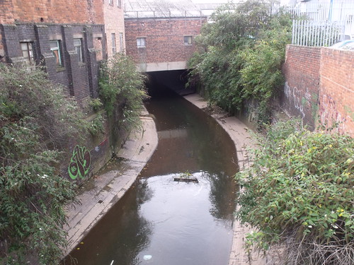
River Rea from Fazeley Street, Digbeth by ell brown, on Flickr
And from Bradford Street in Digbeth (tried poking my camera over the wall - it was quite high!)
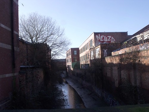
River Rea - from a bridge on Bradford Street in Digbeth by ell brown, on Flickr
This is from Fazeley Street in Digbeth.

River Rea from Fazeley Street, Digbeth by ell brown, on Flickr
And from Bradford Street in Digbeth (tried poking my camera over the wall - it was quite high!)

River Rea - from a bridge on Bradford Street in Digbeth by ell brown, on Flickr
BordesleyExile
master brummie
Thank you for sharing, Ell. Odd to think that the Rea was so important to Birmingham in years gone by.


