Lloyd
master brummie
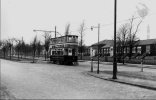
Here is a photo of a tram on Bristol Road, route 71 (Rubery) located I'm fairly sure at the junction with Eastern Road. The tram is therefore heading towards town.
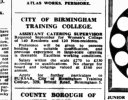
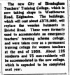
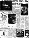
What are the buildings behind, on what would otherwise be the King Edward's school playing fields? They appear to be mostly of wooden planking construction and certainly aren't there now, so were they a wartime temporary structure or earlier - if so, what for?
The university clock tower stands ghost-like behind the building, confirming my location choice, but I am unable to date the photo beyond just before, or just after the second war - although the size of the trees suggests the earlier dates.
Over to you, experts!


