• Welcome to this forum . We are a worldwide group with a common interest in Birmingham and its history. While here, please follow a few simple rules. We ask that you respect other members, thank those who have helped you and please keep your contributions on-topic with the thread.

    We do hope you enjoy your visit. BHF Admin Team

Birmingham Street Name Origins

I wonder which church the 'New Church Street' refers to in Astonian's post? I know that the Particular Baptists opened a church in Summer Lane in the mid-1800's so perhaps it's this one.
 
Ethel Street is situated in central Birmingham and was next to the Forum cinema. I often used to wait in Ethel Street, just off New Street, for a 32 bus back to Hall Green. But who was Ethel? I have looked at some of the Links but could not find any information. Thanks. Dave.
I find that Joseph Chamberlain had a daughter Ethel 1873-1905. Maybe?
 
Ethel Street was certainly there by 1875 as it is in the Trade Directory dated that year. Not in the 1867 Post Office Directory. I can't narrow it more than that at the moment.
 
Whites 1873 and the Post Office 1872 directories do not unclude it. In New St its place is taken up with Post Office Place
 
I believe Post Office Place became Ethel Street. The Chamberlain daughter connection might be an answer and another pointer might be if the Post Office moved or was rebuilt?
The new General Post office in Victoria Square apparently was designed in 1890 and despite a demolition threat in the 1970 survives.
 
Last edited:
Hi mikejee
The old general post office was in pinfold street and not in ethell street can be seen in the distance
And yes it was in 1890 the new post office openend in [ 1890 ] is on the right and Christchurch on the left
The robert peel statue of robert peel was moved to the police training centre in pershore road
And its at the top of new street and hill street as it is so the previuos addrees was pinfold street and not Ethel street as suggested
picture 1 & 2
 

Attachments

  • IMG_20180412_222707.jpg
    IMG_20180412_222707.jpg
    295.9 KB · Views: 32
  • IMG_20180412_222854.jpg
    IMG_20180412_222854.jpg
    277.2 KB · Views: 32
A Google search for "Grindlestone Lane" threw up this thread, but a search within this thread draws a blank so I hope that my post here is not in the wrong place. I had never heard of the name "Grindlestone" or "Grindstone Lane" until I looked at the Enumeration District 8 page of the 1841 census which has the description: Hagley Road to Grindlestone Lane and Chad Lane. The census records properties beginning at Five Ways then turns into Chad Lane. A Brief History of Bearwood, says of toll-houses: "there was one at Five Ways and another at the junction of Hagley Road (then Grindlestone Lane) and Sandon Road (then Smethwick Lane)". Edgbastonia magazine, Feb 1892, describes Grindlestone Lane as a "narrow little green lane" where "picturesque vagabonds" camped. The writer, who describes himself as "not an octogenarian" would see these gypsies "Sunday after Sunday, on his way to Edgbaston Church". Until discovering this I had imagined that the Hagley Road had always been an important and busy road from the west into Birmingham and had not been a narrow lane for possibly hundreds of years.
 
Last edited:
I can but quote from Carl Chinn:-This may take it's name from a pool where docks or water lilies grew, and it is interesting to note that there was a Dogge Lane mentioned near to the present Hazelwood Road in 1580. Certainly there is a pool in the vicinity just to the west of the river Rea and close to where the river is joined by the Griffin's Brook.
Does anyone know where the name Dogpool comes from ? As in Dogpool lane / inn / mill etc. ? Thanks!
 
Bushmore Road B28
Bushmore Farm with 12 ha of land was sold 1910; at that time there was a race-course on the site of Bushmore Road with a grandstand on Shirley Road. The name Bushmore is medieval, more denoting marshland.
Does anyone know why the street was numbered on the even side 12, 14, 16,16a, 18, 18a, 20, 20a, 22, 24, 26, 28, 30?
And normal on odd side 15, 17, 19, 21, 23, 25 etc. 16 & 16a, 18 & 18a, 20 & 20a are semi-detached houses.

bushmore-rd.jpg
 
Spot on Lloyd - perhaps Maureen had some particular street names in mind, I have some knowledge on the origin of place names and wouldn't mind taking a stab at a name or three (not all of Birmingham yet though!).

Lichfield has three different spellings for the same place in one road (and it is only fifty yards long!) - Laburnum House (correct spelling) is in Laburnum Close, however the roadsigns insist it is Laburnam at one end and Laburnham at the other.
Any idea where the name ' Acfold ' came from. Acfold rd Handsworth wood Birmingham?
Thanks.

Spot on Lloyd - perhaps Maureen had some particular street names in mind, I have some knowledge on the origin of place names and wouldn't mind taking a stab at a name or three (not all of Birmingham yet though!).

Lichfield has three different spellings for the same place in one road (and it is only fifty yards long!) - Laburnum House (correct spelling) is in Laburnum Close, however the roadsigns insist it is Laburnam at one end and Laburnham at the other.
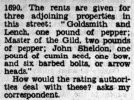
 
From a 1939 article by J. Nigel Hay (attached), I've extracted the origins of earlier Birmingham names. Some refer to the names of whole or partial sections of later streets, but the links could help anyone tracking down former used names for streets/lanes/alleys/passages/fields. Some will be well known, others less so. I've listed these simply to help with searches.

Devil's Hollow Tooth Yard (short passage off Bull Street to Horse Close St Phillip's churchyard)
Deadman's Lane (Warstone Lane)
Hangman's Lane (Great Hampton Row)
New England, God's Cart Lane (Carrs Lane)
Causey, Cock Street, Well Street (Digbeth)
Ann Street, Monmouth Street, Newhall/New Hall Lane, Haymarket, Priory Lane (Colnore Row)
The Butts (Stafford Street)
Corn Cheaping, The Shambles, Bordesley Street, Lake Meadowhill (parts of the Bull Ring)
Sandy Lane (Snow Hill)
Corbett Alley, Withering Street (Union Street)
Black Boy Yard (Jamaica Row)
Swan Alley (Worcester Street)
Castle Yard (Castle Street)
Lamb Yard (Crooked Lane)
Welsh Market, Welch End, Beast Markert (High Street)
Rother Market, Swinford Street, Halesowen Lane (New Street)
Tory Row (Temple Row)
Brick Kiln Lane (Horsefair)
Cottage Lane (Sheepcote Street)
Ferny Fields (Great Hampton Street)
Harlow Street, Little Charles Street (Edmund Street)
Mercer Street, Spicer Street (Spiceal Street)
Priors Conigree Lane, Whitealls Lane (Steelhouse Lane)
Wyllates Green (Prospect Row)
Walmer Lane (Lancaster Street)
Solydens Field, Sonilayne Field (Summer Lane)
Woodcokes Croft (Woodcock Street)
 

Attachments

  • Screenshot_20250325_071345_Chrome.jpg
    Screenshot_20250325_071345_Chrome.jpg
    576.6 KB · Views: 6
Last edited:
Back
Top