-
Welcome to this forum . We are a worldwide group with a common interest in Birmingham and its history. While here, please follow a few simple rules. We ask that you respect other members, thank those who have helped you and please keep your contributions on-topic with the thread.
We do hope you enjoy your visit. BHF Admin Team
You are using an out of date browser. It may not display this or other websites correctly.
You should upgrade or use an alternative browser.
You should upgrade or use an alternative browser.
Birmingham 1969-73
- Thread starter mikejee
- Start date
Richard Dye
master brummie
An understatement I am afraid!oh dear
lyn
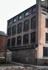
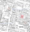
Here is the factory of Harry Monty Manufacturing, in Alliance Place, off Mary Street, with a 1950s map showing the position. The firm was a dress maker (Telegraph address Haremfrox). It was originally formed by Mr Monty, who had had a business in london pre-war, immediately after WW2 in what must have been very small premises off Martineau Street, but which moved in the early 1948 to this much larger establishment, and in 1973 moved again to premises in Moseley Road. The firm specialised in mass-produced clothes, and in later years his products were produced for mail order companies.


I may have shown these two photos on another thread some time ago , but am not quite sure where.
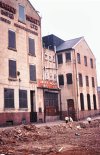
Here are shown, just before demolition, the shops on Wenman St on either side of the junction with Hampden st. They would have been built in the mid 1870s. In the 1876 directory no 64 (then numbered 86) was occupied by John Sharratt, grocer, but no 60 (then numbered 85) did not appear till the 1879 edition, when it was occupied by Herbert Watton, shopkeeper. For over 20 years till WW1 no 60 was a pawnbrokers, for most of that time under Mrs Amelia Horton., and for ten years or so from the ealy 1950s it was a cafe/coffee house/dining rooms under various owners.
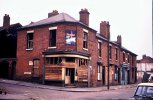
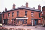
Here are shown, just before demolition, the shops on Wenman St on either side of the junction with Hampden st. They would have been built in the mid 1870s. In the 1876 directory no 64 (then numbered 86) was occupied by John Sharratt, grocer, but no 60 (then numbered 85) did not appear till the 1879 edition, when it was occupied by Herbert Watton, shopkeeper. For over 20 years till WW1 no 60 was a pawnbrokers, for most of that time under Mrs Amelia Horton., and for ten years or so from the ealy 1950s it was a cafe/coffee house/dining rooms under various owners.


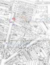
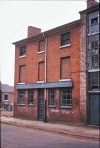
Almost opposite the previous two photos is what was until around 1960 the wireworks of Carter and James, shown on the map in post 335 as "wireworks". It officially changed its name in 1960 to, Wirax Wireworks, and seems to have migrated to Warstock road, though claimed in an appeal in 1954 against industrial zoning that it could not afford to move to a new factory . Henry William Carter, wireworker, moved to Wenman St around 1900, and by 1907 the firm had become Carter & James. Previously he had been in Sherbourne Road and previous to that in Longmore St from about 1876.

Richard Dye
master brummie
Mike, what vintage was that building, approximately.Almost opposite the previous two photos is what was until around 1960 the wireworks of Carter and James, shown on the map in post 335 as "wireworks". It officially changed its name in 1960 to, Wirax Wireworks, and seems to have migrated to Warstock road, though claimed in an appeal in 1954 against industrial zoning that it could not afford to move to a new factory . Henry William Carter, wireworker, moved to Wenman St around 1900, and by 1907 the firm had become Carter & James. Previously he had been in Sherbourne Road and previous to that in Longmore St from about 1876.
View attachment 169226
Thanks,
Richard. Before 1900, when the firm moved in, the site was a glassworks, which is shown on the c1889 large scale map , and has not set directly onto the street, but had an unbuilt area between the building and the street. Afterwards the building seems to be directly next to the street, so I think it reasonable to assume that the building was new to the firm and would have been built around 1900.
Richard Dye
master brummie
Thank you! It seems that the designs from the 1870,s were relatively unchanged.Richard. Before 1900, when the firm moved in, the site was a glassworks, which is shown on the c1889 large scale map , and has not set directly onto the street, but had an unbuilt area between the building and the street. Afterwards the building seems to be directly next to the street, so I think it reasonable to assume that the building was new to the firm and would have been built around 1900.
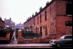
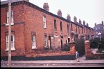
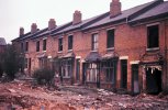
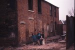
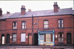
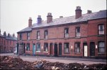
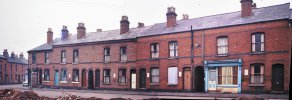
The following two photographs were identified by Phil as being on Larches St. The first as being on the south side, just down just down from the Talbot pub before Larches passage., and the second to the left of the first. He was pretty certain of the first one as one of the hosues was that of his grandmother
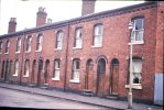
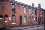
The last photo below is presumably also Larches St, as it was taken between the two earlier ones
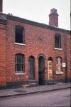


The last photo below is presumably also Larches St, as it was taken between the two earlier ones


Last edited:
Thanks for putting that map of Larches Street up Mike. My great grandmother, Lydia Mason lived and died at no. 98 Larchers Street on 3rd March 1952 (aged 78). She was living with her son William Mason after my great grandfather, also William Mason, had died on 24 March 1946 in 1 Western Road (Dudley Road Hospital)' Both had previously lived at 1/152 Spring Hill. Just to the right hand side & just off the picture was my Primary School (Ladypool) formerly Stratford Road School, which I attended from 1957-62
DaveH
DaveH
oldMohawk
gone but not forgotten
There are a couple of aerial shots showing Larches Street dated 1946 on the 'britainfromabove' website and here is one of them showing Larches Street junction with Highgate Road top left marked with red spot and the junction with Ladypool Road bottom right marked with blue spot. left click and zoom for close look
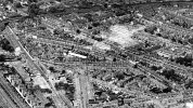
image source 'britainfromabove'

image source 'britainfromabove'
Mark Tooze
master brummie
Brilliant photos Mike - you need to put them in a book!!
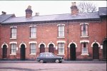
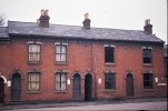
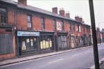
Nearby are three photos from Highgate Road. The first two show the same series of (ex-)shops from two directions. The Provincial Press, was at no 59 and shows the buildings going down the street as far as no 99, though the further buildings are indistinct.
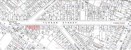
The second is looking in the other direction showing nos 61-75. (nos 59-75 marked in red on the map)
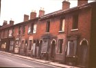
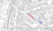
The third photo shows the buildings in blue on the map which are indistinct on the first photo, nos 91-99 Hoghgate st, and a part of the frontage of no 2 Turner St. Two buildings stand out, No 93 , K.E.M (Birmingham) Ltd, electrical engineers, and R.A.Chinn, Turf Accountants. The latter, I understand, the business of the father of Carl Chinn

The second is looking in the other direction showing nos 61-75. (nos 59-75 marked in red on the map)


The third photo shows the buildings in blue on the map which are indistinct on the first photo, nos 91-99 Hoghgate st, and a part of the frontage of no 2 Turner St. Two buildings stand out, No 93 , K.E.M (Birmingham) Ltd, electrical engineers, and R.A.Chinn, Turf Accountants. The latter, I understand, the business of the father of Carl Chinn

Last edited:
Interesting, thank you.I think most of the buildings around there that side of the Rea were originally quite good . It was a very respectable area in what was later called Balsall Heath, but was originally Edgbaston
Lady Penelope
master brummie
Not my side of the city but a really detailed record of the area Mike. Well done for recording this before it disappeared. I really like that you have included the maps so that individual houses can be identified. Impressive!
devonjim
master brummie
Seeing the name Harman Bros links to silverware, we have a cigarette box marked "Aristocrat" EPNS HB but my main point today is what exactly is Masonoid I often see beakers and the like advertised on ebay but despite playing on Google I can't find out what it is, is it silver or a form of EPNS. Anybody know?I seem to remember reading that one of the forum's young ladies started work as an enthusiastic junior in Vyse St. If so, then the next few pages of this thread will probably bring back some memories. It looks from the new Google earth feature that some buildings remain, but I seem to have an effect on this new feature - that every place I really want to look at is in the distance or not included at all.
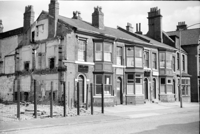
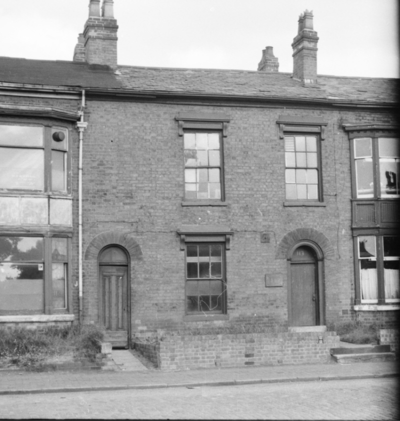
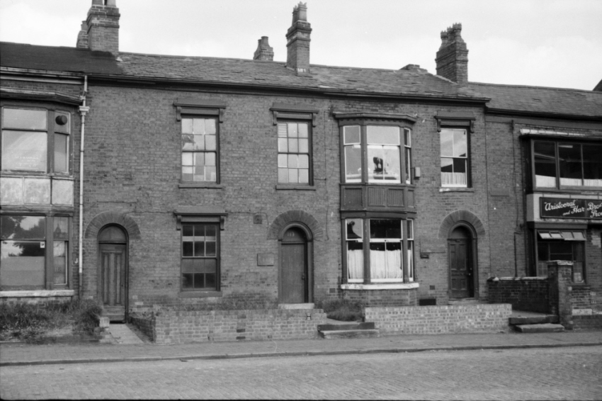
12. You can see that demolition has started, but 125-6. occupied by Samuel Hope, manufacturing jewellers, is still there, the firm having occupied part of the site since the mid 1870s, moving there from Bradley St West. The Midland Engraving & Key cutting service and C.F. Wrighton, manufacturing jewe;lers, share 127. Wrighton’s, originally Charles Morris Wrighton, have also been there from about the same time, moving from Augusta St.
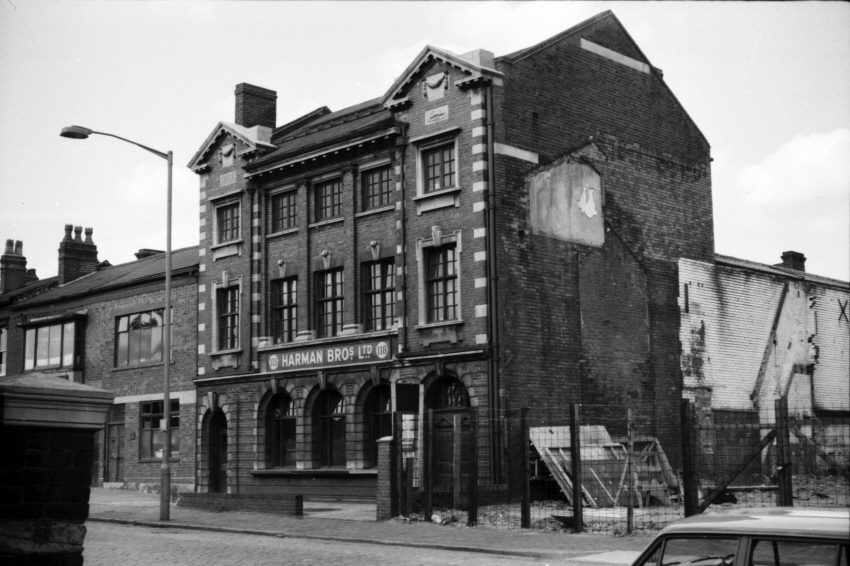
13. On the other side of the demolished hole is an impressive building (nos 115-118) occupied by Harman bros, manufacturing silversmiths.
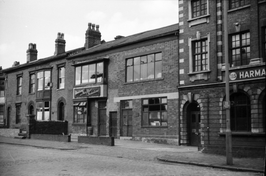
14. No 114, a less impressive building also occupied by Harman’s,
15. No 113 which certainly was also once used by Harman’s, but looks empty now.
16. Nos 112 – 114
Richard Dye
master brummie
I am sure you have seen this but it looks like a silver alloy used to make drinking vessels and the like. Looks like something that could/would be made in Birmingham.Seeing the name Harman Bros links to silverware, we have a cigarette box marked "Aristocrat" EPNS HB but my main point today is what exactly is Masonoid I often see beakers and the like advertised on ebay but despite playing on Google I can't find out what it is, is it silver or a form of EPNS. Anybody know?
https://www.google.com/search?q= ma...&sclient=img#vhid=82lnPGeuo1RRrM&vssid=mosaic
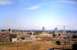
hi limes what great photos...i lived in geach tower..the other shot is amazing..we have the lucas factory to the left with wheeler st almost cleared.. i think on the right corner is the new st georges church and i can just pick out the church on lozells road also i can see the gunmakers arms pub on gerrard st...would you have anymore photos that you could share please as they are a snap shot of our history...many thanks
lyn
lyn
Limes
knowlegable brummie
Hiya, no problem.hi limes what great photos...i lived in geach tower..the other shot is amazing..we have the lucas factory to the left with wheeler st almost cleared.. i think on the right corner is the new st georges church and i can just pick out the church on lozells road also i can see the gunmakers arms pub on gerrard st...would you have anymore photos that you could share please as they are a snap shot of our history...many thanks
lyn
On the right there is Hampton Primary, St. George's new church was not yet built. I'm from the area myself (Hodgson Tower, Hampton, St. George's, Hospital Street)
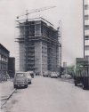
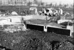
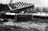
Here's a picture of St. George's new church being built. I also have a load of pictures of St. George's in the fields prior to its demolition.
edit: also notice you can still see Aston Hippodrome on the far right of frame
Attachments
Last edited:
Limes
knowlegable brummie
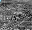
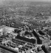
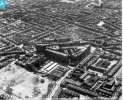
Same area as my first pictures above, but taken aerially in 1945, prior to the slum clearances of Lennox street and Wheeler street etc
Attachments
brilliant thanks limes...yes i can see aston hipp now...missed it earlier.i think the colour photo shows us the extent of demo that went on..thousands of houses gone.not to mentions pubs..churches shops and schools...when time permits we would love to see anymore photos you think may be of interest...thank you for taking the time to shareHiya, no problem.
On the right there is Hampton Primary, St. George's new church was not yet built. I'm from the area myself (Hodgson Tower, Hampton, St. George's, Hospital Street)
Here's a picture of St. George's new church being built. I also have a load of pictures of St. George's in the fields prior to its demolition.
edit: also notice you can still see Aston Hippodrome on the far right of frame
lyn

