anitaszaban
master brummie
can u find anything about no 2 or no 3 ridley street plz ?
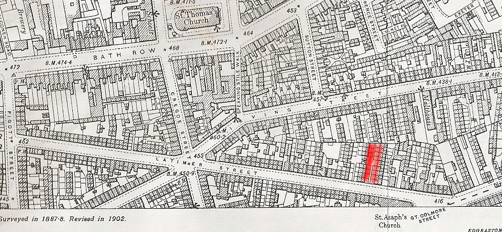
Can anyone explain the numbering on Latimer Street, 8, Waterloo terrace or 8 back 71 Waterloo Terrace, Latimer Street? differs on electoral cencus.As I said in post 12, there was another Latimer St . This would be the street you were born in. Not sure exactly where the border of Edgbaston is, but this Latimer st was certainly more towards it than the other. It is shown in red on the map below

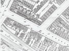
Thank you very much for the street maps. It is amazing to think that the house was still there in 1950.Welcome to the forum. I assume that the full address is 1 back 101 Ladywood Road (the Road possibly being just a squiggle}. Below are two maps from c1950 (it was still there then) and c1889 showing its position.
I have moved this to the streets and neighborhoods section
View attachment 153986View attachment 153987


Below is the entry next to 71 Icknield st from the Kellys for 1890, which seems to show it belonged to the cemetery
View attachment 154560
I lived at 7/13 Ridley Street until 1958.View attachment 92697
Hi, How did the back to backs numbering system with courts work ?
Im looking for 7/10 ridley street,
I have seen a picture of ridley street but it just says Court one ?<br>thanks Anita x
I'd like to ask how you get the maps with all the numbers on. I have been on oldmaps.co.uk loads of times but have never found them like yours.Welcome to the forum. I assume that the full address is 1 back 101 Ladywood Road (the Road possibly being just a squiggle. Below are two maps from c1950 (it was still there then) and c1889 showing its position.
I have moved this to the streets and neighborhoods section
View attachment 153986View attachment 153987
The post-war oldmaps map site did usually have numbers on them. That site is however no longer in existence,. I gather that eventually the national library of scotland maps site [ https://maps.nls.uk/os/] plan to scan and incorporate these maps into their collectionI'd like to ask how you get the maps with all the numbers on. I have been on oldmaps.co.uk loads of times but have never found them like yours.
Monument Road was, until 1887/8, known as Icknield Street West.Thanks Mikejee.
I can see what you mean, I never knew the canal bridge was known as Icknield St as this street didn't commence until after crossing Dudley Road at Spring Hill then continuing towards Hockley.
Nice map clarity of my house and the structure in question.
By the way, if you look at my avatar the grassy bank on the right is the opposite view from the one pictured in my thread.
Cheers
My name is John Taylor I used to live in Springfield street ladywood from 1955 I live next to the Waldron family dad leswaldronWaldron Terry Waldron and Jane Waldron also the rogers family Raymond Peter John Tommy Janet George and the Harris family John Carol Joan Richard Harris if any one as any information please don't hesitate to contact me by email pooldarts12@gmailalso the Morgan family Frank Morgan cathy Morgan Marie MorganThank you very much for the street maps. It is amazing to think that the house was still there in 1950.
Hi, 1/71 if I remember correctly was near to Sid Butts the drapers & Colemans the hardware store & just up from there was the newsagents shop practically opposite St Marks Street. Was your maiden name Willes or Willis by any chance because if it was we knew each other. I you are the person I am thinking of then we are talking roundabout 1965 to 1968 & were both in our early teensHi, I've just found your site, and the above map is really useful as it shows the house numbers. I lived at 1/71 Shakespeare Road, and wondered if there was a map available showing more of the area as part of my old home is just about visible on the above map. It's great to see the layout, and reinforce the memories you have. Thanks very much, and I look forward to being part of this special site.
As far as I know the Old Ladywood website no longer exists. The chap that ran the site for years has now retired. His name was Mac if I remember correctly. His website was excellent for people who resided in the back to backs in LadywoodHi brummiebri: There is a lot of information online regarding Old Ladywood in bygone days. This site https://oldladywood.co.uk/is excellent and even has the street where you lived on with some super photos. There is a main site called digital-ladywood.org.uk
and another I like very much with people's memories of life in Ladywood many years ago. https://www.oldladywood.co.uk/memories1.htm
 birminghamhistory.co.uk
Use the blue arrows at top right of the Web Archive page to navigate back in time if you want a missing street. There are different pictures depending on the year.Our member pjmburns (Janice) gives a link to the archived Ladywood site in the link below (see post #13 for the Ladywood site link). Not all the links in the archive work, but what's there might be of interest. Viv.
Links: Ladywood past & present website
Edit. Old link to the website removed as no longer working. Refreshed link to the website is now below.birminghamhistory.co.uk
hi colin just caught up with your post...what a smashing view you would have had of the steam trains maybe someone could provide us with a 1950s map to make sure that the structure you talk about had gone..would be interesting to find out exactly what it was used for thoughHi,
A long shot I think!
I'm trying to find out what a building at the back of my house was used for.
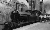
I lived at 103 Shakespeare Road from 1956 until 1968. At the bottom of our yard was a wall over which was a short sloping embankment down to the railway across from the platform of Monument Lane Station. On an old map of 1914 it shows a building on this embankment directly in line with our house (see map) which must have been on raised supports. I know that around this time our house was in fact a pork butchers and maybe this structure was possibly a holding pen/slaughterhouse? although I'm sure the neighbours weren't too happy having pigs brought down the path behind their houses! Or maybe it was something to do with the railway although less likely as there wasn't access to the bank other than to climb up the retaining wall of old railway sleepers seen in the photo.
The photo, taken in 1950, shows a girl sitting on my wall and the structure would have been directly in front of her. It also had gone by 1939 as the census shows it not as a butcher.
Any suggestions or help greatly appreciated.
View attachment 154549View attachment 154550
