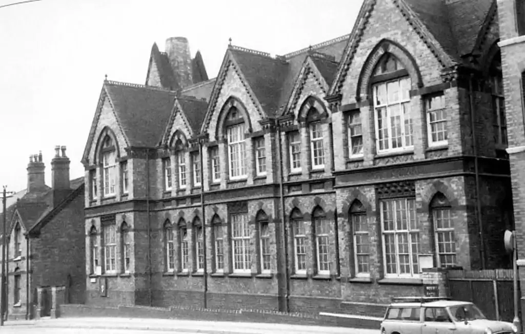
I seem to have invaded this thread with a sub-thread if you will. Well, it was Posties picture of the school and Raggas superbe shots of Furnace Lane, pictures that I have been waiting to see for a long time. If that was not enough there was someone who lived right there. The slope that seemed to match the old survey elevations came to life and would you believe it an old mail box making it's lonely last stand right where the ancient furnace stood all those years ago. If I am right, non of the buildings in the photo's would have been there in the furnaces heyday, except the one thing; the ridge below the northern wall of the playground. The location is just visible in Raggas photo's and is marked by the wall leading off to the right up the hill past the green gate to the school. The wall itself would not have been there way back but it marks the spot. The wall is also shown on the 1890 survey maps. In answer to Peters point about the terrain; I would say that it is exactly what was needed. No, water does not flow up hill; it did not have to. It was already up there. It was water from the old leat and long furnace pond that served Aston Furnace (probably not used there after the Newcomen Engine was installed) and led across the pictures to the school playground approx by spoil embankments and ditches to maintain as much of the elevation as possible. Once there it formed a pool using existing terrain and a lower spoil bank. How this pool would have been used is not known at this point. But there are refferences to it. Hockley Brook as stated was below ground under the feet of the photographer. It never drove anything as far as I can find but it did supply the water to the leat much further up-stream as we know from before. When the area was latterly developed and the leats and pools drained, the lower spoil banks would have been levelled but the ridge under the wall seems to have remained and I am suggesting that this marks the approx. outline of the northern bank of the second pool. I think that Raggas pictures may tell more of a story than intended. I believe that tailraces in the midlands would have often been very deep and long, and on the survey maps you find that most of them are guarded by fences to stop people from falling in and breaking their necks. This would have meant that the race could not have been fed back into Hockley Brook right there because it would have been lower than the Brook and the higher brook water level would have back-flooded the bottom of the water wheel. So the tailrace had to be taken further on, to be fed back into Hockley Brook when the lavels were compatible or in this case on down to Aston Brook Flour Mill pool, all the time trying not to loose any more head which would have meant keeping to compatible higher ground. If you look at some of the old maps, you can see that the length of Aston Brook Mill pool seems to vary. Sometimes it is stubby and sometimes longer. The reason for this may be that it was originally fed from the Furnace tail race but when the second furnace pool was in place it may have been fed from that greater head. This would have allowed Aston Brook Flour Mill pool to gain head by further banking up and the pool would then have stretched further up the hill. A larger diameter more powerfull water wheel could then have been used.
")