
-
Welcome to this forum . We are a worldwide group with a common interest in Birmingham and its history. While here, please follow a few simple rules. We ask that you respect other members, thank those who have helped you and please keep your contributions on-topic with the thread.
We do hope you enjoy your visit. BHF Admin Team
You are using an out of date browser. It may not display this or other websites correctly.
You should upgrade or use an alternative browser.
You should upgrade or use an alternative browser.
A B row Aston-Birmingham
- Thread starter dek carr
- Start date
Rupert will correct me if I am wrong....
Leading from Dale End toward the junction with AB Row and Prospect Row was first called Coleshill Street (c 1795) which around the time of the Inner Ring Road scheme became re-aligned northwards somewhat and later dualled to become Jennens Road of which the western end shared the original Jennens Row and Buck Street alignment.
Leading from Dale End toward the junction with AB Row and Prospect Row was first called Coleshill Street (c 1795) which around the time of the Inner Ring Road scheme became re-aligned northwards somewhat and later dualled to become Jennens Road of which the western end shared the original Jennens Row and Buck Street alignment.

Phil
Gone, but not forgotten.
Speedwing
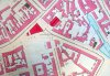
From what I recall from memory they haven't moved the roads so much as they have improved them and renamed them (well more like redistributed them). If you look a these before and after maps you will see what I mean. Coleshill St on the new map is in fact the old Lawrence Street, and Jennings Rd is made up of Coleshill St, Prospect Row & Ashted Row and I think at the end it might incorporate a bit of Jennings Row.
From what I recall from memory they haven't moved the roads so much as they have improved them and renamed them (well more like redistributed them). If you look a these before and after maps you will see what I mean. Coleshill St on the new map is in fact the old Lawrence Street, and Jennings Rd is made up of Coleshill St, Prospect Row & Ashted Row and I think at the end it might incorporate a bit of Jennings Row.
Attachments

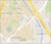
I suppose that in the earlier days of horse transportation and fewer landmarks; Coleshill would be a landmark to aim for and I understand that it was a posting centre. This would certainly have been the way to go there...the street to leave Brum by. Coleshill Street became Prospect Row for a short stretch at the junction with A B Row and then Ashted Row at about Woodcock St or so. Personally I would have thought that Jennens should be Coleshill. Makes more sense to me and fits better with tradition perhaps and it is still the route. Maybe they can change Coleshill to Jennnenshill.
I have lost track of what this area is becoming space for. When I think of it, I can't remember this area being a highly industrialised one...maybe small workshops. My familiarity was one of transit only though. My way to town and home again.
I have lost track of what this area is becoming space for. When I think of it, I can't remember this area being a highly industrialised one...maybe small workshops. My familiarity was one of transit only though. My way to town and home again.
Phil
Gone, but not forgotten.
Yes it is Jennens Row, but I have called it Jennings Row since I was five years of age and I'm too old to change now, the row was called after John Jennens I believe and this is only one of the threads about him on this forum. There is another by John Houghton
https://birminghamhistory.co.uk/forum/showthread.php?t=35225
https://birminghamhistory.co.uk/forum/showthread.php?t=35225
st.evenlucy
master brummie
Howe Street, Nova Scotia Street , Buck Street , Doe Street, Princess Street , Princess Row, Market Street have all been eaten up by The uni now
HI PHIL;
Have you got any pictures of A B row foundry castings that used to be at the top end that was there for donkeys years
right up until the demo; clearance it was a really a big black hole to work in or that old pub across the rd from it
i think it was the corner of woodcock street have a good day best wishes astonian;;
Have you got any pictures of A B row foundry castings that used to be at the top end that was there for donkeys years
right up until the demo; clearance it was a really a big black hole to work in or that old pub across the rd from it
i think it was the corner of woodcock street have a good day best wishes astonian;;

www.midlandspubs.co.uk
Pub Historian
Interesting stuff here.
This from my ever expanding pile of references for the area, firstly from William Hutton's Perambulations:
"We now cross the Lichfield road, down Duke-street, then the Coleshill road at the A B house. From thence down the meadows, to Cooper's mill; up the river to the foot of Deritend bridge; and then turn sharp to the right, keeping the course of a drain in the form of a sickle, through John a Dean's hole, into Digbeth"
(https://www.gutenberg.org/files/13926/13926-h/13926-h.htm)
His route around Brum largely following the then Birmingham boundary.
This allegedly from Pevsner:
"1675, Of about that date were A-B House (Aston and Birmingham) beside the bridge, raised on piles above the floods, and two Dutch-gabled houses:"
The latter referring to Cooper's Farm and Ravenhurst House
Despite a number of broken links this is an interesting thread. Of course, my interest is in the Red Lion pub. The A. B. House mentioned "beside the bridge" was at Deritend Bridge NOT here. However, the house with the
old date stone was once known as A. B. House [fits with Hutton's walk]. Attached is the 1861 census for No.1 where the enumerator has included A. B. House in the property reference. Note that a publican is living here. I am thinking that this is possibly the Red Lion, a pub with a very short lifespan - only a couple of years at most. By the way, I agree with Peter's post and on later maps, produced in the late Victorian period, the building is on the edge of the Parliamentary, Ward and Union boundaries.
Attachments

www.midlandspubs.co.uk
Pub Historian
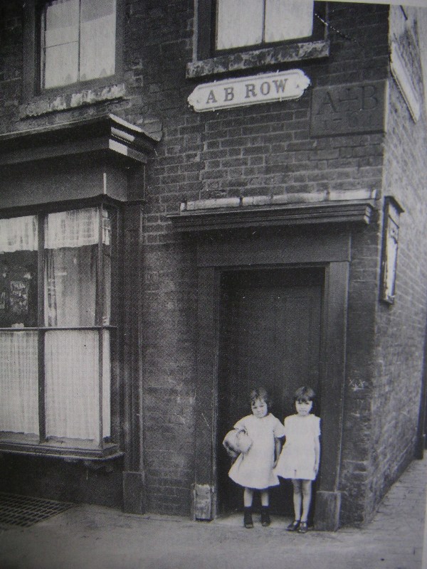
These photo's were on here before but have not seen them lately. Anyway one shows the plaque but am not able to determine which corner house it is. One picture shows the opposite side of Coleshill St. or whatever it is. I think the plaque must be on the east corner of Princess St., that seems to be where the boundary line is. Actually. if you follow the boundary line, it seems to meander all over the place and suggest that it follows leats and tailraces of old mills; and rivers. I think that was the procedure. Maybe more permanent markers than anything else. Sad to see it all wiped clean is it not. Just old worn out buildings but they anchored our lives for many years. Now just the plaque remaining and the little girls would be about 88 now.
I think the caption in the first photograph is wrong. There were separate markets at Gosta Green and here on this triangle. The Gosta Green market lasted until the late 19th-century but this building ceased to serve as a market hall many years before [mid-to-late 1850s].
www.midlandspubs.co.uk
Pub Historian
In case of interest .. or for what it's worth, here's my bit on A. B. Row :
https://www.midlandspubs.co.uk/birmingham/ab-row/
https://www.midlandspubs.co.uk/birmingham/ab-row/

mw0njm.
A Brummie Dude
Secure Connection Failed
The connection to www.midlandspubs.co.uk was interrupted while the page was loading.
The page you are trying to view cannot be shown because the authenticity of the received data could not be verified.
Please contact the website owners to inform them of this problem.
this what i get,why?
The connection to www.midlandspubs.co.uk was interrupted while the page was loading.
The page you are trying to view cannot be shown because the authenticity of the received data could not be verified.
Please contact the website owners to inform them of this problem.
this what i get,why?

john knight
signman
Had no problem, here it is again,https://www.midlandspubs.co.uk/birmingham/ab-row/
www.midlandspubs.co.uk
Pub Historian
Secure Connection Failed
The connection to www.midlandspubs.co.uk was interrupted while the page was loading.
The page you are trying to view cannot be shown because the authenticity of the received data could not be verified.
Please contact the website owners to inform them of this problem.
this what i get,why?
You may have clicked on just when I was uploading it again due to a typo I had spotted. Sorry about that.Secure Connection Failed
The connection to www.midlandspubs.co.uk was interrupted while the page was loading.
The page you are trying to view cannot be shown because the authenticity of the received data could not be verified.
Please contact the website owners to inform them of this problem.
this what i get,why?
www.midlandspubs.co.uk
Pub Historian
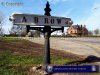
I took a photograph of the old sign in 2002. I notice that these old Brum street signs appear on e-bay for a couple of hundred quid a time!

ellbrown
ell brown on Flickr
A B Row doesn't exist any more. Last year saw a car park on the Eastside Locks land, that still hasn't been built on.
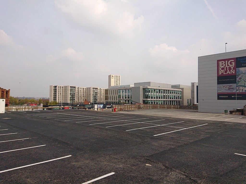
Don't really take photos much of this corner any more, or not recently when nothing has changed here. Also not got much reason to go this way since my work moved from the Science Park into the City Core last autumn.
Don't really take photos much of this corner any more, or not recently when nothing has changed here. Also not got much reason to go this way since my work moved from the Science Park into the City Core last autumn.
Susan shaw
master brummie
Thank you all so much for the wonderful pics in this thread. the pic opposite the Black Horse,A B Row doesn't exist any more. Last year saw a car park on the Eastside Locks land, that still hasn't been built on.
Don't really take photos much of this corner any more, or not recently when nothing has changed here. Also not got much reason to go this way since my work moved from the Science Park into the City Core last autumn.
Susan shaw
master brummie
Thank you all for the wonderful pics in this thread. They bring back so many memories from childhood. The pic opposite the Black Horse , Prospect Row is wonderful. I have searched for what seems forever for this scene. Tom Waters the Mens Tailors, where my dad got a suit from (the car parked outside). Taylors the sweet shop, I can still see the white and pink iced mice in the window and an entrance to where my friend Pat Crowe and her family lived. Hughes the fish and chip shop just out of view. You have made me very happy and I thank you all. Kind regardsI took a photograph of the old sign in 2002. I notice that these old Brum street signs appear on e-bay for a couple of hundred quid a time!
View attachment 141792

Carl Chinn receiving the boundary stone from the reception area of Gabriel & Co, steel foundry. Viv
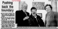
Source: British Newspaper Archive
Source: British Newspaper Archive

Pedrocut
Master Barmmie
I have this photo of A B Row, which shows the 1764 stone marking the boundary between Aston and Birmingham. Viv.
https://birminghamhistory.co.uk/forum/images2/userpics/10014/A_B_Row.JPG
Same picture from Golden years of Birmingham (1999) but showing a little more. Described as original offices of Gabriel and Company (est 1884) being at 5 AB Row.

BenedictRUK
New Member
Does anyone know where the AB Stone is now? Gabriel and Co had it from 1996, but it (or a new version) was on site from 2011 at least, going by this link:
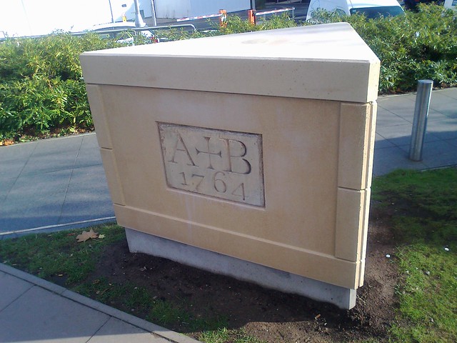 So where is it now?
Many thanks,
Ben

Many thanks,
Ben