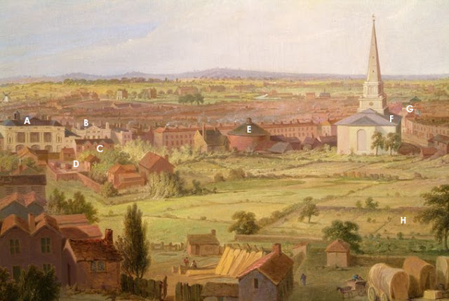
Firstly my post 25 in this thread has been amended slightly.
Reference was made to the bridge shown in the foreground of Sulman's Panorama which was demolished at some point in the early 20's or even before perhaps as early as 1883.


These are from Roger De Boer's "Birmingham's Electric Dustcarts" which though out of print is available at eight of the City's local libraries plus the Library of Birmingham Reference section. (628.44209424)
The original glass negatives were discovered in a drawer at the old offices of the Salvage Department in Montague Street though where they are now is a bit of a mystery.
In the background is the remnants of the bridge featured in Sulman's panorama viewed from the Corporation yard looking east with the Montague Street Pig and Cattle Market beyond the facing brick wall.
Clearly the bridge was supported on six iron columns supporting two cast iron beams in an almost identical manner to the surviving structure in Cerro's yard off Liverpool Street and easily visible through their gates.
Spanning these beams would have been a timber frame structure supporting the trackbed which would have been similar in detail to those used on the line up from Oxford and to those erected along the line between Plymouth and Penzance.
The pictures show the sawn off remains of the timber trusses poking out the brickwork and the supporting sandstone pads which still exist today in remaining brick abutments at Liverpool Street, Great Barr Street and Montague Street.
Pencil sketches on one of Brunel's contract drawings for the viaduct provides confirmation of what must have been a change of plan when it became obvious the connection with Curzon Street station was frustrated. Hopefully I will have a drawing of the structure based on measurements of the brick courses in each photo and Brunel's Design office drawings for inclusion in the near future.
As luck would have it there are views of the east side of the viaduct before it was finally demolished and these can be found in the Library of Birmingham's Warwickshire Photographic Survey which includes nine images taken by George Whitehouse of the Pig and Cattle Market.
This link should take you to the online collection though the quality of the scans is a bit dubious or from the their catalogue reference MS 2724/2/B/2609 through to 2617
https://calmview.birmingham.gov.uk/...rc=CalmView.Catalog&id=MS+2724/2/B/2609&pos=1
Imagine having walked through the entrance in Montague Street seen in earlier posts and looking north. The viaduct is visible along the left with the offices of the Salvage Department appearing beneath the arches. Imagine also the smell!
The second looks through the arches toward Banbury Street and the City in the open section of the Cattle Market near the stalls where stock would be received from Midland railway Cattle Dock nearby.
The third taken inside the Pig market looks north east along the inside curved wall fronting Montague Street.
Finally K4 Architects of Fazeley Street have produced a speculative vision of the area based on recycling the remaining section of the viaduct between Upper Trinity Street and Liverpool Street.
https://www.k4architects.com/duddeston-viaduct/4578897594


