• Welcome to this forum . We are a worldwide group with a common interest in Birmingham and its history. While here, please follow a few simple rules. We ask that you respect other members, thank those who have helped you and please keep your contributions on-topic with the thread.

    We do hope you enjoy your visit. BHF Admin Team
  • HI folks the server that hosts the site completely died including the Hdd's and backups.
    Luckily i create an offsite backup once a week! this has now been restored so we have lost a few days posts.
    im still fixing things at the moment so bear with me and im still working on all images 90% are fine the others im working on now
    we are now using a backup solution

Some old pictures of Birmingham canals

guilbert53

master brummie
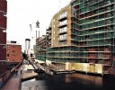
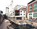
For those that are interested, I have just dug out a load of old photographs I took about 20-25 years ago of the redevelopment of the canal area around Broad Street, and the building of the Convention Centre and other buildings like the NIA.

I have scanned them in and posted some of them here.

To see how parts of central Birmingham were 20 or so years ago is just staggering

https://forum.birminghamhistory.co.uk/showthread.php?t=29123
 
Another amazing picture of Birmingham in the 1980s.

Sorting out some old photos the other day and found this.

I think the picture is from around 1986, but to be honest I am not sure WHERE I was standing when I took it.

There is a bend in the canal, and a bridge part way along, so my guess is EAST of the Telecom Tower, but where exactly I have no idea.

Pictures like this make you realise how far Birmingham has come in the last 25 years (and how much it HAD to come to shake off the industrial past)

I remember walking those canals 25 years ago and never met anybody.

It looks to me as if you were on the towpath of the Birmingham & Fazeley canal at the rear of Pritchard Street - the area has been redeveloped now but it lines up against the GPO Tower and what I think is Alpha Tower in the background. Sound reasonable?

I actually used to like the canals in the 1970s and 80s - it was really good how you could go through the red door in Gas Street and you were instantly transported back a 100 years or so! The atmosphere was so special - what industrial Brum was really about. The Georgian cast iron window frames, the remains of old gas lamps long since cold - you could almost hear the ghostly trip hammers and the clip-clop of the boat horses in the distance from so long ago.....the echoes under the GPO Tower as you walked up Farmer's Bridge locks..... And I used to love the solitude - as you say, you could walk for miles and not meet anybody. All long gone - but I stll miss it.....

PS let's see some more photos!
 
hi quilbert53
Many thanks for my childhood memories the times i have been down that stretch from ladywood [ momument rd through to old gas streeet
and the gas street tunnel was really dark and i mean low and dark you could not see your hand in front of yourself
there used to be a gang of us in those days and chased by charlie the big shire horse and by the cannal boat people whom lived in those tiny houses at the gas street basin we used to unleashed there barches and float out on them
good old boys days ,best wishes astonian ;
 
2279679367_49f368edaf_b.jpg

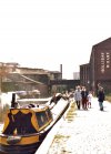
I wonder what year this photo was taken ?
must be well before the modernisation of
Broad Street ...... ragg
a :upset:
 
I'm guessing late seventies as the 'new' ATV studios in Bridge St. are in the background of the photo!
 
We used to ride on top of the coal in the barges going along the Witton Canal, they were mostly pulled by horses then, but the posh ones had engines. Also we would feed the horses at the locks, Oh to be young again!!!!
 
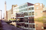
Interesting views of the Farmer's Bridge Locks. View No 1 is taken near Saturday Bridge and shows part of the former Myers Steel Pen Factory, which has been destroyed by the developers instead of a restoration or conversion.

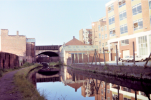
View 2 is looking to Livery Street Bridge and Snow Hill- lock 12
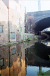
View 3 is the other side of the Snow Hill Viaduct
 
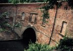
Finally if you look closley you can see this is the Brandwood Tunnel it is 322 metres in length and wide enough to be able to take two way narrowboat traffic, It is on the Stratford Canal and the plaque above the entrance used to have an image of Shakespeare but it has worn over the years.

can018.jpg
 
Brandwood Tunnel Grade II Listed...it looks like the Bard has stood the test of time better on the other end ?
Pedro/anyone, are these tunnels dug or are they trenches filled? 350 feet is a very long tunnel 150 years ago! Just thinking out loud……
 
I am not sure of the location of these images , as I said they were rescued from the bin and were in an envelope marked canals ! which is not helpful. I did find a location but the bridges were the wrong direction!!

View attachment 160675
This is the start of the Warwick and Birmingham Canal just by the junction of the Digbeth Branch.
 
This is a little further along the Warwick and Birmingham Canal, not too far form the River Rea Aqueduct
Mort.
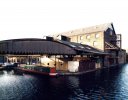
I had decided that these were the only positions I could find that fitted on maps, but had not realised that the view is almost the same today. It is interesting that the building with the overhanging ironwork used to be an ice factory
 
Mort.
I had decided that these were the only positions I could find that fitted on maps, but had not realised that the view is almost the same today. It is interesting that the building with the overhanging ironwork used to be an ice factory
Yes, it is a set of super buildings. I cycled past them the other day
 
Finally if you look closley you can see this is the Brandwood Tunnel it is 322 metres in length and wide enough to be able to take two way narrowboat traffic, It is on the Stratford Canal and the plaque above the entrance used to have an image of Shakespeare but it has worn over the years.

View attachment 160679

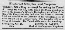
Presumably this is refers to the Brandwood End tunnel. There is a West Hill district in King's Norton.
The tunnel here is stated to be 2,600 yards long!
(Jackson’s Oxford Journal, November 1793.)

98C904D0-8A9C-4F11-81B3-6967AB872F42.jpeg
 
West Hill, or Wast Hill Tunnel is on the Worcester & Birmingham Canal as stated. Brandwood is as stated on the Stratford upon Avon Canal. They are not the same

The two images on the Warwick & Birmingham Canal are on thesection from the junction with the Digbeth Branch and show the Stop Lock, the later (curved) Fellows, Morton & Clayton depot, the older FMC depot is shown in the second image and the former Ice House.

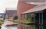
The other image shows the Worcester & Birmingham Canal from Salvage Turn to Granville Street, with the wharf on the left. Beyond the bridge are the buildings of Davenports Brewery.
 
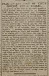
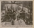
This begs the question, when did King's Norton Tunnel on the Stratford Canal become the "Brandwood End Tunnel" ?

"On the Stratford Canal, according to Bradshaw’s Canals and Navigable Rivers of England and Wales, by Henry Rodolph De Salis (1904), the King's Norton tunnel was 352 yards long. Boats hauled by means of handrail fixed to side wall."

"On the Worcester and Birmingham canal, West Hill tunnel, commonly called King's Norton, was 2750 yards
long. Boats towed through by company's tug." (times given).
 
Back
Top