oldMohawk
gone but not forgotten
The problem I have with the Booth Lane location is about the telephone poles. In my childhood I never saw 10 bar telephone poles on the Queslett Rd. I did see similar on the Kingstanding Rd and below is a pic of some on the Kingstanding Rd in 1920 (before my time !) but they are 14 bar, the ones in the mystery pic are 10 bar.

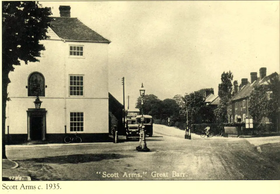
image from the Birmingham Library collection
image from the Birmingham Library collection


")


