-
Welcome to this forum . We are a worldwide group with a common interest in Birmingham and its history. While here, please follow a few simple rules. We ask that you respect other members, thank those who have helped you and please keep your contributions on-topic with the thread.
We do hope you enjoy your visit. BHF Admin Team
You are using an out of date browser. It may not display this or other websites correctly.
You should upgrade or use an alternative browser.
You should upgrade or use an alternative browser.
Camp Hill
- Thread starter carolina
- Start date
www.midlandspubs.co.uk
Pub Historian
I was tinkering a bit with Camp Hill during MOTD and, before hitting the wooden hills, I thought this photograph may interest some, particularly those interested in engineering : https://www.midlandspubs.co.uk/birmingham/camp-hill/index.html#Test
I believe this to be a rare image in that it shows the Camp Hill Flyover being erected BEFORE the actual construction date. Any thoughts welcomed of course.
Night night
I believe this to be a rare image in that it shows the Camp Hill Flyover being erected BEFORE the actual construction date. Any thoughts welcomed of course.
Night night
not sure which photo you mean keiron but quite a few before it was finished were posted on this thead some years ago
lyn
 birminghamhistory.co.uk
lyn
Camp Hill Flyover
The thread about the Dolls Club produced a great deal of information about, and cracking photos of, the Camp Hill Flyover that appeared next to it next to it. Chances are some folks that recall the 'tempory' flyover will have missed out because they wouldn't have expected it to feature in a...
 birminghamhistory.co.uk
www.midlandspubs.co.uk
Pub Historian
not sure which photo you mean keiron but quite a few before it was finished were posted on this thead some years ago
lyn
Camp Hill Flyover
The thread about the Dolls Club produced a great deal of information about, and cracking photos of, the Camp Hill Flyover that appeared next to it next to it. Chances are some folks that recall the 'tempory' flyover will have missed out because they wouldn't have expected it to feature in a...birminghamhistory.co.uk
Lyn, you cannot have looked properly .. I have uploaded a few images of the bridge being constructed in a DIFFERENT location BEFORE it was erected between High Street Bordesley and Camp Hill. These images are not featured on the thread you mention.
www.midlandspubs.co.uk
Pub Historian
Viv
The photo that you have posted is the one that started this thread, but it has one piece of information that the others lack, and that is the date of 1875. This beings some 5 to 8 years before K.E.G.S. opened making it entirely possible that the old post office was the site of the school.
Nearly but not quite. The post-office was towards the left of this postcard view. The building to the right, however, almost certainly occupied part of the site used for the original school building. It was formerly the residence of the surgeon Henry Cox.
www.midlandspubs.co.uk
Pub Historian
In addition to some well-known images, I have posted a couple more photos that are, to the best of my knowledge, previously unpublished. See : https://www.midlandspubs.co.uk/birmingham/camp-hill/
www.midlandspubs.co.uk
Pub Historian
just found these in my old files...not sure if they have been posted before but better to have them twice than not at all
building of the flyover
lyn
View attachment 189843View attachment 189844View attachment 189845
Er, this is the removal of the flyover not the "building of the flyover" - but thanks for posting
not sure so ive edited my post to cover bothEr, this is the removal of the flyover not the "building of the flyover" - but thanks for posting
mw0njm.
A Brummie Dude
Camp Hill Flyover
Mike as you say that wasn't the one I recall, anyway I don't think I have ever been back to Bristol since 67 so it couldn't have been, What road was that on. Phil
 birminghamhistory.co.uk
devonjim
master brummie
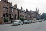
picture 1 Daily walk term time 1951-56 up from High St Bordesley
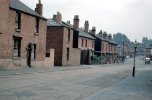
picture 3 As Boy Scouts we practiced urban tracking, involved chalk marks on pavements along this stretch of road and neighbourhood.
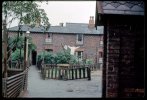
The properties on the left of "446" were the view from school art room windows, I was once complimented on an "impressionist style" painting I produced, not intended, I just couldn't draw any better, I had to look up what it meant, perhaps I should have said that I thought it was a compliment!
Last edited:
devonjim
master brummie
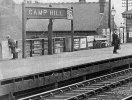
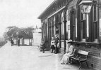
Was this the station corner of Moseley Rd and Highgate Rd
mw0njm.
A Brummie Dude
Was this the station corner of Moseley Rd and Highgate Rd
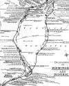
Camp Hill Goods Station
Rail Around Birmingham takes a look at the changing face of the railway in and around Birmingham and the West Midlands, past and present. All disused and operational railway stations and lines are covered in detail with both historical and contemporary maps provided, photographs of the present...
www.railaroundbirmingham.co.uk
Radiorails
master brummie
Today a frequent mention is made of 'land grabs'. Looking at the older maps of the original city it seems that Birmingham lead the field in earlier times. 
mw0njm.
A Brummie Dude
www.midlandspubs.co.uk
Pub Historian
I don't know Camp Hill very well and this may muddy things but in 1868 Kelly's directory refers to a Post Office Receiving House. It seems to be further up the road away from the Ship. To confuse matters the numbering seems different as well.
View attachment 99460
Janice
Hi Janice, I was intrigued by this so have done a little digging myself. I have posted some notes at www.midlandspubs.co.uk/birmingham/stratford-road/ which may help - or add to the confusion
www.midlandspubs.co.uk
Pub Historian
Hi Janice, I was intrigued by this so have done a little digging myself. I have posted some notes at www.midlandspubs.co.uk/birmingham/stratford-road/ which may help - or add to the confusion
Further to this, I have clocked in a 1826 Rate Book that Stratford Road is not named as such and that all properties from the Church to the Black Horse and Angel are bundled in as Camp Hill.
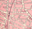
The above link should take you to a map from the turn of the (19th/20th) century. If I've got this right you should see the goods station at the top with a web of different lines going off the main one. At the bottom of the screen there's a black blob on highgate road simply marked Sta. Both of these were called Camp Hill. The bottom one was Camp Hill/Balsall Heath a local passenger station and the top one is the goods station. They're not very close together. If you drag the map down you should be able to see Stratford Place and the Grammar School on the other side of Camp Hill/Stratford Road.
These maps can be very useful although there aren't as many as there appear to be.
These maps can be very useful although there aren't as many as there appear to be.


![Camp Hill Flyover.JPG 3[1].JPG Camp Hill Flyover.JPG 3[1].JPG](https://birminghamhistory.co.uk/forum/data/attachments/111/111304-7ab7742db905a3fd2b14b9115aa2c46f.jpg)
![Camp Hill Flyover.JPG 5[1].JPG Camp Hill Flyover.JPG 5[1].JPG](https://birminghamhistory.co.uk/forum/data/attachments/111/111305-69c90af51ecf5b4ead58314a0b60fd87.jpg)
![Camp Hill Flyover[1].JPG Camp Hill Flyover[1].JPG](https://birminghamhistory.co.uk/forum/data/attachments/111/111306-7f3b4d6335f98466b385af9dce3671b5.jpg)
