-
Welcome to this forum . We are a worldwide group with a common interest in Birmingham and its history. While here, please follow a few simple rules. We ask that you respect other members, thank those who have helped you and please keep your contributions on-topic with the thread.
We do hope you enjoy your visit. BHF Admin Team
You are using an out of date browser. It may not display this or other websites correctly.
You should upgrade or use an alternative browser.
You should upgrade or use an alternative browser.
OLD AND NEW PHOTOGRAPHS
- Thread starter Astoness
- Start date
SteveBhx
master brummie
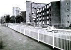
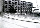
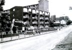
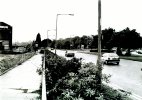
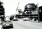
Next you can see the window frames have gone on some flats and the arm of a crane is on the right hand side of the photo and there is someone in the bus shelter. Now this looks like a dual carriagway so this could be Ladywood Middleway, Street view has crossing lights and bus shelter around 219 is this the same location?

SteveBhx
master brummie
Great photograph with the Rotunda framed in the centre by the cranes.Last view is a bit further to the left and shows the work that is ongoing for the rebuilding.
View attachment 179356
Dionysius//88
master brummie
I've just been reading a Birmingham Mail online bulletin that says all is not well at the Peace Garden due to rotting away with Graffiti , Litter, Faeces , all believed to be human plaguing the site . What is the matter with people ??
Last edited:
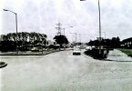
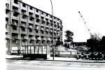
The block of flats in the photo must have been on Tangmere Drive, the first of a long row of blocks on Tangmere Drive. Just looked on Streetview and so many of those blocks seem have vanished in favour of low-rise housing, Can't say I'm surprised given the problems they created, not just on Castle Vale, but in general. Used to get the #64 bus up Tangmere to the terminus/shops when the estate was still relatively new. Thought it was a very open and airy place to live, right on the border of the countryside, easy access to nice walks along the canal, lovely in winter. Stop off at several pubs along the way, Suppose that's all changed now.Next we have a rather vague description of Chester Road Castle Vale for the following pictures - this one is on the approach to Spitfire island although now there are not so many high rise buildings.
View attachment 179347
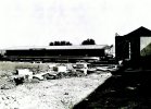
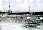
There was no Spitfire Island or 'Spitfire' sculpture in the days I used to visit. But I remember the British Leyland factory nearby on Chester Road. My dad told me about making the planes there and wheeling them across Chester Road to the airfield which later became Castle Vale. Viv
Last edited:
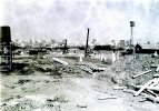
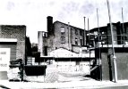
The structure alongside the chimney (left side) looks partially demolished or derelict. Was it a mill or brewery ? Viv
Pedrocut
Master Barmmie
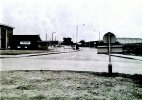
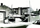
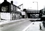
Now we are approaching A & S The warehouse, as it is on a corner I assume this used to be pub - any suggestions. A few cobbled accesses to buildings and I assume the space where a sign used to be on the building on the left.
View attachment 179398
Looks like New Canal Street.
Pub was once the Hope and anchorNow we are approaching A & S The warehouse, as it is on a corner I assume this used to be pub - any suggestions. A few cobbled accesses to buildings and I assume the space where a sign used to be on the building on the left.
View attachment 179398
Dionysius//88
master brummie
Interesting to know Steve thank youFrom Wiki
The First World War Memorial colonnade, which had been built as part of the Hall of Memory to designs by S. N. Cooke and W. N. Twist, in 1925, was relocated here when Centenary Square was laid out 1989. Railings with doves of peace were erected, sculpted by Anuradha Patel.
Dionysius//88
master brummie
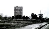
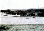
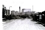
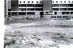
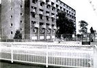
Steve I'm almost certain those are the blocks of flats behind the Hall of Memory there was actually four , Cambridge Tower being the first M=my mate lived in Cambridge in the late 60's till he got married and moved away . Although it was council housing he was almost at penthouse level on the fourteenth floor the girls loved it it I'm told .Finally on this roll are two shot labeled Broad Street / Sheepcote Street as this area is now almost unrecognisable I can only agree but the actual position of the photographs I am unsure of but we have the blocks of flats and the PO Tower for reference.
View attachment 179401
Last edited:
Stokkie
master brummie
Here's the Hope and Anchor together with a sad story.
https://www.closedpubs.co.uk/warwickshire/birmingham_b5_hopeanchor.html
https://www.closedpubs.co.uk/warwickshire/birmingham_b5_hopeanchor.html
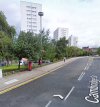
Dionysius I agree. The view below of the towers is from Cambridge Street. One tower has the telecomms equipment on top. I think the B&W photo was taken behind the ICC (thereby obscuring the PO Tower), somewhere near the Malt House. But it's difficult to get at the exact position for a proper view due to building development. Viv

Last edited:

