• Welcome to this forum . We are a worldwide group with a common interest in Birmingham and its history. While here, please follow a few simple rules. We ask that you respect other members, thank those who have helped you and please keep your contributions on-topic with the thread.

    We do hope you enjoy your visit. BHF Admin Team

Brearley Street

Astoness

TRUE BRUMMIE MODERATOR
Staff member
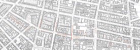
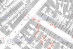
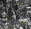
hi mike and all you map experts....i would be so grateful if anyone can provide me a map showing the invidual properties of brearley st from say summer lane going across hospital st to where it ended at gt hampton row...in perticular i am looking for number 225 which i suspect came under brearley st west...

many thanks for you help on this one...

lyn:)
 
Lynn
Gladly,but you don't say when. Between 1880 and 1900 there seems to have been a renumbering (again) from continuous to odd one side and even the other
Mike
 
oops sorry mike..thats my first senior moment of the week and i was doing so well:cry:...anywhere from 1940 to say 1955 if poss...

thanks mike..

lyn:)
 
Lyn
Here is a map c 1913 of Brearley St. No 225 is on the north side between Great Hampton Row and Great Russell St. the pub on the corner of Great Hampton row is the Star & Garter (no 239) I think no 225 is one of the two buildings marked in red.
mike
 
mike you are an angel...thank you so much...num 225 is quite a bit further up than i guessed but you know me...couldnt find me way round me own back garden....but no wonder my friend who as a child remembers the star and garter..they were almost next door to it....

now all i need is a pic of the pub...im sure i have one or maybe ive seen one but do you think i can find it..:rolleyes:

thanks again...

lyn:):):)
 
Mike

Could I ask you to post a little bit more of your map please :) Could you show me more of Great Russell Street (even into Lennox St) at that time, I would be sooooo grateful.

Judy
 
mike how annoying...this pic i have must just be out of shot of my friends house at no 225 and the star and garter is only a few steps to the left then....never mind its close enough and she is happy to have it..

lyn:)
 
Jayell
Here is the street from New john St west on the left to the top of Lennox st at Gerrard St on the right
Mike
 
Many thanks for that Mike. Not sure I am any wiser now, but I have printed it off to have a good look at.

Judy
 
Does anyone know of a Brierley Street in Birmingham? On 1881 census Coxson family were living at number 70 but I cannot find the street in A-Z. Some Coxsons were gunmakers, could it have been near the gun quarter? any suggestions welcome.
 
On the 1881 census the house numbers are consecutive and the listing is:
307half Summer Lane, then Brearley Street 51 to 62 (consecutive), Court14 (11 houses), 63 to 65, Court 15 (5 houses), 66, Court 16 (6 houses), 67, 68, Court 17 (4 houses), 69, 70.

Court 14 is fairly unique as it has 11 houses but even with that information it's very difficult to pinpoint No. 70.
 
In 1881, before the street was renumbered, The Nelson pub was no 79. Now this seems to occupy 2 plots so strictly speaking it might b elabelled 79-80, or 78-79, or might be a double plot. From this it would seem that no 70 must be either the green or blue buildings marked on th emap below. I would consider the green one the most likely as this seems more like a private house
map c1888 showing choice of what was probably no 70 Brearley st in 1881.jpg
 
Its still there just off New John Street West and it would be fair to say near or in the Gun Quarter. View attachment 178551View attachment 178552
thank you, the difference in spelling Brierley/Brearley may just be error on the census I'm guessing .... Thanks for your help, this location makes sense, seems that generations of my family lived and worked within the same small area of Aston throughout 1800s and up to end of WW2.
 
In 1881, before the street was renumbered, The Nelson pub was no 79. Now this seems to occupy 2 plots so strictly speaking it might b elabelled 79-80, or 78-79, or might be a double plot. From this it would seem that no 70 must be either the green or blue buildings marked on th emap below. I would consider the green one the most likely as this seems more like a private house
View attachment 178558
Thank you mikejee for highlighting no 70, I guess the Nelson was their local then
 
On the 1881 census the house numbers are consecutive and the listing is:
307half Summer Lane, then Brearley Street 51 to 62 (consecutive), Court14 (11 houses), 63 to 65, Court 15 (5 houses), 66, Court 16 (6 houses), 67, 68, Court 17 (4 houses), 69, 70.

Court 14 is fairly unique as it has 11 houses but even with that information it's very difficult to pinpoint No. 70.
Thank you, I'm happy to know the street location
 
Here's a link to the 1889 map. Part of Brearley St is at the very top, mainly to the right of Summer Lane. 1891 census puts court no. 18 (marked) between nos. 68 and 70 (going right to left), so probably somewhere in that vicinity...

Thank you for the link, lots of information on the map, I can see the gun and pistol works off Summer Lane, so seems likely they could have worked there. Fascinating to see these locations and link them to families/individuals.
 
I started compiling this map the other day to work out the house numbers prior to renumbering, hopefully it will be of use to somebody in the future. It appears smaller courts were combined into one large court and many courts were obliterated by factories. Census source for this was 1881, Birmingham, St Georges, Districts 5, 11, 14, 19, 29 & 64.
 

Attachments

  • brearley-st-pre-renumbering.jpg
    brearley-st-pre-renumbering.jpg
    1.2 MB · Views: 30
I started compiling this map the other day to work out the house numbers prior to renumbering, hopefully it will be of use to somebody in the future. It appears smaller courts were combined into one large court and many courts were obliterated by factories. Census source for this was 1881, Birmingham, St Georges, Districts 5, 11, 14, 19, 29 & 64.
Really helpful, thank you
 
Should perhaps add that Brearley St west and Brearley St were combined and completely renumbered, even one side, odd the other, between the Kellys of 1883 and 1884
 
Last edited:
There is another thread for Brearley Street called Brearley Street Newtown, on that thread reference is made to the Rose & Crown at No. 154 (new numbering system) corner with Hospital Street.
On the 1871 census there is a Rose & Crown at No. 91 (old numbering system) near to the junction with Well Street, perhaps the newer one was named in recognition of the much older one.
 

Attachments

  • bridge-st-west-1871-census-rose&crown.jpg
    bridge-st-west-1871-census-rose&crown.jpg
    289.2 KB · Views: 20
  • bridge-st-west-rose&crown.jpg
    bridge-st-west-rose&crown.jpg
    502.2 KB · Views: 21
that is a very clear shot of the area john...it shows the star and garter pub better than the actual photo we have of it

lyn
 
that is a very clear shot of the area john...it shows the star and garter pub better than the actual photo we have of it

lyn
These aerial views are a revelation Lyn, when I saw St. George's Terrace on the 1889 map it looked a really upmarket area, perhaps it was originally, but as seen in post #24 it doesn't give that impression. I would love to see a picture just after the terrace was built.
 
These aerial views are a revelation Lyn, when I saw St. George's Terrace on the 1889 map it looked a really upmarket area, perhaps it was originally, but as seen in post #24 it doesn't give that impression. I would love to see a picture just after the terrace was built.
hi john we do have a photo of it on the forum somewhere..will try and locate it

lyn
 
sorry john its colmore terrace i have a photo of not st georges terrace..colmore terrace does have an upmarket house and from memory i think it belonged to someone of note ..also on the forum and you have most likely seen them are photos of gt georges square..

lyn
 
Back
Top