-
Welcome to this forum . We are a worldwide group with a common interest in Birmingham and its history. While here, please follow a few simple rules. We ask that you respect other members, thank those who have helped you and please keep your contributions on-topic with the thread.
We do hope you enjoy your visit. BHF Admin Team
You are using an out of date browser. It may not display this or other websites correctly.
You should upgrade or use an alternative browser.
You should upgrade or use an alternative browser.
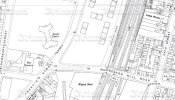
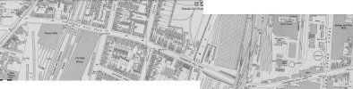
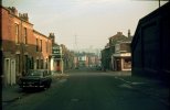
Duddeston Mill Road
- Thread starter brummy-lad
- Start date
brummy-lad
master brummie
Here are some
Attachments
-
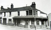
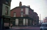 duddestone mill road junc inkerman st the victoris poss 1960s.jpg48.7 KB · Views: 24
 -
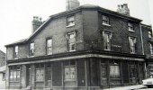
 Duddeston%20Mill rd Victoria Inn on the corner of Inkerman St.jpg103.8 KB · Views: 22
 -
 Duddeston%20Mill rd Manor Arms on the corner of Cato St.jpg121.4 KB · Views: 24
 -
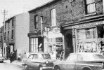
 Duddeston Mill Road,Saltley.jpg88.5 KB · Views: 23
 -
 Duddeston Mill Rd 1965.jpg61.1 KB · Views: 23
 -
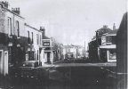
 Down duddeston road from station 1969.jpg116.7 KB · Views: 23
 -
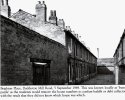
 corner duddestone mill road and cato st 1958.jpeg173.4 KB · Views: 23
 -
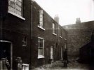 6 Court, Duddeston Mill Road.jpg53.1 KB · Views: 22
brummy-lad
master brummie

An aerial view from 1935, Duddeston Mill Road is running horizontally through the centre of the image.
More photos of Duddeston Mill Road
Attachments


great photo mike...often seen the mill marked on maps and wondered what it looked likeHere is the Duddeston Flour Mill. Presumably the same building as marked as a sawmill on the 1880s map. There is a corn miller listed in the 18855 directories, but his works are on the road seemingly nearer to Birmingham
View attachment 219993View attachment 219995
lyn