• Welcome to this forum . We are a worldwide group with a common interest in Birmingham and its history. While here, please follow a few simple rules. We ask that you respect other members, thank those who have helped you and please keep your contributions on-topic with the thread.

    We do hope you enjoy your visit. BHF Admin Team

Ladywood Road

Below is a 1950s map. . On the extreme left of the photo, behind the lampost, is a feature (cornice?) which is different from that above the doors in the photo. this then must be the entry which seems to be shown on the map to the left of no 126. Therefore the main houses featured must be 126-124, with part of 123 on the right map 1950s showing 126 to 123 Ldywood road.jpg
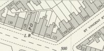
 
Below is a 1950s map. . On the extreme left of the photo, behind the lampost, is a feature (cornice?) which is different from that above the doors in the photo. this then must be the entry which seems to be shown on the map to the left of no 126. Therefore the main houses featured must be 126-124, with part of 123 on the right View attachment 201105
Hi Mikejee, is there any chance you have this map area for 168 ladywood road?
 
The are changed a lot around ww2. There are no large scale maps available online between about 1913 and 1950s, and by 1950s the area was completely different , and 168 did not exist. No. 168 was the Salvation Army hostel. This was "The Hawthornes , before becoming the hostel.
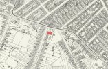
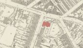
It is shown on the 1886 map below and the smaller scale 1913 map

map 1913 showing the Hawthornes ladywood road.jpgmap 1886 showing the Hawthornes ladywood road.jpg
 
Back
Top