-
Welcome to this forum . We are a worldwide group with a common interest in Birmingham and its history. While here, please follow a few simple rules. We ask that you respect other members, thank those who have helped you and please keep your contributions on-topic with the thread.
We do hope you enjoy your visit. BHF Admin Team
You are using an out of date browser. It may not display this or other websites correctly.
You should upgrade or use an alternative browser.
You should upgrade or use an alternative browser.
Ex Staff Member {Maggies}
proper brummie kid
Hello Vikki,
I haven't read every thread on Kingstanding on this site so I don't know if you have already got the information that you wanted a number of years ago.
You were enquiring about the location of Warren Farm.
If you walk down the Charlton Road from Hawthorn Road (when Warren Farm existed, Hawthorn Road was known as Short Heath Lane) to the far side of Norbiton Road and stand on that corner, the back gardens of the houses that stand on the corner of Charlton Road and Norbiton Road are built on top of Warren Farm foundations.
It used to stand at the end of what was known as Holly Lane (Kingstanding Road was also called Holly Lane at the time.
Charlton Road follows, more or less, the route of Holly Lane.
There used to be a large body of water on Warren Farm land called Lodge Pool, the island that now stands at the bottom of the hill in Warren Farm Road is built on top of a filled in Lodge Pool.
Augustine Lewis Wells, my Great Uncle, owned and farmed Warren Farm until his death in 1934.
With best wishes from Rod.
My mum during the later part of ww2 talks of having worked for Birmingham Corporation as a nursery nurse at the day nursery in Kingstanding called the Circle Day Nursery does anyone recall such a place i have seen some photographs of her in her uniform with the children but not of the front outside of the building .Stared early in the mornings when the women went to work in the munitions factory
Last edited:
"There used to be a large body of water on Warren Farm land called Lodge Pool, the island that now stands at the bottom of the hill in Warren Farm Road is built on top of a filled in Lodge Pool".
Many thanks again Rod. I did wonder what happened to Lodge Pool as it cropped up on the Pool Cottages, Rodwell Drive thread. Will drop in a link here to that thread (https://birminghamhistory.co.uk/forum/showthread.php?t=35541). Viv.
For years I've tired to remember exactly were there was a nursery (the plantsman type) along Kingstanding Road. Now I've just spotted this on Google maps and think it might be the place. This spot is just along from Old Oscott Hill, heading towards the Circle. Does anyone know if this was once a nursery? We used to buy plants, shrubs etc from there, maybe even our Christmas tree. I did wonder if it was part of a farm, but we definitely used to go in through a gate off K'standing Rd. I'm talking about it being there in the mid/late 1950s. Viv.

jennyann
Gone but not forgotten. R.I.P.
Looks as though the Circle Day Community Nursery is still going at 750 Kingstanding Road. https://ukplaces.com/nursery-schools/birmingham/circle-community-day-nursery
jennyann
Gone but not forgotten. R.I.P.
This is a link to Chris Hilcox's excellent site on Kingstanding. Chris has a Copyright link on this site. https://kingstanding.wordpress.com/...ncludes-photos-of-dulwich-road-senior-school/
oldMohawk
gone but not forgotten
Hi Miriam.
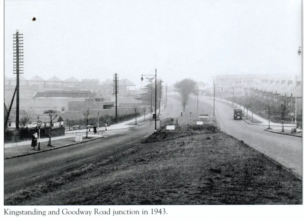
I used to be taken past the nursery on the way to my Nans. We lived on the Beeches Estate and used to walk up Goodway Rd. I think the old Drill Hall is also in the photo and there was a Co Op milk depot, I remember all the horses lined up from the milk carts.
Phil
I used to be taken past the nursery on the way to my Nans. We lived on the Beeches Estate and used to walk up Goodway Rd. I think the old Drill Hall is also in the photo and there was a Co Op milk depot, I remember all the horses lined up from the milk carts.
Phil
oldMohawk
gone but not forgotten
Some features I often notice in old pics are the old GPO Telegraph Poles - in the photo in #1091 each pole has 14 bars and each bar had maybe 4 wires so a barrier of 56 wires birds had watch out for.
In the road I lived in my kite got snagged on telephone wires, it was up there for months.
In the road I lived in my kite got snagged on telephone wires, it was up there for months.
Thanks all for your interesting posts. Think I've probably mislead you - I'm looking for the gardening variety of nursery not the little cherubs variety!! But all the same, you've added some nice memories to the thread. Viv.
oldMohawk
gone but not forgotten
Hello Miriam,
I can't remember what the building became. I've just had a look around the on Google Streetview and can see a very large nursery on the corner, and what I knew as the Drill Hall may still have something to do with the Territorial Army because I can see a Union Flag in front of the building but can't read any notice boards.
Phil
MiriamB
master brummie
Hello Phil. Remember the drill hall - When I was a 'Gel' many moons ago - I remember going to a dance there. I knew a certain person would be going so I dressed my self 'up to the nines' - He never batted an eyelid! didn't fancy me, I expect
but I still remember himto day.!!!!!!!! Miriam.
but I still remember himto day.!!!!!!!! Miriam.
oldMohawk
gone but not forgotten
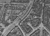
My brother-in-law vaguely remembers a nursery with shrubs (not little cherubs) near the old Midlands Counties Dairy situated on the site of present day Heather Croft road, and the nursery probably sold heathers maybe suggesting the road name. The Google Earth 1945 view shows the building with a small field behind, the 2005 view shows the building being demolished, and the 2007 view shows the present block of flats.I'm looking for the gardening variety of nursery not the little cherubs variety!!
Attachments
Last edited:
Phil, that's fantastic I think that's the place. I remember it was near Atlantic Road where we lived, so I think there might have been an entry/entrance to it from Atlantic. I remember it as a great, big, open field (not like the garden centres today, more like a really large allotment with a shed). But it was a business and we bought lots of shrubs from there. And you're right, we probably did pick up one or two heathers too. I remember the field having a lot of low growing shrubs, all in long lines, which could well have been heather, but I would have been very young at the time so can't be sure. I also remember the field was quite raised up from the entrance. I expect this was probably once part of a farm but as most of the land had been built on by the 1950s, I've always found it odd that this sticks out in my mind. Whatever it was, I loved the place. Thanks for solving my nagging question. Viv.
Phil
Gone, but not forgotten.
I have been asked by cal1966 to see if I can dig up some photos of Kingstanding and Perry Common. Well Caroline this thread I have dug out holds quite a few if you delve into it, but sadly quite a few are still missing due to the hacking we suffered.
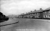
I have looked through the thread and I will try not to repeat any that have been submitted previously, as I explained in my PM I have no great knowledge of Kingstanding and its surroundings, so please forgive any errors. So lets make a start with these few that I have no doubt you will recognise. If you have a problem just run your mouse over the thumbnail and a title will be revealed
I have looked through the thread and I will try not to repeat any that have been submitted previously, as I explained in my PM I have no great knowledge of Kingstanding and its surroundings, so please forgive any errors. So lets make a start with these few that I have no doubt you will recognise. If you have a problem just run your mouse over the thumbnail and a title will be revealed
Attachments


Phil
Gone, but not forgotten.
Cal
here are a few more of the Perry Common area, hope you can recognise them.
here are a few more of the Perry Common area, hope you can recognise them.
Attachments


irene floyd
master brummie
Lovely Pic's Phil.Have You Any Of Bendall Rd In the 60s? Irene