• Welcome to this forum . We are a worldwide group with a common interest in Birmingham and its history. While here, please follow a few simple rules. We ask that you respect other members, thank those who have helped you and please keep your contributions on-topic with the thread.

    We do hope you enjoy your visit. BHF Admin Team

Old Maps

Carolynn

master brummie
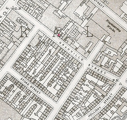
Would anyone have old maps showing 40 Granville Street and 148 Park Road, Aston. I would be most grateful. Thanks
 
Here are what I think are no 40 Granville st and no 148 Park road, aston . If I am wrong i'm certain that it is only by one house, but I think these are the most likely. In the Granville st one Broad st is just in the left hand top corner. In Park road, the park is in the top lLH corner with Frederick then Albert & then Victoria roads.
Mike.

map_c_1914_no_148_park_rd_astonA.jpg


map_granville_st_c_1913_no_40_prob_.jpg
 
Last edited:
Mike many thanks for your help. Apologies in delay for replying to you. Granville Street was hairdressers and Park Road was a grocery shop. Carolynn. :)
 
Back
Top