Lee Harris
proper brummie kid
I am hoping someone can help me please with this enquiry.
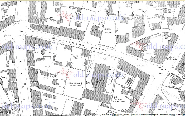
Six children of my Harris ancestors were all baptized between 1796 and 1810 at the Mares Green Independent Chapel,located in Messenger Lane, West Bromwich. The family lived in ‘West Bromwich’ (first four baptisms) and ‘Handsworth’ (last two baptisms) as per the baptism info.
I need to find out exactly where the Chapel was located. West Brom was a series of villages about 1800. Around that time some of my Harris ancestors lived in Handsworth at Grove Lane.
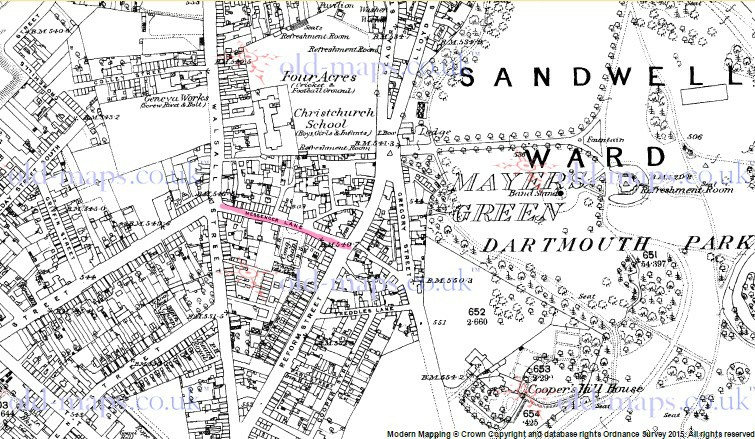
As far as I can tell, Messenger Lane doesn’t exist now, but I think it may have become Messenger Road, Smethwick. (If so, my ancestors would have lived just a short distance from there, at Grove Lane).
Or was the Messenger Lane elsewhere in the West Bromwich area, and no longer exists?
I don’t have a street number (- not available in 1841 to 1861 Censuses) so am wondering which Grove Lane they lived in because there are two Grove Lanes – one in Smethwick, close to Messenger Rd/Lane, and the other is just a mile or two away in Handsworth near Church Lane and Handsworth Park. Perhaps years ago it was all one long lane and all classified as "West Brom' or 'Handsworth' back then. Some old maps I’ve checked aren’t showing details about this.
I’m hoping someone with knowledge of West Bromwich and Smethwick can help me please by telling me if the Mares Green Chapel was located in or nearby to the existing Messenger Road.
And would anyone know if Grove Lane ‘Handsworth’ in Censuses included the Grove Lane that now exists in Smethwick?
Thanks in anticipation.
Last edited by a moderator:


