-
Welcome to this forum . We are a worldwide group with a common interest in Birmingham and its history. While here, please follow a few simple rules. We ask that you respect other members, thank those who have helped you and please keep your contributions on-topic with the thread.
We do hope you enjoy your visit. BHF Admin Team
You are using an out of date browser. It may not display this or other websites correctly.
You should upgrade or use an alternative browser.
You should upgrade or use an alternative browser.
map request
- Thread starter Astoness
- Start date
Lyn
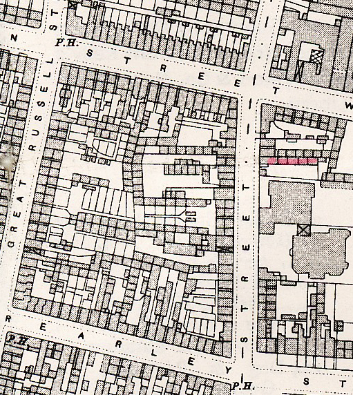
Only just been able to det round to it. court 29 in red . the 1889 map shows 6 houses in the row behind the house on the street. plus an extra one behind the street house on the other side of the entrance
 View attachment 71819
Only just been able to det round to it. court 29 in red . the 1889 map shows 6 houses in the row behind the house on the street. plus an extra one behind the street house on the other side of the entrance
Hi Mike,
I hope I'm talking to the right man here - if I'm not my apologies and Merry Christmas anyway!
My great grandfather was a policeman in Aston between 1885 and his death in service in 1903. The censuses and other info give me various addresses in the area - Duddeston Mill Road in 1891, Argyle Avenue in 1901, Lime Terrace Witton Road in 1911 and Nechells Park Road in 1915 and 1918. Could you point me in the direction of a large scale map that would give me house positions for the first three please. The house in Nechells Park Road is still there and seemingly well maintained.
Many thanks
Steve
Sully
Below are three maps. to get them all on one map would not be possible un;ess the houses were so small you wouldn't see them, but I think you should have no trouble placing them as I have included on maps roads that are still there.
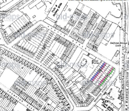
Argyle Avenue is, like some otthe similar places in Birmingham , not, as you would expect, a road, but a court/terrace leading off Argyle st. They houses are back to backs, and those definitely in argyle Avenue are in red. the one in blue, I am not clear as to whether theyare included in the avenue or not, but cannot find another terrace nearby that seems to fit. the green houses would be listed in Wharton St. Not sure of the numbering
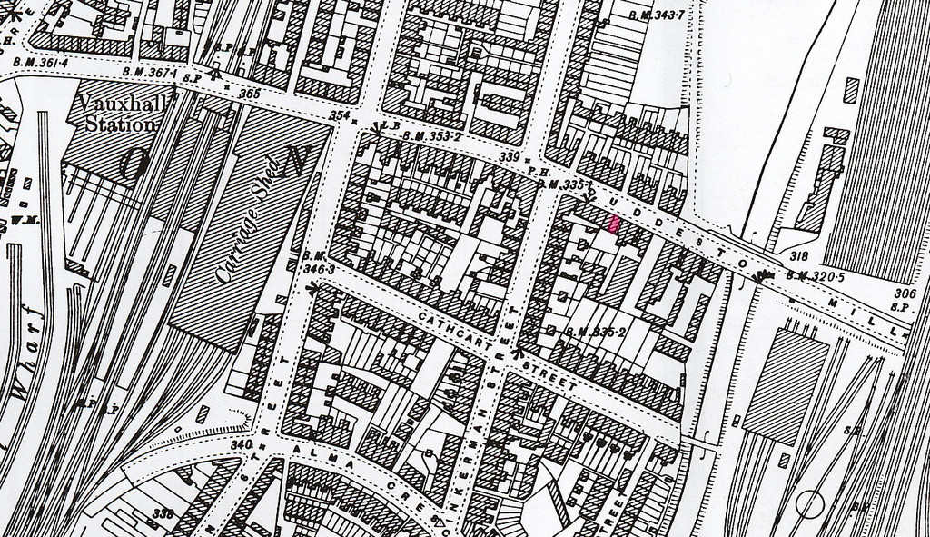
No 122 duddeston mill road is marked in red.
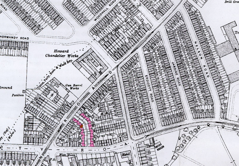
Lime terrace is in red. I think, but am not sure no 5 would be theone i have amrked in a darker red-brown
Mike
Below are three maps. to get them all on one map would not be possible un;ess the houses were so small you wouldn't see them, but I think you should have no trouble placing them as I have included on maps roads that are still there.
Argyle Avenue is, like some otthe similar places in Birmingham , not, as you would expect, a road, but a court/terrace leading off Argyle st. They houses are back to backs, and those definitely in argyle Avenue are in red. the one in blue, I am not clear as to whether theyare included in the avenue or not, but cannot find another terrace nearby that seems to fit. the green houses would be listed in Wharton St. Not sure of the numbering
No 122 duddeston mill road is marked in red.
Lime terrace is in red. I think, but am not sure no 5 would be theone i have amrked in a darker red-brown
Mike
anvil man
master brummie
Mjkejee,
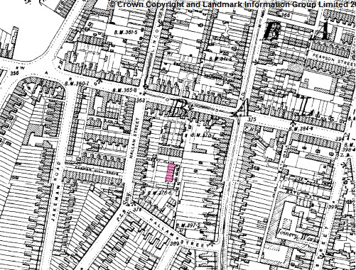
I've just come across thread and realize you are the Birmingham road map man. I wonder if you could find me a map showing Victoria Place HallamSt Balsall Heath?
I have recntly come across a telegram sent to my late mother from a friend wishing her a happy 21st bithday in 1928 and would be appreciate your help.
Wonderhorse
New Member
Hi
Is it still possible to find a map of the lower end of Duddeston Mill Road, perhaps relating to the 60's and before. I lived there in old victorian housing then and sadly with it all gone and industrial warehousing now, there seems precious little information about that housing. I was too young to remember the name of the shared tenement yard where our house would have been.
Thank you either way.
Les