• Welcome to this forum . We are a worldwide group with a common interest in Birmingham and its history. While here, please follow a few simple rules. We ask that you respect other members, thank those who have helped you and please keep your contributions on-topic with the thread.

    We do hope you enjoy your visit. BHF Admin Team

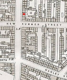
Map of Summer Lane & Hockley

mossg

master brummie
Is there anyone who could upload a streetmap covering the above area?
I would like to use it to cross reference pubs and other places of interest to me.
I have started with this small map,and would like to cover a larger area.
1-The Dolphin.
2-The Justice.
3-The Geach.
4-St Matthias Tavern.
5-The Vulcan.
6-The Red House.
7-The Green Man.
8-The Three Horse Shoes.
9-The Birmingham House.
10-Cross Guns.
Maybe some of you could correct it or add to it.
 
hi mossg...last year there was quite a long running debate:rolleyes: as to where the vulcan pub was situated.....thanks to your map you have confirmed that is was indeed on the corner of njsw and hosptal st...opposite box carton.....if you want any pub pics just let me know as i have got or already posted pics of most round that area....my only regret is by the time i was old enough to go in them a lot had been demolished....:(:(:(

lyn:)
 
Hi Mossg

Thanks for posting the map with the position of the pubs, that is really useful.

Judy
 
i have just found on the 1841 cencus a relative that was a boot and shoe dealer 44 summer lane can anyone tell me where No 44 would have been, i have tried to look on the maps but have no idea of the number.
 
Hi Maur

On this map your relatives premises would be roughly where I have placed the red X.

On mikejee's map on reply 2 of this thread it would be about the third or forth premises down from New Summer St. Perhaps Mike will be able to pin point it for you.

Phil
 

Attachments

  • Summer Lane .jpg
    Summer Lane .jpg
    142.8 KB · Views: 77
Thanks Phil I have been looking in the old directorys and find that the boot and shoe dealer was still there into the 1900s.
 
Hi Maur

There must have been some sort of a change at the turn of the century as I see by the listings in 1903 No 44 was a shared premises having two listings. Miss Mary Anne Stansbie Boot & Shoe Maker & Mr John Parish Greengrocer.

By the time of the next listing I have 1913 No 44 was recorded as Mr Alfred Hands Confectioner.

Phil
 
Maur
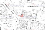
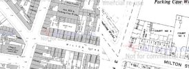
attached is a map (1913 but the positon and possibly the buildings are the same) with no 44 marked in red. The position is confirmed by the entry to a court (8 Court) just after it, as shown in the 1855 directory
Mike

no_44__summer_lane_c_1913.jpg
 
hi phil and mike....maur will be pleased..i told her you would help her out....

lyn:):)
 
Thankyou ....... Phil and Mike for all the information you have found me, thats great. I am finding these Stansbies everwhere , i think that every street must have had one, and thanks to Lyn for pointing me in the right direction.:)
 
lol maur...its just like my lot..im sure that took up residence in most aston..hockley and lozells street....

lyn:):):)
 
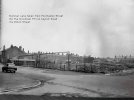
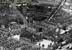
A great view of Cowper St (?) School.
Yes it is, also Porchester Street where before the war my father started as a carpenter at Pearson's Shopfitters, spent all his working life there, and went on to become a director of the company.
 
  • Appreciate
Reactions: MWS
Thank you. You guys are amazing..any idea why this house was so big in comparison to others on the street?
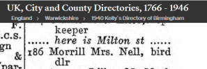
i dont think it is bigger laura...i could be wrong but i think mike may also have coloured in no 1 milton st....186 is the little bit on the end....hopefully he will be able to say...

here is a todays view...the ground now has an aldi supermarket standing there

lyn

 
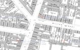
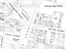
Looking at these 2 maps from 1889 & 1950s it looks as though No. 1 was absorbed into No. 186. What is strange is that there isn't enough room for the remaining numbers 2 to 10, numbering goes from 3 to 7 with only 2 houses between. Perhaps a mistake on the map?
 

Attachments

  • milton-street-maps.jpg
    milton-street-maps.jpg
    318.6 KB · Views: 16
I do not think I am wrong in relationship to what the map shows (though this may not be accurate) . The uncoloured 1950s map shows it as one building, as does the c1889 map , both below

map c1889 showing corne summer lane and Milton St.jpgmap 1950s showing corner of Summer lane and Milton St.jpg
 
Back
Top