• Welcome to this forum . We are a worldwide group with a common interest in Birmingham and its history. While here, please follow a few simple rules. We ask that you respect other members, thank those who have helped you and please keep your contributions on-topic with the thread.

    We do hope you enjoy your visit. BHF Admin Team

Ladywood queries

BordesleyExile

master brummie
1) Could anyone tell me quite where Victoria Place, Ladywood would have been or is? This was the address given on a birth certificate.
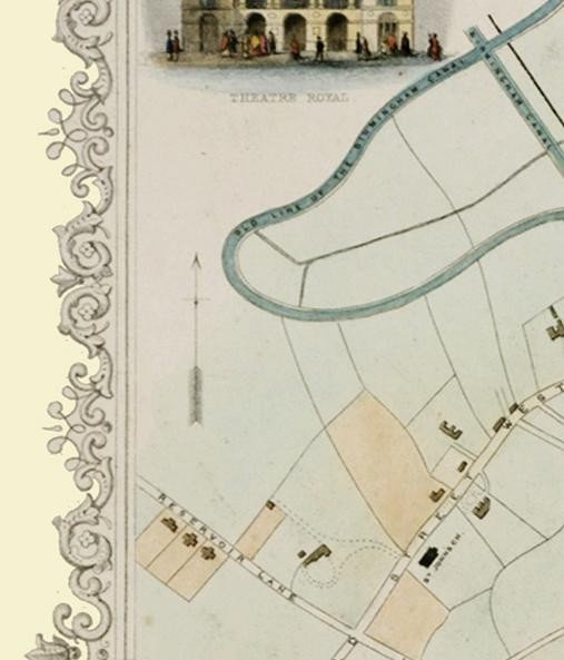
2) The address for Ann Milner in 1851 seems to be Reysenbryn Cottage, Ladywood, although the writing is difficult to read. Does anyone with local knowledge understand what the word should be & where the location is or was? This is a long shot I know, but any help would be appreciated. Ann variously gave her birth year as 1787, 1785 or 1789 & had been born in West Bromwich. A widow, she lived with her son John Milner who was born in Birmingham about 1828.
I do so like to anchor the family to a location.
 
The 1921 kelly's lists the following victoria places:

Victoria place, 40 Alma st. Aston..
Victoria place, Artillery street
Victoria pi. Aston, 48 Grosvenor rd
Victoria pi. Aston, 140 Queen's road
Victoria pi. I l l Aston Brook street
Victoria place, Bell Bam road
Victoria place, 63 Birchfield road..
Victoria pl.26 Charles Henry street
Victoria place, 141 Edward road . .
Victoria place, 59 Friston street....
Victoria place, Handswortli, 36
Brearley street
Victoria place, 41 Hanover street...
Victoria place, Heatlifield road,
King's Heath
Victoria pi. Hockley, 48 Heaton st.
Victoria place, 35 Hope street,
Victoria place, 336 IcknieldPort rd
Victoria place, 142 Lee Bank road..
Victoria place, Main street
Victoria place, 49 Mary street
Victoria place, 7 Moorsom street..
Victoria place, 11 Nechelis Pk. rd.
Victoria pi. 60 Park road, Hockley​
Victoria place, Rann street
Victoria place, Rawlins street..,.
Victoria place, Rocky lane
Victoria place, 59 Rupert street....
Victoria place, 91 St. Mark stree.t..
Victoria place, Waterworks street.,
Victoria place, Westley street
Victoria place, 55 Wheeler street​
Victoria place, 104 Wvnn street

The Wynn st one is the last "place/terrace" off wynn st on the east side going towards Great colmore st. Can't find the victoria place off bell barn rd, though there is a victoria terrace, so it might be a mistake in kellys.
m ike
 
Thank you very much indeed, Mike. That gives me more to go on - the 1970s A-Z had not been making any sense but now I have locations to search.Victoria WAS popular!
 
The family seem to have favoured Friston St, living at 1 back 29 , 28 Friston St in 1871 & 6 back of 12 Friston St in 1881 so perhaps Victoria Place at 59 Friston St is more likely. Nevertheless I will cross check further tomorrow. Thank you, Mike.
 
I do not know the area at all but from the 1851 census the name of the cottage appears to be the enumerators attempt to spell Reservoir.


The next entry to your family is Rotton Park Engine house and the neighbouring addresses are Icknield Street West,
The address appears to be close to Edgbaston Reservoir and near to Rotten Park Farm.Perhaps one of our members has the farm on an old map.
 
Thank you, Alberta, for your creative input & problem solving. I would never have thought of the word as reservoir, but your suggestion makes sense. I am delighted that you have given me a better sense of the location - 1851 Ladywood is well outside my area of expertise.
 
Found a piece of info. that says that the Rotton Park Farmhouse stood where City road and Fountain road meet.
 
Thank you so much, Alberta. I will be hunting this evening to see if I can find photos of that site to see what the farm was sacrificed for. In order to understand the area better I have ordered the Ladywood & edgbaston maps from Alan Godfrey.
With regard to the other query, Victoria Place Ladywood was next to or near Mount PLeasant, but I cannot find that either. Could anybody help, as the Alan Godfrey maps will not show small detail?
 
Mount Pleasant later was renamed Artur St, and went from Sherborne Rd to Balsall Heath Rd, as can be seen on the 1890 map. It is Arter St on the allan Godfrey 1913 map. If it is this one then the mary st or Edward rd ones from the directory seem the most likely
But this doesn't correspond to my description of ladywood, but the only other ones seem to be off coventry road or mount pleasant av. which is in Handsworth.
mike
 
Thank you, Mike. It would never had occured to me that Mount Pleasant had had a name change to Arter St. With the aid of your full description I have been able to find Arter St. The Balsall Heath location is a puzzle. The eccl parish on the 1861 census for Samuel Symmonds (dob abt 1811) was given as St Johns, so I am off to search for a map of eccl areas.
 
Alberta this is to let you know that you were absolutely correct in surmising that Ann Milner's cottage was Reservoir Cottage. I am now in receipt of a 1849 death certificate for George Milner, husband of Ann. The address is given as Reservoir Cottage, Reservoir Lane. The Waterworks Reservoir Tower , which I guess must be the Rotten Park Engine House of 1851, is in Reservoir Road so I think that "Lane" was changed to "Road" by 1879.
Thank you very much indeed.
 
map_1851_mapseeker.jpg
Your assumption as to the name change is correct. The 1855 directory (which would refer to 1854) calls it reservoir road, but, on the mapseeker website is the attached section of an 1851 map showing it as reservoir lane. So change was between 1851 and about 1854.
mike
 
Mike that is brilliant! I had been looking for so long for a detailed map of Ladywood for around the 1851 period & had come to the conclusion that I was chasing rainbows. It is great to narrow Reservoir Cottage down to one of 3 buildings. Thank you.
 
shirley..you must be delighted to have made progress with this...

mike and his maps are brillient..

lyn
 
Glad its of use. I don't think you can necessarily limit it to those three cottages shown on the map, as the map doesn't go as far as the reservoir, and there might be further buildings off the map. Incidentely, i have now found another mention of the lane. The 1849 whites directory doesn't have a street list, only a list of people, but a word search of the pdf shows:
Williams​
Samuel D., lime merchant, Easy

row ; house. Reservoir lane
This is the only mention of reservoir lane; No George Milner is listed.

Mike
 
Thanks Mike. The reason that I think Reservoir Cottage is one of the 3 shown on Mapseeker is that the 1879 map seems to show 3 cottages in what looks to be the same location, albeit with a different shaped footprint and in 1879 there were no dwellings in Reservoir Lane closer to the Reservoir.
Saving a copy of the close up from Archives CD did not work as the whole Birmingham map was saved, so later this afternoon I will experiment with printing out the portion of the map, scanning, saving & posting. If this strategy works it should be possible to show on BHF the area in 1879.
 
I think this is what you meant. If you have vista on your computor , then you can copy anything on screen with the snipping tool (which is on there somewhere in accessories. It is from the archive CD map cd.
mike
 
Thank you Mike. That is exactly the map I had referred to. I am self taught & it takes me a little while to acheive the result I want. Thanks for the Vista tip. I set up my new computer, complete with Vista, 8 days ago & I am still discovering strategies.
 
The footprint of Rotten Park Reservoir alters according to the maps of different periods & I see from other research on the web that the water level can be cause for concern if it is too low or too high, so it would perhaps explain the distance of the cottages from the water.
Thank you for looking up the directory, Mike. George Milner was a labourer up to the time of his death in 1949, so it is no surprise that he was not mentioned in the directory. How much easier when later family members were in business & therefore findable in directories.
 
Back
Top