• Welcome to this forum . We are a worldwide group with a common interest in Birmingham and its history. While here, please follow a few simple rules. We ask that you respect other members, thank those who have helped you and please keep your contributions on-topic with the thread.

    We do hope you enjoy your visit. BHF Admin Team

Gosta Green Recreation Ground

waswigg

proper brummie kid
about 1957 i can remember going to a park, which had no grass and only a few play things horse, witche's hat ,I can't even remember swings.
I lived in Gosta Green I was only about 6 or 7 went with some friends. Even at that age I was adventurous.
can any one help please ,I thik there were rails all around and it may have been down a hill
Anyone remember it?
 
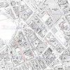
The map below dated 1951 shows a childrens playground (shaded pink) on the corner of Lister Street and Holt Street. Gosta Green itself is shaded green. If this is the park I could upload an aerial photo which shows it as it was in 1933.
Screenshot (510).jpg
 
That's the park my old mate,used to get loads of scratches on my knees and legs,an aerial photo would be great. To think we were okay to wander about age 5,6,or 7 and no harm would come to you. Couldn't do it now
cheers waswigg
 
Yes as a child I used to be out all day apart from coming back for meals etc .... :)
Below is an aerial view of Gosta Green dated 1933 and to match the map the park is shaded pink and Gosta Green shaded green. The central fire station had not yet been built.
GostaGreen1933.jpg
image from 'britainfromabove'
The park is now under a building
Parknow.jpg
 
Last edited:
Thanks a lot for your reply,I am writing my life story (prompted since my mom died) its surprising how far back you can remember if you push your mind
I can remember things age 5 (not bad 70 in 18 months) great time in the slums,9 years army early n/ireland (1972) climbed Ben Nevis. Moved to Somerset 40yrs ago
I could carry on , this map will bring more memories back
thanks very much for map
waswigg
 
Do you have a view of Sheep st it was off Lawrence St , I used to live in 36 Sheep st nr Kyrle Hall like to see distance to the playground you found
many thanks waswigg
 
I'll have a look at the old maps and aerial views and see what I can find.
There is Lawrence St mentioned in the 'Old Streets' thread.
Regarding childhood memories ... when I was five I was in our house when the Luftwaffe decided to drop a bomb on it ... so I definitely remember that .. and when you were playing in the park in 1957 I was in the RAF doing National Service ... lots of memories in the National Service thread .... :)
 
The 1951 map below shows Sheep Street and Kyrle Hall.
map1.jpg

On the aerial view I have marked what I think is possibly Lawrence Street.
GostaGreenarea1933.jpg

Enlargement ... Police Station marked
DukeStLawrenceSt_1933.jpg
Please note that there are forum members who know much more about this area than I do !
 
Last edited:
As I was looking at Lawrence st I noticed where the houses were a Ruin. I can remember this house may have been 2. Always wondered why they were a ruin ,was it a bomb or a fire,does any one know?
waswigg
 
Waswigg,

Re: your post #13, you've started a separate thread about this and I have replied there.

Maurice :cool:
 
Thank you Oldmohawk for the Map of the Children's Playground
It reminded me about taking my young sister to what we call now (Pre School)
Past that park
 
Back
Top