• Welcome to this forum . We are a worldwide group with a common interest in Birmingham and its history. While here, please follow a few simple rules. We ask that you respect other members, thank those who have helped you and please keep your contributions on-topic with the thread.

    We do hope you enjoy your visit. BHF Admin Team

Gas St picture published 1858

I think the house shown in your link is really attractive, Aidan, & one I shall be researching. If you look at the two arched windows in the 1858 picture they & the hipped roof match those to the left of the Gas Retort so perhaps its one complex. I had always assumed the striking curved roof of the Gas Retort was part of the original 1822 building, but the print leads me to question that. I certainly think that it is an issue to unpack. The canal puzzled me too at first, but there looks to be a limb off the Gas St Basin which leads under Gas St. I am happy to be corrected.
https://www.imagesofengland.org.uk/Details/Default.aspx?id=410202
https://www.english-heritage.org.uk...-west-midlands-region/harwestmidlandsacc.pdf/
https://www.theriverproject.co.uk/venue.html
 
The picture is looking away from the Gas Street basin and the street running diagonally up from the left is Holliday Street. Bottom right of the picture you can see a basin that ran under Gas Street and linked up with the main Gas Street basin above the bar which was behind the draughtsman. The curious thing is that this picture is made before 1858 in the late 1700s before the Worcester canal was constructed. You should be able to see the Corporation Wharf and the Worcester Canal on the other side of Holliday Street but it is not there. As an aside when the Worcester Canal was constructed it was not connected to the existing BCN canal above the bar and it looks like this iron company had a second basin put through to send goods in the Worcester direction.
A very important insight to back then is this picture and a little vision to fill in the words on Wickipedia. The junction behind the chimney is Berkley Street.
The title talks about roofing material and the picture seems to have, behind the buildings, an assemblage of roofing trusses with men working. Is that Holloway Head windmill again middle distance to left of the chimney. Maybe you can run a sightline on that Aidan. I think that the distant tower is too far west though and again the draughtsmanship is very fine.

https://www.british-history.ac.uk/m...d=10089&ox=4675&oy=2316&zm=1&czm=1&x=765&y=17

The map spreads over two pages so here is the other part

https://www.british-history.ac.uk/m...d=10098&ox=325&oy=2061&zm=1&czm=1&x=149&y=503
 
Lovely find. As you say most disconcerting as I can't seem to get a reference point even for the familiar canal junction, but I wonder if the house to the left was this one that was subsequently enlarged? https://maps.google.co.uk/maps?q=52...z-pXmVbLiAQc7rcwdHCzBA&cbp=12,71.09,,0,-12.78

I think the view on the first picture is the OTHER side of Gas Street, the WEST side.

Part way down Gas St is the remains of a canal arm that goes UNDER Gas St, and I think we are looking at this view.

The Retort House (mentioned above) has the same windows as in the orginal picture (windows within a brick window frame) although the roof is different.

See the Retort house below here and compare it to the picture above (the building with chimney coming out the top).

https://maps.google.co.uk/maps?hl=e...ppWuYmcIZ6v7LMn4bQ9BfA&cbp=12,257.27,,0,-8.01
 
You got in before me , but as confirmation, the works in the 1855 directory is unnumbered but is after no 7,. numbering goes 1,2 ... down the north side of the street from Broad st and then up the south side. It is on the south side before the lead works shown on the 1890 map and in one of the blue areas, most likely the darker blue area

gas_st_1890.JPG
 
I think the basin in the picture has to be to the north of the light blue colour. If the Worcester canal is not yet constructed in the picture...it being not shown, then a more southerly basin would have nothing to feed in to. Unless there are other features here that are not known. Since Holliday street was offset to feed down under the new canal you would have thought that some indication would have been present in the picture of this but there is not any.
 
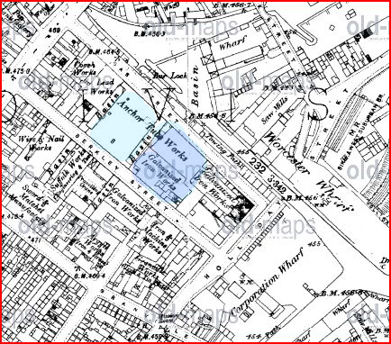
.... Is that Holloway Head windmill again middle distance to left of the chimney. Maybe you can run a sightline on that Aidan. I think that the distant tower is too far west though and again the draughtsmanship is very fine....

Within artistic licence, I think you may be right Rupert and it could be Holloway Head Windmill. There does appear to be a slope down to the left of the windmill tower. I would have expected it to be farther left in the picture though and we should be able to see the St Thomas Church (there is perhaps a hint of it to the right of the windmill but too indistinct to be sure - is there a bigger copy of this picture?). But this must be done by imagination as I can't think of where the artist would have got such a vantage point. I wonder if the steeple of The Church of the Messiah https://forum.birminghamhistory.co.uk/showthread.php?t=30581&p=330669#post330669 was used and hence some errors in the representation?

The maps you posted are amazing in showing what a hive of industry that Broad St area really was.
 
Last edited:
Yes, Aidan, a hive of industry indeed. so much so that given the smoke and prevailing wind direction...the rich folk moved abode westwards in the direction of Edgebaston and Bournville. Later Cadbury moved out from the top of Bridge Street at which time the Worcester Canal would have serviced his chocolate factory and when the railway ran alongside of the canal he had the best of both worlds. They had their own engines.
 
Back
Top