• Welcome to this forum . We are a worldwide group with a common interest in Birmingham and its history. While here, please follow a few simple rules. We ask that you respect other members, thank those who have helped you and please keep your contributions on-topic with the thread.

    We do hope you enjoy your visit. BHF Admin Team

Elkington Street/Bracebridge Street 1930's to 1968

MadMomma

Wannabe Brummie Again
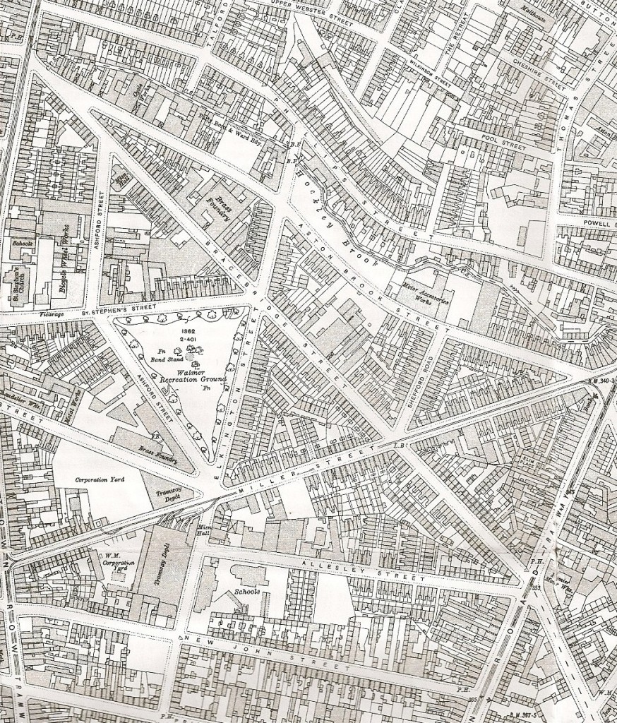
Does anyone out there know where I can get a map or pictures of Elkington Street or Bracebridge Street. My grandparents lived on Elkington Street from the mid 1930's to around 1968 when their home was compulsary purchased as part of the slum clearance?

Any help/advice gratefully received.
 
Hi madmomma
The map attached is a bit earlier than the period you are interested in, but it should still be pretty accurate for the 1930s . In and after the war there may have been a lot of changes due to bombing. It shows Elkington st running roughly north to south and Bracebridge st diagonally across the map. It looks on google that elkington st is still approximately the same in position, but half of Bracebridge has disappeared. i don't think any original buildings remain in either after the clearences, but stand to be corrected on this.
mike


map_c_1913_elkington_st.jpg
 
Thank you for all your help - I never expected to get anything back so quickly and yes, Mike, half of Bracebridge Street has disappeared - maybe because of the bombing but also because of the changes in the roads round there.

My Mum used to tell the tale of Elkington Street being bombed and the family coming back from the shelter at the end of the road to find no windows and the mantel clock upside down but still keeping perfect time - mind you this is the woman who expected to break out in swastikas when she got German Measles.

Kind Regards
Avril
 
Hi Avril,
2 pictures at both ends of Bracebridge St. First 3 at Aston Road end, 4th at Newtown Row end.
 
Back
Top