• Welcome to this forum . We are a worldwide group with a common interest in Birmingham and its history. While here, please follow a few simple rules. We ask that you respect other members, thank those who have helped you and please keep your contributions on-topic with the thread.

    We do hope you enjoy your visit. BHF Admin Team

Bournville Lane

From this picture from virtual earth it looks as if no 60 (north side of bournville lane, corner of oxford st ) has been heavily modernised (compared to its neighbours), but the building is still there.
Mike


60_bournville_lane.JPG
 
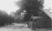
I took the liberty of taking a couple photo from ground level one of the front and one from side and rear(as we were passing:)
 
Last edited:
Mike thanks for that as you say these have been modernised but the outer stucture is still the same have sent some pictures on to Sarunte 43
 
184 Bournville Lane

Does anyone know the history of this residence? And if there are photos available?
Thank yo
SR
 
Hi sarunte, in 1930-1935 it was occupied by the Jones family,who I think,previously lived at 60 Bournville Lane.I believe they worked at Cadburys.After that it was occupied by the Macham family,who were originally from Selly Oak.
 
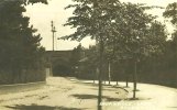
Been trying to trace this bridge on Bournville Lane. Can't see the bridge there tody, but where was it. Was it connected to the Cadbury factory ? Was it near the station ? Viv.

image.jpeg

image.jpeg
 
Somewhere I have already answered this question, but can't find it. Map c 1903 below shows it going from just to the east of the pavilion by the cricket pitch to the other side of the road, which later became the girls' grounds. It is still shown in the c1916 & c1937 maps, but has gone by 1955. By that time there was a subway from the restaurant block to the girls' grounds so was probably thought unnecessary.
map c1903 showing bridge over bournville lane.jpg
 
Thanks Mike. Oh yes, now you mention it I seem to remember the subway being referred to on here somewhere else. Viv.
 
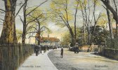
The tint on this ebay postcard seems to have really enhanced the view and the Cadbury workers (?) in the Lane. Dated 1904. Viv.

AF5F64A6-CF9B-49EF-86BA-A60E88C84EE1.jpeg
 
The Cadbury employee who owned this postcard marked where he//she entered the site for work (below the lamp post). The person didn’t post the postcard, so no date on this one. Viv.

17AD63EC-BCAA-41B0-9228-86A5856970A9.jpeg
 

Attachments

  • 6DF47E1F-08AF-4BE0-8FAF-35C536040B7C.jpeg
    6DF47E1F-08AF-4BE0-8FAF-35C536040B7C.jpeg
    143.4 KB · Views: 8
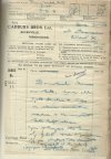
The houses you can see on that postcard straight ahead were those built originally in 1879 for the foreman and factory manager. They were demolished in December 1913(see below) and the site used later for part of the dining block


demolition for dining hall.A.jpg
 
It all seems so casual “ Demolish houses on site”. Nice to see they reused bricks and tiles. Viv.
 
Last edited:
It’s not often you see litter in the streets in photos from the early 1900’s, but this 1909 image has some (as well as leaves or horse droppings I think). Maybe it’s the litter from a busy day of visitors returning to the train station. Viv.

E9C19597-45B1-4333-8E13-4D6F990A398F.jpeg
 
Back
Top