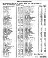
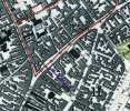
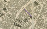
This is extracted from Showell's Dictionary of Birmingham, published 1885. Some roads had already had more than one name change by the time the Dictionary was published. Note, some names have changed yet again since this list was published.
Baskerville-street is now Easy-row.
Bath-road is Bristol-street.
Beast Market was that part of High-street contiguous to New-street; also called English Market.
Bewdley-street, afterwards Ann-street, now Colmore-row.
Birch Hole-street has been improved to Birchall street.
Black Boy Yard is now Jamaica-row.
Brick Kiln lane is the Horse Fair.
Broad-street—Dale End was so called in the 15th century.
Buckle-row. Between Silver-street and Thomas-street.
Button Alley—Bishop-street, Masshouse-lane.
Butts-lane—Tanter-street; The Butts being Stafford-street.
Catherine-street—Whittal-street.
Cawsey (The Causeway)—Lower part of Digbeth.
Chapel-street—Bull-street was so called in the 14th century.
Chappel-row—Jennens'-row and Buck-street.
Charles or Little Charles-street—Now part of New Edmund-street.
Cock-street—Upper part of Digbeth; also called Well-street.
Colmore-street—From Worcester-street to Peck-lane.
Cony Greve street is now Congreve-street.
Cooper's Mill-lane is Heathmill-lane.
Corbett's Alley—Union-street.
Corn Cheaping or Corn Market was part of the Bull Ring.
Court-lane—Moat-lane.
Cottage-lane—Sheepcote-lane.
Crescent-street—Part of King Edward's Road.
Cross-street—Vauxhall-street.
Crown-street, afterwards Nelson-street is now Sheepcote-street.
Deadman's Lane—Warstone-lane.
Ditch—The Gullet was The Ditch.
Dock Alley—New Inkleys.
Dudwall-lane—Dudley-street
Farmer-street—Sand-street.
Ferney Fields—Great Hampton-street
Feck-lane or Peck-lane—Covered by New-street Station.
God's Cart-lane—Carrs-lane.
Grindstone-lane—Westfield-road.
Hangman's-lane, or Hay Barns-lane—Great Hampton-row.
Harlow-street—Edmund-street.
Haymarket—one of the names given to Ann-street.
High Town—Upper part of Bull Ring.
Hill-street—Little Charles-street.
Jennings-street—Fox-street.
King-street and Queen-street, as well as Great Queen-street, have made way for New-street Station.
Lake Meadow-hill—Bordesley-street and Fazeley-street.
Lamb-yard—Crooked-lane.
Long-lane—Harborne-road.
Ludgate-hill was part of Church-street.
Martin-street—Victoria-street.
Mercer-street, or Spicer-street—Spiceal-street.
Mount Pleasant—Ann-street.
New road—Summer-row.
Old Meeting-street has at various periods been known as Grub-street, Littleworth street, New-row, and Phillips-street.
Pemberton's-yard, Lower Minories, or Coach-yard—Dalton-street.
Pitt-street and Porter-street were portions of Old Cross-street.
Priors Conigree-lane, or Whitealls-lane is now Steelhouse-lane.
Priory-lane—Monmouth-street.
Rother Market—New-street next to High-street and High-street next to New-street was once so called.
Sandy-lane—Snow Hill in the 16th century. Lee Bank-road has also been called Sandy-lane.
Shambles—Part of Bull Ring.
Swan Alley—Worcester-street.
Swinford-street—Upper end of New-street.
Temple Alley, also called Tory-row—Temple-row.
Walmer-lane (in the 15th century Wold Moors)—Lancaster-street.
Water-street—Floodgate-street.
Welch End or Welch Market—Junction of Bull-street, High-street, and Dale End.
Westley's-row, Westley-street, or London 'Prentice-street forms part of Dalton-street.
Withering-street—Union-street.
Wyllattes Green—Prospect Row.

