Rupert
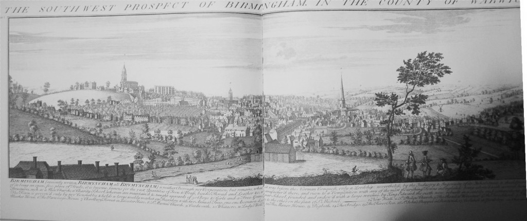
Had some difficulty in scanning the keys to the panoramas from post 8, so that it could be read reasonably, so have transcribed the details for the key, and included one comment from the book
Key (I have spelled it as the original)
South West Prospect
1. New Hall
2. St Phillips Church
3. Road to Worcester
4. The Free School
5. The Market House
6. The Parsonage House
7. Charlbury Forest in Leicestershire
8. St.Martins Church
9. Curdworth
10.Whitacre
11.Lady’s Well
12.The Manor house
13.Digbeth
14.The Bridge
15.The River Rea
16.St.John;s Chappel jn Deritend
17.Collshal (Coleshill ?)
18. Yardeley
There is a note that the Birmingham Art gallery has a drawing in pen and ink wash entitled “The West Prospect of Birmingham in the County of Warwick 1729” which is taken from approximately the same point , but the curator of the museum states that there is hardly any similarity in detail with this print.
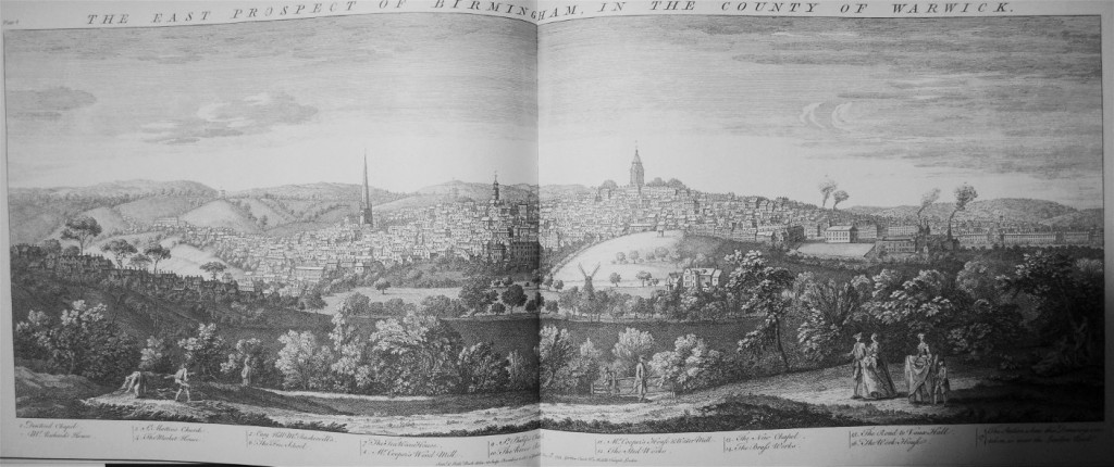
East Prospect
1. Deritend Chapel
2. Mr.Richard’s House
3. St.Martin’s Church
4. The Market House
5. Easy Hill, Mr Baskervill’s
6. The Free School
7. The Tea Warehouse
8. Mr Cooper’s Windmill
9. St.Phillip’s Church
10.The River Rea
11.Mr.Cooper’s Houfe and Watermill
12.The Steel Works
13.The New Chapel
14.The Brasf Works
15.The Road to Vaux Hall
16.The work Houfe
17. The Station from which this Drawing was taken was near the London Road
Mike