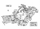
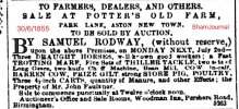
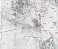
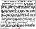
Aston Hall (built 1618-1635) once stood in 327 acres of land. As many owners of manors and halls, the land surrounding their houses provided them with opportunities for pastimes such as hunting sports. A small portion was usually cultivated and planted as formal and vegetable gardens around the house. Eventually, in the majority of cases, land would be sold for development of housing and industry.
In the case of Aston Hall it’s land contained forests, woods, moors and farmland. (Doubtless the parliamentary damaged wood staircase in the Hall was made from local wood).
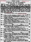
This advert of 1855 refers to the removal of Aston Park trees and underwood/fallage to make way for road building. One wooded area known as “Barton’s Wood” was to have 300 trees removed. Must have been a significant wooded area. Some of Barton Wood was close to the Walsall turnpike road.
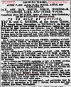
In 1853 there was also a plot/road named Barton’s Bank.
Barton features clearly in the land references, so what do we know about Barton and the connection to Aston Hall ? The Midlands Pubs site gives us clues:
Source of extract below:
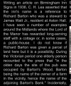
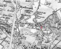
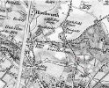
Do Barton’s Wood and/or Barton’s Bank (before it became a road) show up on any early maps please ? If the memory of the elderly Victorian person in the Midlands Pubs extract is correct, part of Barton’s Wood could have been where the Barton’s Arms stands today. Are the Aston Hall ‘Moors’ marked anywhere ? And does ‘Keepers Clump’ appear anywhere ?
Viv.
In the case of Aston Hall it’s land contained forests, woods, moors and farmland. (Doubtless the parliamentary damaged wood staircase in the Hall was made from local wood).
This advert of 1855 refers to the removal of Aston Park trees and underwood/fallage to make way for road building. One wooded area known as “Barton’s Wood” was to have 300 trees removed. Must have been a significant wooded area. Some of Barton Wood was close to the Walsall turnpike road.

In 1853 there was also a plot/road named Barton’s Bank.

Barton features clearly in the land references, so what do we know about Barton and the connection to Aston Hall ? The Midlands Pubs site gives us clues:
Source of extract below:

Do Barton’s Wood and/or Barton’s Bank (before it became a road) show up on any early maps please ? If the memory of the elderly Victorian person in the Midlands Pubs extract is correct, part of Barton’s Wood could have been where the Barton’s Arms stands today. Are the Aston Hall ‘Moors’ marked anywhere ? And does ‘Keepers Clump’ appear anywhere ?
Viv.
Last edited:

