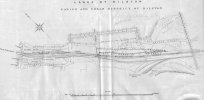
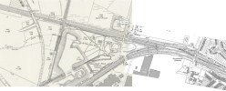
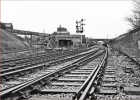
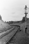
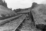
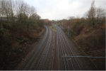
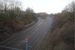
Not Birmingham, but not very far away. I recently acquired an old map, c1913, showing GWR purchases in Smethwick and Bilston. It was not clear what the purchases were for and, in the Smethwick case, the peculiar dog leg shape, so investigated.
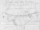
For those like me , who pick up on peculiarities, the missing T in "Western " on the heading is because I had to scan it in several parts, and that bit got missed.
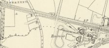
Most large scale maps of that period used for planning relied on the 1st edition 1:500) OS map from this area the 1880s. This certainly seems to be true in this case. Although that scale map is not available to us (and, very irritatingly, the one immediately to the left of this one is on the NLS database) the smaller scale map from 1887 is available, and shows Sandwell Park colliery immediately off to the right, with a rail connection , a very small part of which is shown on my map. this however is shown as a siding or tramway, and do not seem to be directly connected to the main line.
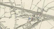
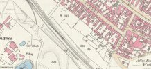
the 1902 map is similar.
But on the 1913 map , the lines in the colliery are marked in a similar way to the main line and appear to connect.
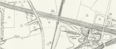
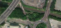
Also slightly indicated on the 1902 map, but clearly on the 1913 map, it seems that the reason for the dogleg on my map is because this was an access track to the area concerned, with banks either side.
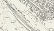
the 1937 map shows the land near the track k on my map as part of the railway land, presumably for signalling purposes needed for the new connection of the colliery to the main line.
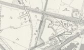
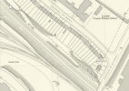
By 1957, the sidings are still there, but the mine is disused and soon to be built over
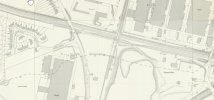

For those like me , who pick up on peculiarities, the missing T in "Western " on the heading is because I had to scan it in several parts, and that bit got missed.
Most large scale maps of that period used for planning relied on the 1st edition 1:500) OS map from this area the 1880s. This certainly seems to be true in this case. Although that scale map is not available to us (and, very irritatingly, the one immediately to the left of this one is on the NLS database) the smaller scale map from 1887 is available, and shows Sandwell Park colliery immediately off to the right, with a rail connection , a very small part of which is shown on my map. this however is shown as a siding or tramway, and do not seem to be directly connected to the main line.

the 1902 map is similar.

But on the 1913 map , the lines in the colliery are marked in a similar way to the main line and appear to connect.

Also slightly indicated on the 1902 map, but clearly on the 1913 map, it seems that the reason for the dogleg on my map is because this was an access track to the area concerned, with banks either side.
the 1937 map shows the land near the track k on my map as part of the railway land, presumably for signalling purposes needed for the new connection of the colliery to the main line.

By 1957, the sidings are still there, but the mine is disused and soon to be built over


Last edited:

