• Welcome to this forum . We are a worldwide group with a common interest in Birmingham and its history. While here, please follow a few simple rules. We ask that you respect other members, thank those who have helped you and please keep your contributions on-topic with the thread.

    We do hope you enjoy your visit. BHF Admin Team
  • HI folks the server that hosts the site completely died including the Hdd's and backups.
    Luckily i create an offsite backup once a week! this has now been restored so we have lost a few days posts.
    im still fixing things at the moment so bear with me and im still working on all images 90% are fine the others im working on now
    we are now using a backup solution

Unknown locations

Astoness

TRUE BRUMMIE MODERATOR
Staff member
i think that this is a case of if you know them you know them folks...there maybe one or two where a kellys look up could help but on the whole there are not many clues to most of these photos...all said to be in birmingham so here goes...

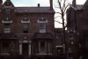
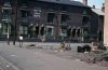
these first 3 i think maybe on the newtown housing estate in or around unett st where i lived will have to do a street walk to try to confirm...
 

Attachments

  • 09.jpg
    09.jpg
    113.5 KB · Views: 86
  • 10.jpg
    10.jpg
    95.3 KB · Views: 86
  • 11.jpg
    11.jpg
    98.1 KB · Views: 87
next 5..note pics 4 and 5 are mirror images
 

Attachments

  • 01.jpg
    01.jpg
    50 KB · Views: 82
  • 02 Court Yard.jpg
    02 Court Yard.jpg
    70.4 KB · Views: 82
  • 02a Court Yard.jpg
    02a Court Yard.jpg
    72.5 KB · Views: 77
  • 03 Court Yard.jpg
    03 Court Yard.jpg
    46.9 KB · Views: 84
  • 04.jpg
    04.jpg
    53.1 KB · Views: 78
next 5
 

Attachments

  • 06 Midnight Special Cafe.jpg
    06 Midnight Special Cafe.jpg
    104.7 KB · Views: 87
  • 07.jpg
    07.jpg
    93 KB · Views: 86
  • 08.jpg
    08.jpg
    135.1 KB · Views: 78
  • 14 House.jpg
    14 House.jpg
    82.6 KB · Views: 92
  • 13 Court Yard.jpg
    13 Court Yard.jpg
    103.8 KB · Views: 77
next 5.....

oops posted pic 1 twice and just noticed that pic 5 is of soho road and i have still posted pic 2 as its the only one i know the location of which is guildford st at the corner with geach street
 

Attachments

  • 14 House.jpg
    14 House.jpg
    82.6 KB · Views: 59
  • 15.jpg
    15.jpg
    99.8 KB · Views: 70
  • 17.jpg
    17.jpg
    128.1 KB · Views: 65
  • 18.jpg
    18.jpg
    74.8 KB · Views: 76
  • 21 Soho Road.jpg
    21 Soho Road.jpg
    86.3 KB · Views: 81
Last edited:
next 5
 

Attachments

  • 22.jpg
    22.jpg
    112 KB · Views: 60
  • 23.jpg
    23.jpg
    109.5 KB · Views: 74
  • 24.jpg
    24.jpg
    116.9 KB · Views: 87
  • 29.jpg
    29.jpg
    114 KB · Views: 59
  • 30.jpg
    30.jpg
    108.9 KB · Views: 59
last 2..

pic 4 post 4 and pic 1 on this post look to be near to each other as the chimney stack looks the same
 

Attachments

  • 19.jpg
    19.jpg
    83.7 KB · Views: 69
  • 32.jpg
    32.jpg
    79.9 KB · Views: 69
Last edited:
next 5.....

oops posted pic 1 twice and just noticed that pic 4 is of soho road
Photo 4 will be 1965 or later, judging by the car number plate. Is Soho Road Pic 5? Dave.

yes it is pic 5 dave..my error i have edited my post

lyn
 
Last edited by a moderator:
The midnight cafe is shown in 1962 Kellys as 69 Birchfield Road

map_c_1950_showing_69_birchfield_road.jpg
 
excellent mike thank you....thats 2 locations we have...mike take a look at the next pic is that an aston number for midland tool
 
Yes it is. Was a bit worried as the ffirm in 1855 & 1956 was 123 Holloway head, which on the map looked nothing like the building here (and was not Aston) but in the 1958 edition it was at 73 Geach St
map_c_1950_showing_73_Geach_St.jpg
 
well would you believe it..post 4 pic 2 is taken at that corner of geach st...many thanks janice and mike

lyn
 
Post #10, I was just about to say that this picture from post #3 was Geach Street and found you have already mapped it Mike. At first I was puzzled as when I was a lad this is where they garaged milk carts, although my memory may be off target a bit. Any way I agree with Geach St
 
Great pictures Lyn.

No 3 of post #1 could be Livingstone Road, looking towards Bridgelands way.

No 4 of post #3 looks like either Cambridge or Blenham Road, not sure if that's Kings Heath or Moseley

No 2 of post # 5 is possibly Oxford Road Mosley
 
Hi Lyn

Just had a look through these very impressive photos and I can only find one that strikes a chord of familiarity and that is the block of flats (photo no 3) on post four. To my mind there is little doubt that they are one of several blocks that were built in Nechells in the 50's they were bordered by Great Francis St, Windsor St, Henry St and Heneage St. They are gone now and have been replaced by mainly houses, but I do have this photo of how they used to look not long after they were built
 

Attachments

  • Nechells Great Lister St Flats  Flats 1958 .jpg
    Nechells Great Lister St Flats Flats 1958 .jpg
    147.4 KB · Views: 41
phil i thought they had a look of nechells way..my sister lived in a similar block in nechells many years back...

lyn
 
Comprehhensive redeveelopment areas ,
plans were drawn up for five new comprehnsive redeveelopment areas. These were;

parts of aston and nechells; this was renamed nechells green but the name didn,t catch on.
The summer lane area; this became known as newtown .
Ladywood; this was the only one of five areas to retain its name due to its being a pleaseant sounding name.
With rich historical association;
bath row area; this became lee bank the names of churchill rise
or great chamberlin were rejected in favour of lee bank ;

the gooch street area ; this became known as highgate.
The names of calthorpe, forest island, silver vale , rea bourne and belgravia were rejected ;
best wishe to every one alan;;;astonian;;;
 
hi all post 3 photo 1, the high rise flats look the wrong way round for perry barr. I think that the high rise flats along new john street west , in newtown would be a better bet kind reguards sidwho
 
just to add to my post above post I have enlarged the picture just to the left of the high rise flats look at the top of the roofs of the houses it looks like the high rise block of flats on new town row so this would put the postion of the photo at unettet street eww town kind reguards sidwho
 
Post 1. Picture 2 10.jp looks like Newtown, Westhorpe Grove off Mossborough Crescent.
Picture 1 9.jpg and picture 3 10.jpg may be reversed if Newtown as the stair wells are towards the wrong end of the blocks. Were the photos off slides?
If reversed picture 3 looks like Newtown, Hadfield Croft off Unett Street. Rob
 
yes rob they were off slides and i also think that that photo could well be reversed which can confuse...i lived in mosborough crescent and i dont think you are far off...i will have to do a street view walk to try and confirm

thanks rob

lyn
 
11.jpg11a.jpg
Lyn. post 1 image 3 reversed and street view of Hadfield Croft. Not quite the same angle. Interesting to see all the changes to the maisonettes and flats.
 
rob i am just doing a bit more research as i am getting confused lol

lyn
 
Last edited:
hi rob pic 1 post 24 is showing the back of the maisonettes in mosborough crescent...count the french windows from the left i lived in the third one along although at good 35 years after the photo was taken and my maisonette is behind the maisonette you see in pic 2 which as you say is hadfield croft...the 2 tower blocks we see in pic 1 are from the left geach and scofield towers...thanks for your help rob as i also agree that post 1 pic 2 is of westhorpe grove..

lyn
 
Last edited:
hi rob pic 1 post 24 is showing the back of the maisonettes in mosborough crescent...count the french windows from the left i lived in the third one along although at good 35 years after the photo was taken and my maisonette is behind the maisonette you see in pic 2...the 2 tower blocks we see in pic 1 are from the left geach and scofield towers...

lyn
Yes, that makes sense. All the blocks are similar. Now for another puzzle.
Looking at the reversed version of post 1 picture 1, (09.jpg) 09.jpg
Assuming taken at the same time with the scaffolding on the same tower as 11.jpg , it would be looking west (to the left) somewhere on the right of this old map, but it is difficult to find the large buildings (factories or shops?) about to be demolished. One for Mike and our other experts, I think.
09a.jpg
 
rob i am going to take a stab at this one and say its possibly new john st west

lyn
 
Great photo's as usual Lyn, #4, photo 2, shows I believe a WW1 message (by the letter style), still on the house wall surviving all those years till the 60's, the photos remind me of a certain part of Brum at this time, namely "Balsall Heath", it is just as I remember the old city before the great change. Paul
 
astoness podt 28 you would be wright in saying new john street west, but need a more upto date map to pinpoint the postion of the picture. the map dose not show any factories as there are as you know lucas gks and others in the area . kind reguards sidwho
 
Back
Top