• Welcome to this forum . We are a worldwide group with a common interest in Birmingham and its history. While here, please follow a few simple rules. We ask that you respect other members, thank those who have helped you and please keep your contributions on-topic with the thread.

    We do hope you enjoy your visit. BHF Admin Team
  • HI folks the server that hosts the site completely died including the Hdd's and backups.
    Luckily i create an offsite backup once a week! this has now been restored so we have lost a few days posts.
    im still fixing things at the moment so bear with me and im still working on all images 90% are fine the others im working on now
    we are now using a backup solution

Then & Now

This 1948 aerial view in Edgbaston shows Harrison's Road running upward from bottom-left to it's junction with Richmond Hill Road. Someone on 'britainfromabove' identified a small building at the end of a garden as a 'WW2 Defence Post'.
1_Harrison's Road Defence Post.jpg

On a another close-up view from a slightly different angle a small round building can be seen.
2_1948_Defence.jpg

A matching modern aerial view shows the area today and some houses seen in 1948 are still there, some are not.
3_Harrisons Rd Now.jpg

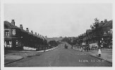
Down at street level the building can be seen - concrete roof - it is somewhat unusual. Does anyone know anything about it. Were there similar buildings in the large gardens of that area ? They would not be shown on maps in WW2.
Harrison's Rd Now.jpg
 
During an air raid on 10 April 1941, Torrey Grove Alum Rock was hit by high explosive bombs.
Photo 1 appears to have been taken from the back garden of house No 5 looking at a man carrying his young daughter as he stands in the garden of No 3 which had been very badly damaged.
House No 1 to the left was completely destroyed and was been replaced by a different design house as shown in photo 2. According to Birmingham Air Raids Rememberance Association (Barra) all three members of a family living there lost their lives.
View attachment 132969

Photo 2 is an aerial view of Torrey Grove and Eastfield Road. Houses 1, 3, and 5 are numbered and P marks the spot where the wartime photographer probably stood. The wartime photo shows houses in Eastfield Road and they are marked in this aerial view.
View attachment 132971

Barra also states that of six people living at No 16, a mother and four of her young children lost their lives. They may of course been in a garden air raid shelter.
The names of the families killed in the bombing can be found from the Barra database and there is some comment in another thread on the BHF about the family who lived in No1.
My nans sister lived there her name was Elizabeth Farr they was the family at 1 Eastfield Road
 
Pictures like that put life in perspective for me, we really don't know how lucky we are today even with covid. A few days ago a woman in Tesco erupted at a member of staff because there was no Bavarian Smoked Ham, "You tell me, go on tell me what my children will take to school tomorrow, they don't eat what this company calls ham only Bavarian Smoked ham so come on tell me what they'll have" Don't think she'd cope too well with a bomb hitting her house, she went ballistic when told to leave the supermarket; that said it livened up my shopping experience :)
 
In 1928 the Carlton Cinema was opened on Taunton Road as seen below.
Image1.jpg

A view now from a similar position.
Calton_Memorial.jpg

On 25 October 1940 the cinema was full when an air raid warning flashed on the screen but as people were thinking about heading for shelter, a high explosive bomb crashed through the roof to explode just in front of the screen sadly killing 19 and injuring 20 more. They are named and remembered on the Barra website https://database.birminghamairraids.co.uk/ if this link does not work use http://barra.historynut.co.uk/
1_Carlton-Cinema.jpg
2_Carlton-Cinema (1).jpg

In 2007, a memorial to the 19 victims was unveiled – a grass area with a curved path representing the auditorium, a straight brick path for the screen and 19 slabs of slate in memory of each individual who lost their life on that tragic night.
3_CarltonCinemaMemorial_iOS.jpg

After the bombing the cinema was repaired and reopened in 1943. An aerial view below (date 1946) shows the cinema.
carlton1946.jpg

A similar aerial view today. The cinema was demolished in 1985.
Calton_2021.jpg
 
Last edited:
Kings Heath High Street
A busy scene in Kings Heath High Street and a man on his motorbike with his wife in the side car ride towards the camera. The huddle of little girls on the right chat about something and a police constable surveys his patch. One building that has clearly survived is the Hare and Hounds pub with the three clock faces on its tower.
index.php

Below is the scene today and the clock face on the pub's tower can just be seen behind the street light on the left. Also a pointed tower on the building on the other corner of York Road is just visible.
KingsHeath2.jpg

A close up of the towers, York Rd on the left.
harehounds.jpg

Google on Kings Heath High St ... have a scroll round ...
 
An early 20th century postcard view of Wood Lane, Handsworth. The man was stood in Wood Lane and Butlers Road is to the left.
old_wood_lane.jpg

Today, the cottage is still there with more windows but at first glance looks not too different. The house in Butlers Road can be seen over the hedge. The 'mock-tudor' decoration has been removed.
WoodLandHandsworth.jpg

If your computer or tablet can do it have a look round in link below
 
In the late 1950s during his photographic wanderings around Birmingham, Keith Berry decided to photograph the Summerhill Post Office in Powell Street.
10SummerHillPO.jpg

It wasn't much of a building back in the 1950s and I suppose it isn't now but it is still there !
PowellStnow.jpg
It can be spotted in the 1933 aerial view in post #1768
 
Long ago Birmingham Corporation decided that the old trams had to go and this one was probably on it's way to eventual scrapping. But it became stuck turning from Victoria Road into Park Road and seems to have been something interesting for local folk to look at ... :)

RParksttram.jpg

Today if a 'ghost tram' could come back it would look somewhat like below viewed from the line of the old Victoria Road. Waterlinks Boulevard is on the right.
Oldtram.jpg

The red lines on the aerial view below show were Park Road from the left crossed Victoria Road.
Victoria_Park Roads.jpg
 
Last edited:
Long ago Birmingham Corporation decided that the old trams had to go and this one was probably on it's way to eventual scrapping. But it became stuck turning from Victoria Road into Park Road and seems to have been something interesting for local folk to look at ... :)

View attachment 168547

Today if a 'ghost tram' could come back it would look somewhat like below viewed from the line of the old Victoria Road. Waterlinks Boulevard is on the right.
View attachment 168543

The red lines on the aerial view below show were Park Road from the left crossed Victoria Road.
View attachment 168544

Thanks for the colour added picture of Park Road where I was born.
 
Court Road Balsall Heath - nothing special but trams ran along it. There was a Paynes Shoe Repairs shop 'Always Dependable' and H.Betts Gents Outfitters selling Swallow Raincoats with nice car outside. Tram 723 is turning right into Edward Road.
Court-Road-Tram.jpg

Today - no trams but the buildings are still there minus the attic rooms and Pizzas can be bought. The old houses further along the road are still there.
Court Rd Now.jpg
 
Last edited:
Good photo of tram 723 which still carries its pre WW2 livery - which I suspect when the photo was taken
Actually the tram was going straight ahead and not into Edward Road - observations of the trucks will show that.
The 37 tram went to Cannon Hill whereas those that turned into Edward Road, the route 39, went on to Alcester Lanes End.
The father of a schoolboy friend of mine once owned one of the shops selling radios and electiral goods. I bought my first electric razor there in 1955 when I was in the RAF stationed at that time in the West Midlands.,
 
Last edited:
Dudley Road with Icknield Port Road off to the right. Tram 102 has stopped and passengers have to walk out and queue in the road to board it which was normal in those days. An Atkinsons pub on the right and the lady with the pram trying to cross the road with the sun in her eyes. St Patricks Roman Catholic Church in the distance.
DudleyRd_IcknieldPortRd.jpg

The much changed view today and the road on the left has been realigned. Buildings on the right across the junction are still there but the one immediately on the corner had been demolished.
DudleyRd.jpg
 
Back
Top