• Welcome to this forum . We are a worldwide group with a common interest in Birmingham and its history. While here, please follow a few simple rules. We ask that you respect other members, thank those who have helped you and please keep your contributions on-topic with the thread.

    We do hope you enjoy your visit. BHF Admin Team

The Snuggery Harborne

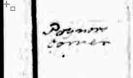
I am not sure if this helps or not. On the census it is spelt Poinder's corner and according to the internet this usually referred to the village "pound". The workhouse in 1834 was on the corner of Gillhurst Lane and Lordswood Road. There seem to have been an Upper and Lower Ravenshurst both on Moor Pool Lane. I can't at the moment locate Birch's or Harrison's Green.

Janice
 
I agree that that may be relevant. Also spelling was not always a very consistent thing then. for example, although, as you say, the enumerators route lists Poinders corner, personally I would say that the actual page (extract below) looks like poynors, which is how i came to fine the document in the staffs archives

poyners_corner_extract__1841_census_harborne.jpg
 
I Think i may have found something?? from an old Harborne society newsheet 1991 an article entitled "the street names of Harborne" It is as follows Harborne Park Road has gone through many changes of name-park lane, park road,Poyners lane,:rolleyes:and mill lane for the stretch passing the old harborne mill on the way to Selly oak.
Poyners corner must therfore be where harborne park road meets the high street at the top end of Harborne ?? the enumerators route still does not make sense though!! and i am still no nearer to knowing exactly where the Snuggery was, i must say though thank you mikejee for the link to Staffordshire archives there is much to discover there it holds all sorts of interesting things that are of particular interest to me and my family research so thank you for giving me the link and thank you to everyone who is helping me with trying to pinpoint the snuggery, it is an interesting voyge of discovery is it not?
 
I have now written down the places on the actual census (not just the description at the front), I have compared them to an 1834 map I found online. It looks as if the enumerator went from the Snuggery down Greenfield Road past "Lodge" and to Poyners Corner before going down Lodge Road to Harborne Town. He carried on via Hrborne Terrace and Harborne Lane to Hagley Road and then turned back down Lordswood Road to the Workhouse and Gillhurst Lane, then Ravenhurst (Upper and Lower) before finishing at Harrison Green.
I also found a reference to a Poyners Farm owned by the revd Simcox.

I am not sure if this helps or not but it does seem to indicate that perhaps the Snuggery was at the end of Greenfield Road.
Janice

Oh Thank you Janice every little helps it is amazing how addictive voyges of discovery can be many thanks for all your help
Lin
 
Back
Top