• Welcome to this forum . We are a worldwide group with a common interest in Birmingham and its history. While here, please follow a few simple rules. We ask that you respect other members, thank those who have helped you and please keep your contributions on-topic with the thread.

    We do hope you enjoy your visit. BHF Admin Team
  • HI folks the server that hosts the site completely died including the Hdd's and backups.
    Luckily i create an offsite backup once a week! this has now been restored so we have lost a few days posts.
    im still fixing things at the moment so bear with me and im still working on all images 90% are fine the others im working on now
    we are now using a backup solution

Stratford Road

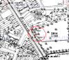
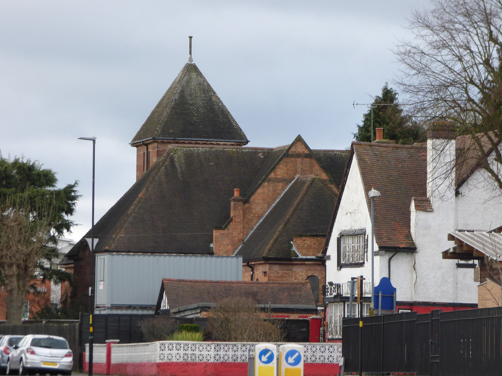
That is exactly the location, opposite the junction of Warwick Road and the Mermaid Hotel. I remember the location well, but I have supplied a map showing the location for those who are still not sure. The covered opening in the photo was between 399 & 401 and led to a timber yard. I've also added another photo that shows the location of the phone box near to this location.

mermaid.JPG Sparkhill Stratford Rd - Warwick Rd.jpg
 
The shoe-wear phone number does not appear until the late 1960s. Not all the books are on Ancestry but it is there in 1968. Definitely not there in 1963 then there is a gap when I can't check.
 
I'm always surprised how well others look at the photos shown on this forum, a comment is made about some obscure detail and it makes me go back and look properly, thank you.
I guess I've always been a bit casual as I would ( still do ) go from point A to B and not be aware of the street names. I look at some of the photos and think so that's the name of such and such a street or arcade.
I now live in a small country town and still do the same. Maybe the wife is right in that I should grow up as well as old!

Cheer Tim.
 
Can anyone identify where this 1873 picture was taken .... I think it could be looking towards town from what is now the Formans Road junction, but there are no landmarks to corroborate ?
 

Attachments

  • Stratford Road 1873.jpg
    Stratford Road 1873.jpg
    168 KB · Views: 66
Thanks to Birmingham Library for providing a better print of this view, with attached notes ....
"Stratford Road corner of Stoney Lane. Photographed 1872. The house within the palings was occupied for many years by the late Mr. Simcox. Solicitor."
Thomas Simcox, solicitor, is shown in the 1871 census as living in The Poplars - a large house with grounds adjacent to the Stratford Road, and a lodge on the Stratford Road opposite the end of Stoney Lane.
I'm surprised that the Mermaid doesn't show in the picture, but I assume it's set back out of view.
The attached detail from the picture shows a woman sat on a short wall that is replicated on the opposite side of the road. This might well be where the Spark Brook crosses the Stratford Road, and forms the boundary between Sparkbrook and Sparkhill.

Sparkhill Stratford Road (from Stoney Lane) detail 1872.JPG
 
I think the Mermaid would be too far in the distance. I couldn't get a clear enough map to show the Mermaid and the Lodge.
15cc7699-b340-4798-819c-5ad8a2379b1d
 

Attachments

  • upload_2018-1-16_11-6-52.png
    upload_2018-1-16_11-6-52.png
    227.4 KB · Views: 21
Electric trams commenced running along Stratford Road to Highfield Road, Hall Green in 1914. Warwick Road services in 1916. Tram tracks could show on maps after those dates.
 
Couldn't get the map in #126 to open. Found a 1903 map, what changes in 30 years! the brook put underground, at least no signs of a bridge, the Poplars now Poplar Rd. My own great grand parents living on the vast estate to the east of the Stratford Rd.(Abbotsford Rd).
 
Hall Green United Community Church seen from York Road.


And from Reddings Lane.


The building used to be Hall Green Methodist Church. They merged with Sparkhill United Church. Between 2008 and 2014.
 
Thanks Ell. The first picture is very familiar to me. The railings of what is now YorkMead School can be seen bottom right. I went there when it was York Road School between 1948 and 1954. The view from Reddings Lane shows what was a Bank on the extreme right (corner of York Road and Stratford Road). Can't be sure whether it was a Barclays? Dave.
 
I also got some photos of Yorkmead Primary School when I was walking up York Road.


There used to be a music shop then later something called seeBay (didn't last long) at that corner. I don't remember it being a bank.

Lloyds Bank close to Hall Green Station closed down within the last few years. So there is no banks left on Hall Green Parade. Even the post office closed down! Was Cole Bank Post Office (it had moved from the other side of the road - that one is now a hairdressers, but post box still outside).
 
In July 1953, D.J.Norton photographed a tram on the Stratford Road passing the Shakespeare pub on the corner of Henley Street.
Tram705StratfordRoad (2).jpg
Recently Google photographed the place in nearly the same position.
Henley.JPG
 
July 1953 when the tram was on its last journey to Kyotts Lake Road after the abandonment of the tramway system.
After the recent former Vale-Onslow buildings fire - well documented here - I had a look at the area.
Stratford Road has remained similar just new occupancies for the most part although there are new buildings in evidence. However, pass through the bridge to Camp Hill and that area seems unrecognisable compared with older views.
 
Stratford Road, Shirley, in 1909 with the Post Office on the right and the Plume of Feathers Pub further on.
StratfordRdShirley.jpg
 
Love the earlier view of the bridge at Camp Hill, the tram, the Shakespeare pub et-cetra (#134).

In the late thirties, early forties, I remember the old L.M.S. locomotives travelling over that bridge, usually hauling wagons. The Ferodo Brake Linings sign was well known. My grandfather & grandmother lived just across the road from the Shakespeare, at 58 Auckland Road. Every Sunday morning my grandmother would walk across to the Shakespeare with a pint jug, to get my grand fathers Sunday 'pint'.

Sadly, some of the houses in Auckland Road have been replaced. A few years ago, whilst in 'Brum', I visited the area, and my grand parents house, 58 Auckland Road is no longer there.

Although the area may still look somewhat similar, the same it ain't.

Eddie
 
I am sure it was a Barclays bank next to the music shop.

The bank on the corner of York Road and The Parade number 1070 Stratford Road was a branch of Barclays. Here are a couple of photos of that end of the Parade when it was new C1913.

Hall Green Stratford Rd The Parade 3_.jpg Hall Green The Parade Stratford Rd (2)_.jpg
 
Love the earlier view of the bridge at Camp Hill, the tram, the Shakespeare pub et-cetra (#134).

In the late thirties, early forties, I remember the old L.M.S. locomotives travelling over that bridge, usually hauling wagons. The Ferodo Brake Linings sign was well known. My grandfather & grandmother lived just across the road from the Shakespeare, at 58 Auckland Road. Every Sunday morning my grandmother would walk across to the Shakespeare with a pint jug, to get my grand fathers Sunday 'pint'.

Sadly, some of the houses in Auckland Road have been replaced. A few years ago, whilst in 'Brum', I visited the area, and my grand parents house, 58 Auckland Road is no longer there.

Although the area may still look somewhat similar, the same it ain't.

Eddie
Hi Eddie, I had a look for images of Auckland Road but could only find an aerial view dated 1937 looking towards the city.
Pic 1 Close up 'Ferrodo' bridge and Auckland Rd to the right.
Auckland Rd.jpg
Pic 2
Large view Camp Hill Goods Station, Highgate Park, Stratford Road and environs, Birmingham, 1937
StratfordRd1937.jpg
oldmohawk
Images from https://britainfromabove.org.uk/en/image/EPW053100
 
Interesting photos (post 138). The date must be post 1914 as the tramway was extended from College Road to Fox Hollies Road in 1914. The two photos must be a different date as the telephone pole cross bars are different; four in the top photo, six in the lower one.
Incidentally the 'stripes. in the apex of one of the shops reads 'Hall Green Parade', it is still there.
 
Last edited:
Norfolk Brummie

The top of Auckland Road and the railway bridge in question across Kyrwicks lane just down the road from my local the Hereford Arms when they closed my original local the Talbot.

Sparkbrook Kyrwicks Lane Auckland Rd.JPG
 
Hi Eddie, I had a look for images of Auckland Road but could only find an aerial view dated 1937 looking towards the city.
Pic 1 Close up 'Ferrodo' bridge and Auckland Rd to the right.
View attachment 122930

Thank you, oldMohawk.
Lovely aerial view in 1937 photo 1. I can see my grandparents house, which I often visited in 1937, the Auckland Road side entrance to the rear of the property, and their back yard. A few yards up Auckland Road, on the right hand side, there is a passage way, shown quite brightly. I would watch the trains pass there, just before they crossed the bridge. Happy memories of a bygone age. Thanks for that.

Eddie

Eddie
 
A lady with her young daughter in tow walks past a bank on the corner of Braithwaite Road and Stratford Road. If someone had said to her that some day the bank would close and the building would become an Arabian Restaurant she would have thought they were mad ...:)
BraithwaiteRdThen.jpg

The scene today, the building is still there but is not a bank ....
BraithwaiteRdNow.JPG
see more https://goo.gl/maps/Sp8FfkUhTM72
 
Outside the Bulls Head some passengers leave the tram on the right, others on the left getting on as the conductor walks in the middle of the road bringing the trolley pole round to the other end of the tram. No definite date but possibly just after the end of WW1.
StratfordRd1919.jpg
 
The tram route numbering system would confirm that it is post 1915. The Bulls Head is still there - looks a little different apparently -and the road has changed significantly. The lack of motor vehicles also suggest an early date.
 
Ah, a good oldfashioned Brummie lamppost, Alan, many a happy day spent climbing those, though not on the main road and probably 40 years later than your photograph! :)

Maurice
 
Back
Top