-
Welcome to this forum . We are a worldwide group with a common interest in Birmingham and its history. While here, please follow a few simple rules. We ask that you respect other members, thank those who have helped you and please keep your contributions on-topic with the thread.
We do hope you enjoy your visit. BHF Admin Team
You are using an out of date browser. It may not display this or other websites correctly.
You should upgrade or use an alternative browser.
You should upgrade or use an alternative browser.
Stephenson Street
- Thread starter ragga
- Start date
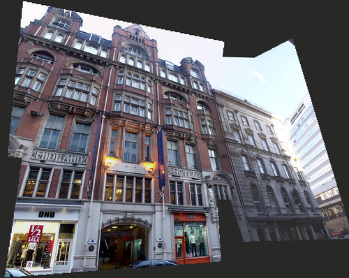
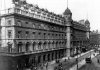
A sketch of the Midland Hotel opposite New Street Station. Stephenson Street looks like a wide road on the sketch, unlike the narrower back street it later became. And there's still evidence of the Midland hotel above ground level, the hotel is now the Burlington. Viv.


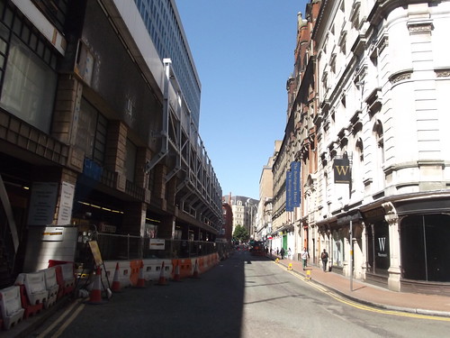
Thanks for the photos Ell, your second one especially shows how narrow Stephenson Street is now. It must once have been much wider as all the old photos I've seen show a bigger piece of land in front of the station. I expect the 1960s station was built further out onto the street. Viv.
Phil
Gone, but not forgotten.
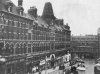
A couple of photos of Stephenson Street and the Queens Hotel, you are right Vivienne Stephenson St certainly looked wider back then. Obviously in the 60's when they rebuilt the encroached into the street a little.
Attachments
Yes Ell I remember an overhang - that's where the Gilded Cage pub was and I think an Army recruitment office in the 1970s. In fact there was a bomb planted nearby underneath the ramp up to the car park. It was exploded by a robot! Viv.
Phil
Gone, but not forgotten.
I think the building line is now the outer edge of the paved are of the Queens Hotel access area, and it was the Ikon Gallery that was damaged in the 1974 bomb blast. The Royal navy & Royal Marines recruiting office was next door.
Attachments
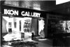
I think the building line is now the outer edge of the paved are of the Queens Hotel access area, and it was the Ikon Gallery that was damaged in the 1974 bomb blast. The Royal navy & Royal Marines recruiting office was next door.
The bomb was eventually defused by the Royal Army Ordinance Corps of Hereford. It was a duffle bag bomb. Here's a photo of it near the ramp. Viv.

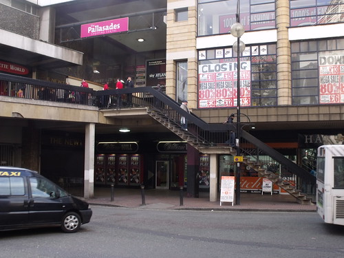
Streetview still has the pre-development view of Stephenson Street and I think it's possible that the edge of the shops underneath the overhang are probably in the same position of the old Queen's Hotel frontage. If you look here

To me it looks like the overhang (of what was the Palisades) might be the only part of the building exceeding the original footprint of Queen's Hotel, while the shops at street level remain within the Queen's Hotel footprint.
Viv.
To me it looks like the overhang (of what was the Palisades) might be the only part of the building exceeding the original footprint of Queen's Hotel, while the shops at street level remain within the Queen's Hotel footprint.
Viv.
Phil
Gone, but not forgotten.
To me it looks like the overhang (of what was the Palisades) might be the only part of the building exceeding the original footprint of Queen's Hotel, while the shops at street level remain within the Queen's Hotel footprint.
Viv.
Vivienne
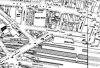
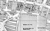
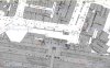
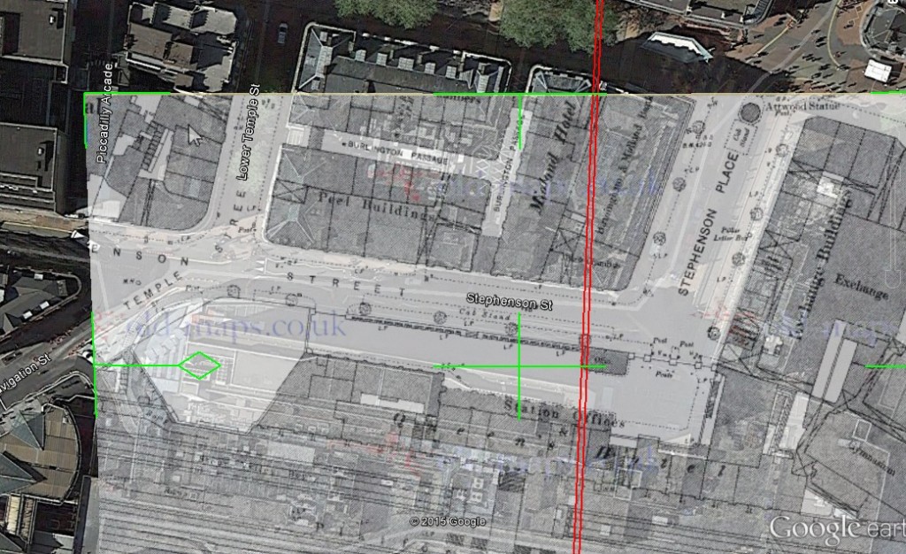
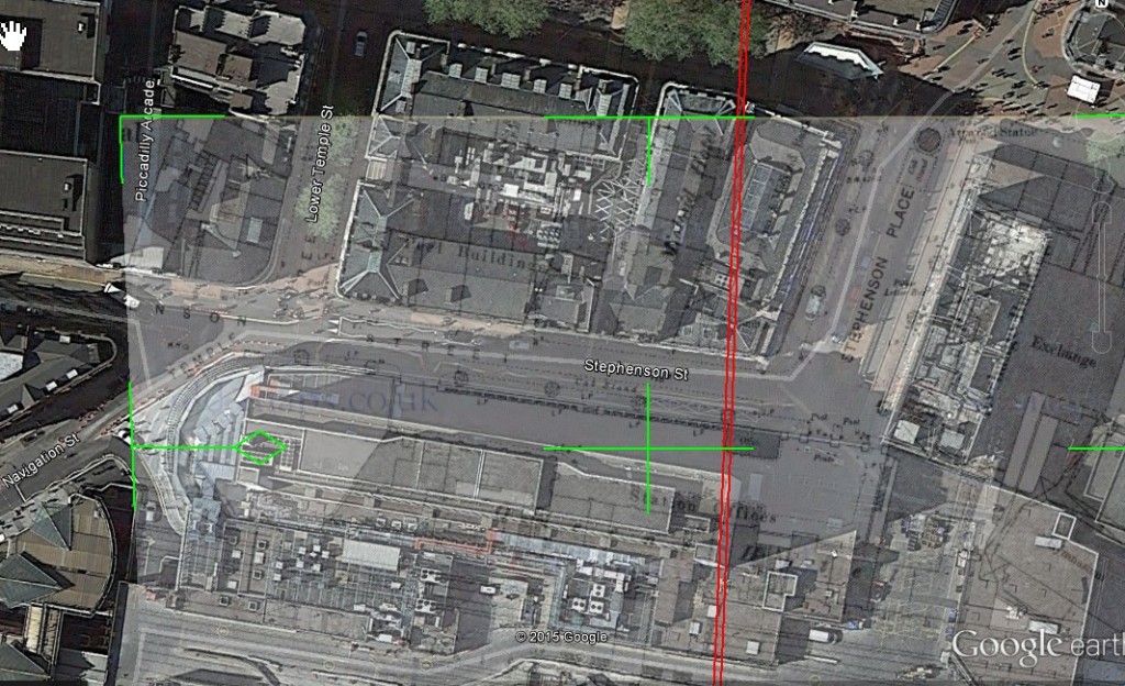
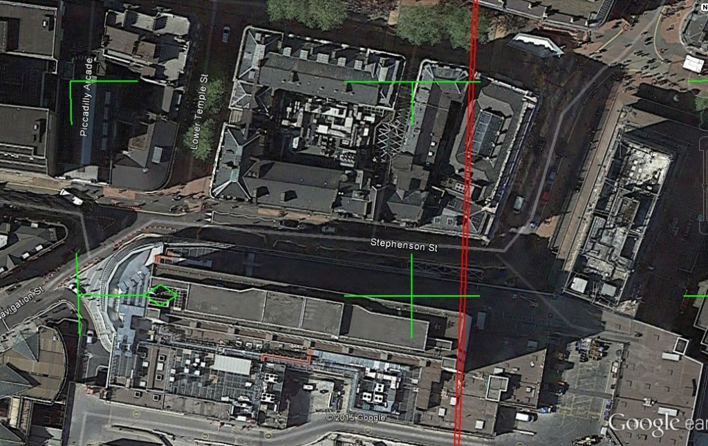
What you say is possibly quite true, here are before and after maps for comparison. though it was more than an overhang wasn't it? It was more or less part of the building without a frontage,
Attachments
Thanks Phil and Lyn. Looking at your maps I think what might have happened is the current shop frontage at ground level was built over and up to the wall/gates which were once in front of the Queen's Hotel. This is a "Queens and North Western Hotel" image showing the wall behind which was a private road giving access to the hotel. I think the wall/gates must have at some time been removed (well before the hotel was demolished) because later pictures show a much wider road without the wall. On one of the maps the road seems to have had a cab stand. Maybe the wall was removed because of an increasing need for cabs to have closer access to the hotel and to lever up room on Stephenson Street for other traffic.Viv.

Blimey business must have been very brisk. A substantial additional floor was added to the hotel plus a couple of towers with cupolas on top! (Sorry no dates). But looks like a lot of additional rooms to me. Or maybe the station took over more of the street level accommodation and the hotel moved upwards? Viv.

Thanks Mike, I knew you'd be able to help! So the modern day canopy/overhang extends out as far as the old gated wall of the Queen's Hotel and the shops underneath would have been built over some of the earlier private road which ran in front of the Hotel. If the railway owned that private road I expect they could do what they liked with it in the 60s development. Viv.
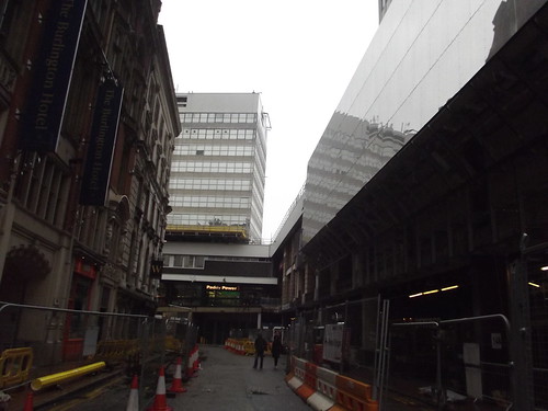
This might help to illustrate how much of the road was built over. Admittedly the angle is slightly different, but if you look at the red brick building immediately ahead in the modern view, you can see clearly that the structure is now much further across the road. On the older photo, the private road is still there divided by a little island - which is where the gated wall once was. So pretty much all of that would have disappeared when the site was re-developed in the 1960s. Viv.

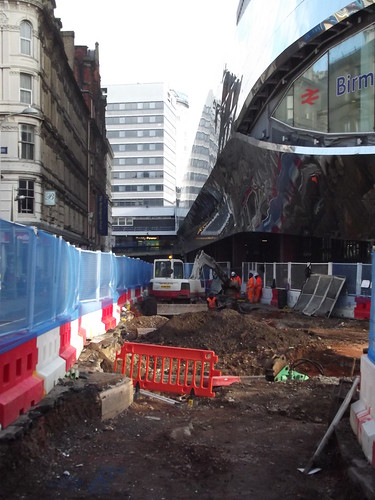
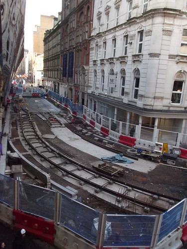
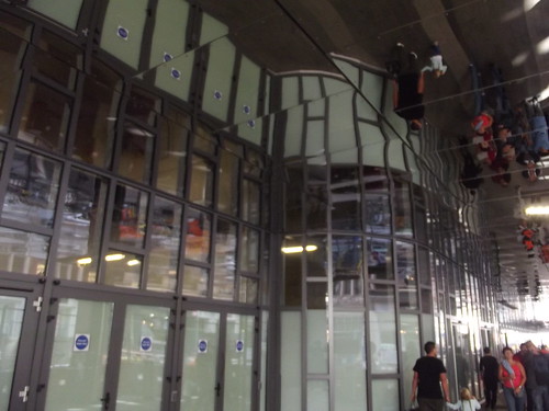
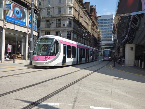
Yes Lyn. And looking at Ell's second photo in post # 63 with the raised road for the tram, it gives the illusion of an even narrower space. I only remember it as, effectively, a back street. There was no reason to use it unless you were going to Navigation Street. But I notice when I came up for the Christmas meet the station exit had been moved to the Navigation Street end. I suppose the exit via the HSBC ramp is out of use while station development takes place. This is all a long, long way from the 'avenue' it once was when the Queens Hotel was built. A pity really because when you arrive at New St this is the first view of the City Centre you get, and it's not currently a very attractive or welcoming view. Hopefully that will all change when the transformation is complete. Viv.
ellbrown
ell brown on Flickr
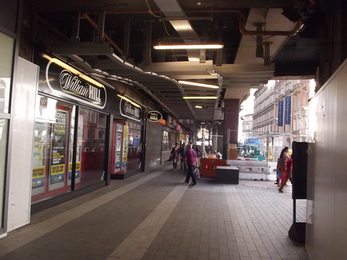
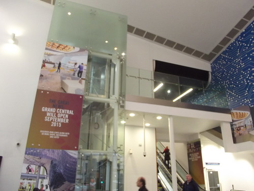
You can still go up the ramp, but the new escalators are pretty close to the new Stephenson Street exit! (have to walk via a temporary tunnel - one goes to the station escalators, the other to the Bullring link bridge). And they have buckets down there (leaking ceiling).
I normally exit to the doors on Stephenson Street further down.
I normally exit to the doors on Stephenson Street further down.
Thanks Lyn. Shows us clearly the extent of the Hotel. Your view, I'm sure you know, is the corner where the Exchange Building met the Queen's Hotel/Station, looking down Stephenson Place. The Hotel was a massive building. And there were hotels almost on top of each other around Stephenson St; The Queens, The Midland and the Colonnade. There most certainly would have been a sizeable volume of visitors passing through Brum in those days.
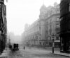
Looking up the street I found this photo on the Shoothill site. It's the rear of the Theatre Royal dated 1901. Massive changes here. The modern day Streetview is taken in pretty much in the same position. Viv.


Looking up the street I found this photo on the Shoothill site. It's the rear of the Theatre Royal dated 1901. Massive changes here. The modern day Streetview is taken in pretty much in the same position. Viv.
The topography of this area has always puzzled me because as others have noted, Stephenson Street is now very narrow and not the wide street it used to be. Looking at the maps, the Queens Hotel must have been a very narrow, if long building or maybe it is just difficult to visualise now.Vivienne
What you say is possibly quite true, here are before and after maps for comparison. though it was more than an overhang wasn't it? It was more or less part of the building without a frontage,
pjmburns
master brummie
This might help. Hope it works. If you slide the blue button on the bottom left an old map will appear overlaying a modern map.
https://maps.nls.uk/geo/explore/#zoom=19&lat=52.4787&lon=-1.8997&layers=171&b=1
https://maps.nls.uk/geo/explore/#zoom=19&lat=52.4787&lon=-1.8997&layers=171&b=1
Fantastic - thank youThis might help. Hope it works. If you slide the blue button on the bottom left an old map will appear overlaying a modern map.
https://maps.nls.uk/geo/explore/#zoom=19&lat=52.4787&lon=-1.8997&layers=171&b=1
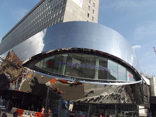
The Midland Hotel across the road to New St Station still has a large sign visible at first floor level. Another indicator that it was intended to be seen when stepping out of the station. Today (and even since the 1960s re-building of the station area) the Midland Hotel sign is pretty well un-noticeable to people emerging from the station. Viv.