B
bandito22
Guest
Hi All,
I am new here and not sure if I am posting this in the right place.
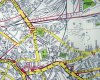
I lived in a street in Small Heath up to 1975 when they were demolishing the houses. I would love to find pictures of the street and findo out the name of it as it no longer exists.
I remember BCFC being literally at the bottom of the road and our address was '5 back of 67' I figured if someone had maps or plans for that era there must only be one house with that address.
Any help appreciated.
Many Thanks.
I am new here and not sure if I am posting this in the right place.
I lived in a street in Small Heath up to 1975 when they were demolishing the houses. I would love to find pictures of the street and findo out the name of it as it no longer exists.
I remember BCFC being literally at the bottom of the road and our address was '5 back of 67' I figured if someone had maps or plans for that era there must only be one house with that address.
Any help appreciated.
Many Thanks.