• Welcome to this forum . We are a worldwide group with a common interest in Birmingham and its history. While here, please follow a few simple rules. We ask that you respect other members, thank those who have helped you and please keep your contributions on-topic with the thread.

    We do hope you enjoy your visit. BHF Admin Team
  • HI folks the server that hosts the site completely died including the Hdd's and backups.
    Luckily i create an offsite backup once a week! this has now been restored so we have lost a few days posts.
    im still fixing things at the moment so bear with me and im still working on all images 90% are fine the others im working on now
    we are now using a backup solution

Salford bridge

From the Goosemoor Lane website:

Stone Age - Dwarf Holes

We do know people lived in this area in ancient times. These partly man-made stone-age caves were in Gravelly Hill and are mentioned in 1490 AD written records in fact. Locals used them in WWII as air-raid shelters. They were demolished to make way for Spaghetti Junction.
Thanks Pedrocut for the maps. They clearly show the sewage works and gravel pits (Gravelly Hill). Wonder what the owners of Copeley Lodge, that romantic spot, would think of Spaghetti?
 
Viv, in post #41 I think I can make out a crane in the distance so this would date the picture to 1924 as in one of Lyn's posts. What do you think?
 
IMG_1487.jpg
From the Goosemoor Lane website:

Stone Age - Dwarf Holes

We do know people lived in this area in ancient times. These partly man-made stone-age caves were in Gravelly Hill and are mentioned in 1490 AD written records in fact. Locals used them in WWII as air-raid shelters. They were demolished to make way for Spaghetti Junction.
Thanks Pedrocut for the maps. They clearly show the sewage works and gravel pits (Gravelly Hill). Wonder what the owners of Copeley Lodge, that romantic spot, would think of Spaghetti?

I thought the filter beds by Salford Park was the sewage farm, but I have just noticed the farm was more over to the West! 1886
 
Ah-ha! I had my bearings wrong - it wouldn't have done at all to have the sewage works next to the reservoir would it? The filter beds in the first map would apply to the water purification wouldn't they?
 
Viv, in post #41 I think I can make out a crane in the distance so this would date the picture to 1924 as in one of Lyn's posts. What do you think?

Looks highly probable Lady P. Well spotted! The crane in both photos has a very long reach and look very similar. Viv.
 
Yes , they were there for that purpose. The sewage farm expanded from that in the map in c1886 . the area in c 1916 is shown below. I have written notes for the recently published Alan Godfrey map of the area for c1916 and below is the part for water and sewage in the area:
One of the most obvious features is Aston Reservoir. Despite being close to a canal junction, this was not built to supply the canals with water but to supply Birmingham with drinking water. The Birmingham waterworks Company was established in 1826 to supply clean water to the inhabitants of Birmingham, Aston, Duddeston, Nechells & Edgbaston. Before then rivers, streams and boreholes giving water of dubious quality had been used. The Company built the main Aston Reservoir, which was originally supposed to be supplied with water from the Tame and Hawthorne Brook, though the Brook was never used. It can be seen that the Tame ran round the top of the reservoir, while Hawthorne Brook is the small stream coming down which meets the railway as it crosses the canal by the Aston Wells Pumping Station. The small reservoirs and filter beds below were constructed later. However, although the company did supply a large number of people, it was not until 1853 that a constant supply was available throughout the area, and in 1868 there were still 150,000 relying on wells for their water. This was used as an argument by Joseph Chamberlain for the municipalization of the water supply, leading to the Birmingham Corporation taking over the water company from 1st January 1876, although work had already started to increase the available supply. There followed a rapid expansion of the works and the Birmingham Mail declared in 1889 that if it had not occurred, then the horticulturalists of Edgbaston would have had to "moisten their lawns with beer". The expansion, begun in 1873, involved further reservoirs at Witton Lakes and Perry Barr, with a connecting main running along the Tame Valley canal to the north west from Salford/ Aston one on this map. The Aston reservoir was still being used for water supply in 1916, but after WW1 was used as a boating lake, and is now at the centre of Salford Park.

To the south west of the reservoir is a large area marked as sewage farm. Up until the mid 19th century human waste in Birmingham was normally disposed of in one of two ways, either by direct dumping into a convenient river (the Rea or the Tame), or, if there was no such convenient depositing ground, collection by night soil men, followed by spreading on farmer's fields in the countryside. However by the 1850s the volume the city produced had increased considerably, and, after floods in the Digbeth area caused by sewage blocking weirs on the Rea, the city surveyor, Pigott-Smith designed a piped system which took the waste from all connected properties to Saltley sewage works. In 1860 it was made compulsory for all new buildings to be connected to the system, though this still left 20,000 properties unconnected.

At Saltley the effluent was allowed to settle and liquid discharged into the river. The solid was spread, allowed to dry, and used as fertiliser. But this, together with the discharged effluent, still gave rise to considerable odours. One man in particular objected strongly to them. C.B.Adderley (later Lord Norton) was MP for North Staffordshire for 37 years, donated Adderley Park and library to the city and, amongst other good works, was responsible for the development of good housing in Saltley. He also owned Hams Hall, a country house upwind of the Tame, and his protestations had been partly responsible for efforts to improve sewage disposal. He continued to complain, together with property owners of Gravelly Hill overlooking the works. After court cases and injunctions the Corporation, under the influence of Joseph Chamberlain, hurriedly cleaned up the Saltley works, introducing full filtration with chemical treatment, followed by draining of remaining liquid over land purchased from Adderley, through canals, followed by discharge into the Tame. The resulting farms produced some good crops. From 1894 bacterial treatment was used to further pre-clean the sewage. This all caused the area of the works to rise from 260 acres in 1877, much on this map, to 1792 acres in 1895 and over 2000 acres after 1900.
 
My grandmother grandfather and aunt moved to Chartley Road (off Hillside) when they retired from Dunns Fruit Stores in Park Lane Aston. I can remember going on the #65 bus and getting off in Slade Road just under the railway bridge to walk up the hill. Great pictures bought it all back especially the shops there and the Armada on the corner! Their house - #27 - backed on to the copse - an enclosed area behind the houses there that had no access to the roads - safe play and a real adventure playground. When my parents were divorced and my mum and I moved from Park Lane we moved into Chartley Road for a while. I can remember being so thrilled to have a front door rather than a shop door that was always open!
 
Ann I lived at 43 Hillside Road (almost top of Hill) from 1962 to 1987, our first house and knew quite a few people in Chartley Road. Before the 65 bus was the 78 tram, which we sometimes used when we lived in Aston to catch to Brookvale Park this would be in the 40's and early 50's . Eric
 
Thanks for that very informative post Mike. My Great Uncle was a 'stationary engine driver' at the sewage works and as I said earlier caught typhoid. I expect several people did.
 
View attachment 112643 View attachment 112644

Goodmans at Salford Wharf, advert 1883.

Busiest in the City 1939
My grandmother grandfather and aunt moved to Chartley Road (off Hillside) when they retired from Dunns Fruit Stores in Park Lane Aston. I can remember going on the #65 bus and getting off in Slade Road just under the railway bridge to walk up the hill. Great pictures bought it all back especially the shops there and the Armada on the corner! Their house - #27 - backed on to the copse - an enclosed area behind the houses there that had no access to the roads - safe play and a real adventure playground. When my parents were divorced and my mum and I moved from Park Lane we moved into Chartley Road for a while. I can remember being so thrilled to have a front door rather than a shop door that was always open!
If you mean the island on the Tame Valley Canal. This is a Google Maps view. Between the M6, Lichfield Rd, Salford Circus and Spaghetti Junction.View attachment 112589
Seeing this image reminded me that not long after Spaghetti Jn opened my grandmother who was 94 asked to be driven over it, she also meant every road on it by the time what finished we had done almost 100 miles, sadly just afterwards she began to develop dementia and eventually died at 96. When my grandfather died in 1945, just afterwards she took in two lodgers one of whom had a fabulous prewar Scot m/cycle the other was from Worcester/Hereford area called Ted Grubb, they both worked at GCE. Eventually she married Ted, who accompanied us on the trip around Spaghetti, he actually predeceased her by a few weeks. These pictures have brought back memories of the three tram routes, the changeover to buses ,and although I had moved away when it was built on my return trips I have used all the routes and now twice in recent years travelled the slow peaceful world beneath it that is the canal system, both Grand Union connection and the Birmingham and Fazeley. Lady P those are superb postcards, I presume you are a collector
Bob Davis
 
Hi Bob,
No I'm not a collector - all the 60's photos were taken by my friend Diane who had the foresight to go out one Sunday with her camera. The two postcards I spotted on Facebook, unfortunately I don't own them.
 
Wow Eric - we moved in to join my Nan at 27 Chartley - about half way up the hill on the right before it turned - in about 1964/5 We were there for a while but was too crowded and we moved in about 1967 I think to Sutton Remember the bakery in Slade Road - Salmon's? - up towards Highcroft and on a corner. Did you back on to the copse or were you the other side?

Edited to add: I did though spend a lot of time there when younger especially weekends. Gave my mum a rest from me I think!
 
Last edited:
Hi Lyn, here's a few of Salford Bridge from the slides my friend Diane took in the 1960's.
index.php
The 1950 photo below was taken not far from where the second photo in the above post#6 was taken. The public toilet block right of centre shows in both views. The shops on the left can also be seen in the first photo in post#41.
SalfordBridge1950.jpg
 
The 1950 photo below was taken not far from where the second photo in the above post#6 was taken. The public toilet block right of centre shows in both views. The shops on the left can also be seen in the first photo in post#41.
View attachment 112736
This picture is not only a good one of the tram (what was route 5?), but two cracking motor cars, the Ford V* Pilot and I think, but am prepared to be corrected, an Armstrong Siddeley. The latter was one of my first Dinky cars, my second was a Buick....probably be a millionair now if I had kept them.
Bob
 
The No 5 tram would be on it's way back to Lozells. The cars are nice, lots of chrome to polish !
 
An interesting thread about Salford Bridge and its locality. It is not an area I ever visited so the views and information are new to me. However, in common with millions of other motorists I have driven OVER Salford Bridge on the notorious Spaghetti Junction. :D
 
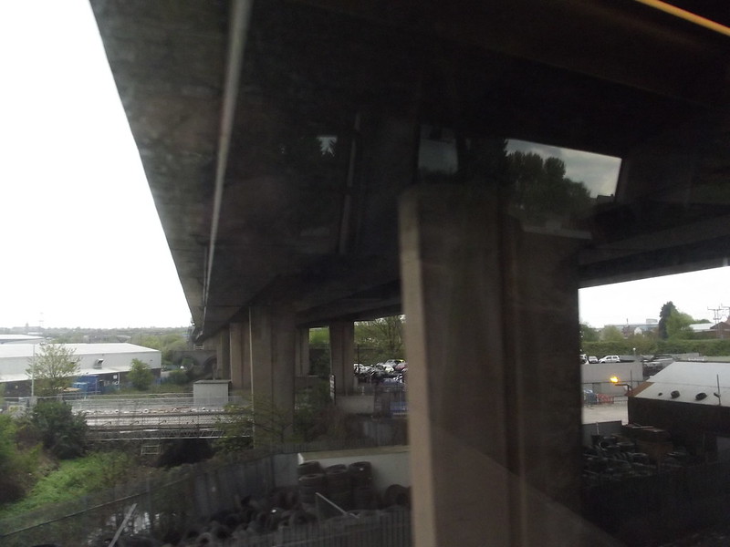
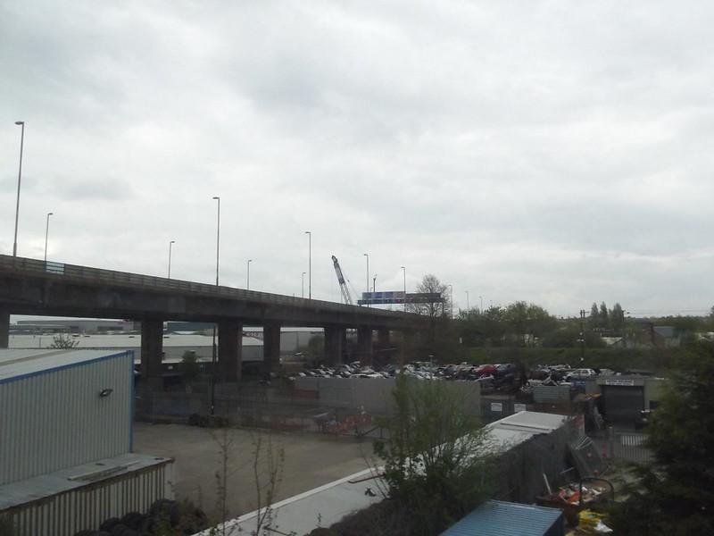
A view from the train passing under the Aston Expressway. Between Witton and Aston. On the line from Walsall to Birmingham New Street. Salford Bridge is not visible from here.


A 'britainfromabove' aircraft flew over the Salford Bridge area in 1920. Lichfield Rd runs across from right to left and the canal approaches the road from bottom left towards the bridge. Leamington Rd can be seen left of the canal bridge running towards it's junction on the Lichfield Rd. The Aston Wells Pumping Station is in the bottom of the image.
SalfordBridge 1920.JPG
 
A 1958 photo to compare with the much earlier dated photo in post#68. In this later photo, the toilet block is just out of shot on the left but the advertisement hoardings are still in place and a van parked in this new photo is almost in the same place as the one in the old photo. Some sheds in the pics have survived the passing years.
SalfordBridgeJunction 1958.jpg
 
The following is taken from a poem in the volume of verse entitled Rhymes, Grave, Gay and Otherwise and the locality around Salford Bridge is commemorated in a long poem called 'Copeley Hill', written by Thomas Townsend in 1876:

My muse claims no Vision of Prophecy, still
Let me dream of thy future, fair Copeley Hill!
Will some levelling Brummagem Mayor of the day
In some vast Improvement Scheme sweep thee away....

And along came Spaghetti Junction.
 
Not sure where I got this one from. Where do you reckon the photographer was standing?

IMG_7904.JPG
 
Last edited:
Back
Top