Mark Wilson
proper brummie kid
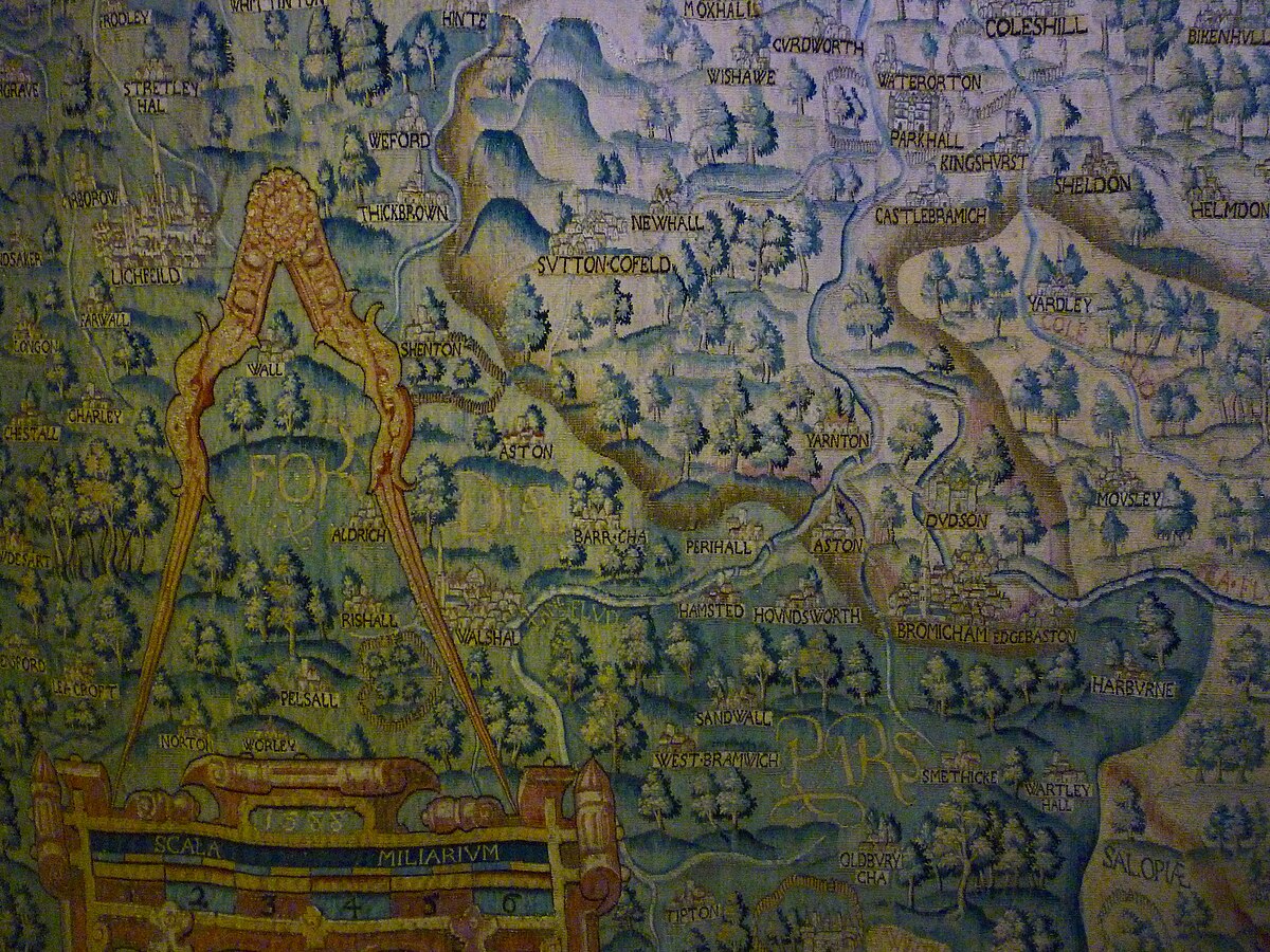
Has anyone come across this before? This is 1 of 4 woven Tapestry Maps commissioned by Ralph Sheldon for his house in Weston, Warks. They were produced in the late 1580s. This has North Warwickshire on it (East Brum/Solihull ). They were originally 4 of these woven together , but they got split up into individual maps probably in the late 18h Cent. The maps show Gloucestershire, Worcestershire Warwickshire and Oxfordshire (these were places with which the Sheldon family had links) in a view from the Bristol Channel to the South east and the London area. The Bodleian Libraries owns three of the Sheldon tapestry maps: the Oxfordshire map, the Worcestershire map and a fragment of the Gloucestershire map. The Warwickshire map is owned by Warwickshire County Council, and is housed at the Warwickshire Museum in Warwick.