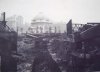
• Welcome to this forum . We are a worldwide group with a common interest in Birmingham and its history. While here, please follow a few simple rules. We ask that you respect other members, thank those who have helped you and please keep your contributions on-topic with the thread.

    We do hope you enjoy your visit. BHF Admin Team
  • HI folks the server that hosts the site completely died including the Hdd's and backups.
    Luckily i create an offsite backup once a week! this has now been restored so we have lost a few days posts.
    im still fixing things at the moment so bear with me and im still working on all images 90% are fine the others im working on now
    we are now using a backup solution

Lost Birmingham Canals

Heartland

master brummie
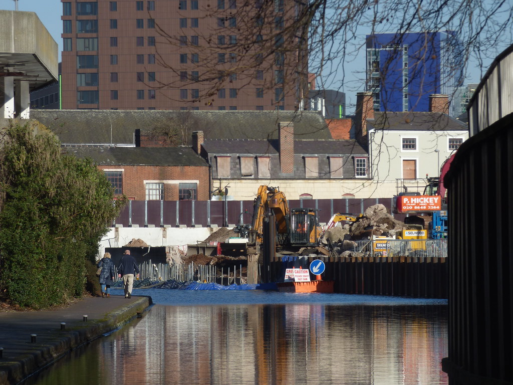
Whilst there has been much interest in waterways certain waterways have been lost through a variety of reason. In Birmingham these former waterways were essentially basins or short branches. Examples include :
(1) The long basins that passed under Gas Street & Berkeley Street
(2) The basin at Worcester Wharf, now covered by the Mailbox
(3) The Old Wharf, Paradise, now totally lost to the new development there
(4) Gibsons Arm and Baskerville Basin, lost to the new Library Complex and Baskerville House
(5) Whitmore's Arm
(6) Brewery Basin
(7) Dowlers Arm
(8) Arm to Heneage Street
(9) Warwick Wharf Basins

No doubt members might suggest more?
 
IMG_2165.jpg IMG_2166.jpg IMG_2167.jpg

(3) Sticker has uploaded some good pictures of the Old Wharf on the Thread, Canals of Birmingham.

The thumbnails are from the Birmingham Daily Post of December 1939 telling the story of the Wharf. The site was being re-excavated to serve as an air raid shelter.
 
An interesting thread. Missed it when it was set up (house move) but would be interested to hear more, especially about the various 'arms'. Thanks Heatland and Pedro.

Viv,
 
IMG_2162.jpg IMG_2163.jpg IMG_2164.jpg IMG_2162.jpg IMG_2163.jpg IMG_2164.jpg
An interesting thread. Missed it when it was set up (house move) but would be interested to hear more, especially about the various 'arms'. Thanks Heatland and Pedro.

Viv,

Yes it could prove an interesting thread. I have put three maps of the Old Wharf from around 1880, 1903 and 1913.
 
According to the newhall square.net site this was the original purpose of the Whitmore Arm. Viv.


"In the early 19th century Newhall Hill was the site of extensive sandpits; the sand was used for building work as well as for moulds in metal foundries. At the foot of the hill was the Whitmore Arm c1810 which left the Birmingham & Fazeley canal at Newhall Street, and it was from here that many tonnes of sand were transported.

William Whitmore also owned a foundry alongside the new arm and was involved in building the Stratford Canal. Presumably he also sent his cast-iron fittings by this route."

And just a little glimpse of the arm can still be seen today. https://www.geograph.org.uk/photo/2953996

 
IMG_2169.jpg IMG_2170.jpg
In post 869 of the “Key Hill Cemetery” Thread it was mentioned about “Mount Misery” and the plight of the sand carriers...

https://birminghamhistory.co.uk/forum/index.php?threads/key-hill-cemetery.4830/page-44#post-590943Z

The two thumbnails show the area around Newhall Street from the 1890 OS Map, the second being the area between the four streets, Newhall St, Great Charles Street, Lionel Street and Summer Row. In this area there are at least 5 wharfs, one being “India Wharf.”

The Bridge at Summer Row is called Friday Bridge, and father down there is Saturday Bridge.

According to the newhall square.net site this was the original purpose of the Whitmore Arm. Viv.


"In the early 19th century Newhall Hill was the site of extensive sandpits; the sand was used for building work as well as for moulds in metal foundries. At the foot of the hill was the Whitmore Arm c1810 which left the Birmingham & Fazeley canal at Newhall Street, and it was from here that many tonnes of sand were transported.

William Whitmore also owned a foundry alongside the new arm and was involved in building the Stratford Canal. Presumably he also sent his cast-iron fittings by this route."

And just a little glimpse of the arm can still be seen today. https://www.geograph.org.uk/photo/2953996
 
IMG_2171.jpg IMG_2172.jpg IMG_2173.jpg The area of the wharfs from around 1903, 1913 and 1945.

Friday and Saturday Bridges reappear in the 1945 map.
 
Friday and Saturday Bridges get a few mentions on the Forum and post 18 by Peter Walker on the Thread “Canal Question” says...

“Saturday Bridge was built 20 years after Friday Bridge, but it took another 55 years until Sunday Bridge was built.

Friday Bridge was at the top of Summer Row, only 200 yards from Great Charles Street, and Saturday Bridge further down the hill - the one which is still standing. You can see the name from the towpath.

The question is: where is Sunday Bridge? The name appears on some old maps, but I don't think it's been used for years. As a clue it's away from the centre of Brum, just outside the city boundary in fact.
Peter”
 
FRIDAY BRIDGE.

Friday Bridge seems also to refer to a small area around the bridge, for example there is a PH on the 1880 map about 5 establishments from the Bridge. This was probably No22 Summer Row and is shown in 1900 Kelly's as the Wagon and Horses. In 1849 it was for sale and described as an old established Inn and Market House and situated at Friday Bridge, Summer Row.

From Summer Row and along Great Charles Street to Newhall Street there is mentioned India Wharf to which Ind Coope and Co moved in 1863 from Broard St. Also mentioned in Great Charles Street are a Bloomfield Wharf in 1870 and an Old Packet Wharf in 1864.
 
Some good additions there Pedro. There seem to be so many more than I thought. But I suppose many of the smaller branches ceased to be of use following economic changes and when transportation methods changed. Thanks for digging this out.

Talking of digging out, this is an interesting image. Who'd have believed this was in the Centenary Sq area? Don't know if it's Old Wharf but it could also be one of the arms bounded by Cambridge St and Easy Row on your maps in post #4. Not too sure though. This is from the blog link below, and a very interesting read it is too. Viv.

https://boatlife.blogspot.co.uk/2015/11/birminghams-old-buried-canal-arms.html
 

Attachments

  • image.jpeg
    image.jpeg
    91 KB · Views: 30
Both sides of Friday Bridge at the beginning of Summer Row, the one is looking down Summer Row from Great Charles Street the other is looking up toward Great Charles Street and the bridge is hidden by hoardings. The other photo only shows where the road begins to rise up a little to accommodate the bridge and the edge of the hoardings on that side of the road.

Summer Row  Friday Bridge 1945.JPG

Ladywood Friday Bridge Summer Row.JPG
 
Whitmore's Arm has quite an interesting history as it extended beyond George Street and once formed part of William James plans for an inland port and early railway link to it. William Whitmore owned the Lionel Street foundry and was engineer to James on the Lower Stratford Canal and was responsible for building the surviving cast iron Aqueducts at Wootten Wawen and Bearley.
 
Photos from Heritage week tour of St Chads. We began outside so I took a couple of photos. The guide told us that when the cathedral was being built if we had wanted to cross the road seen in the first photo we would have had to swim. There was a canal there in the 1830s and they built a wharf so that the building materials could be brought by barge. I am not sure when the canal went - possibly someone will know or I will investigate.
 

Attachments

  • Outside St Chads.jpg
    Outside St Chads.jpg
    502.4 KB · Views: 5
  • Main door.jpg
    Main door.jpg
    605.7 KB · Views: 5
  • Main door St Chads.jpg
    Main door St Chads.jpg
    595 KB · Views: 5
nice pics jan glad you enjoyed the tour...very interesting info which has now got me wondering if there is a map available showing that old canal and wharf

lyn
 
I wonder if the canal mentioned in Janice's post #8 was a branch arm of Honduras Wharf ? Maybe a map will help - please Mike ? Viv.
 
thanks for the map mike..what a hive of activity the wharf must have been when building st chads

lyn
 
I'm wondering if the canal branching to the left is the remains of Snow Hill Wharf. Could it be ? I posted this on another thread when discussing Honduras Wharf (in the foreground).Viv.

image.jpeg
 
viv no expert but i would say yes that must be where the materials were landed for the building of st chads..i wonder how long the job took from start to finish took
 
Both sides of Friday Bridge at the beginning of Summer Row, the one is looking down Summer Row from Great Charles Street the other is looking up toward Great Charles Street and the bridge is hidden by hoardings. The other photo only shows where the road begins to rise up a little to accommodate the bridge and the edge of the hoardings on that side of the road.

View attachment 117794

View attachment 117795
The top photograph suggest is 1948. The young women appear to be in the fashion of the new look and the cars seem to be of that era. The 32 Lodge Rad trams finished in March 1947 but Rosebery Street tram depot did not become a bus depot until August of that year. The track, not surprisingly, is still there but the overhead has not yet been removed which suggests the date I give.
 
Whitmore's Arm has quite an interesting history as it extended beyond George Street and once formed part of William James plans for an inland port and early railway link to it. William Whitmore owned the Lionel Street foundry

Hi,

I remember George Jones' Lionel Street Foundry very well from the early 60's as I worked on the corner of
Lionel Street and Newhall Street, but I was completely unaware of any canals in that 'block'!
George Jones was involved from the 1840's according to the net, and it still went by that name in the
1960's. What was his relationship with Mr Whitmore, and when did it close, or indeed, has it?

Kind regards
Dave
 
Friday Bridge was actually built later than the Newhall Branch, it was the result of diverting the turnpike over the canal and to avoid the narrow aqueduct that carried the canal branch over the old turnpike as is seen in Snapes Survey of the BCN (1777) as shown below. It is also to be seen that Congreve Street was then known as Friday Street, hence the name of the bridge..

210402.jpg
 
I'm wondering if the canal branching to the left is the remains of Snow Hill Wharf. Could it be ? I posted this on another thread when discussing Honduras Wharf (in the foreground).Viv.
Viv - that picture is at St Chad's in the crypt. The guide referred to it as showing the time of building. I didn't take a picture of it as it was not well lit and would have reflected the flash. So I am glad you have put a copy on here.
 
The image at St Chads shows what I gather is a painting. The warehouse with the boats loading appears to be associated with the Corn Mill. Carriers called at that wharf with traffic for and from the steam mill
 
Demolition at the Snow Hill Wharf site from the Birmingham & Fazeley Canal. Seen just beyond the Snow Hill Bridge. A residential development will be built at Shadwell Street. They dammed the right side of the canal wall.

 
I had another look at the painting posted regarding Snow Hill. as it related to a recent enquiry regarding Farmer's Bridge Canal Locks. The painting seems to predate the erection of the "Old Steam Mill" a flour mill whose location adjacent to Snow Hill Wharf was not "Old" as the original Old Steam Mill was placed on the corner of Water Street and Snow Hill, but the then owner Rayner, moved the mill there from the earlier site.

These buildings, of the painting, look to be of wood. Snow Hill Wharf was generally developed as Birmingham Canal Navigations Wharf and was in operation by the 1830's. The warehouses can be seen on maps including the Rent Maps of the 1870's, which can be seen in microfiche form at Birmingham Public Library.Snow Hill wharf.jpeg
The painting

Snow Hill W.jpg
 
Back
Top