• Welcome to this forum . We are a worldwide group with a common interest in Birmingham and its history. While here, please follow a few simple rules. We ask that you respect other members, thank those who have helped you and please keep your contributions on-topic with the thread.

    We do hope you enjoy your visit. BHF Admin Team
  • HI folks the server that hosts the site completely died including the Hdd's and backups.
    Luckily i create an offsite backup once a week! this has now been restored so we have lost a few days posts.
    im still fixing things at the moment so bear with me and im still working on all images 90% are fine the others im working on now
    we are now using a backup solution

High Street Deritend

Someone please correct me if I'm wrong, but my estimation of the site of the buildings in Lines' painting is approximately where the blue dot is on the modern day map. I'd say more or less next to the Kennedy mural. The pavement there would have been part of these buildings. A series of road widening (on both sides) and, channges to the bridge make it difficult to be 100% accurate even using the Georeferencing tool in Lyn's post #49. But at least it's an approximation. Viv

Chitro-1693125559381.jpg
 
Hi Viv, firstly let me apologise for the scans - I haven't got the hang on this new PC yet - my other one crashed and I lost everything having not backed up for some time (everyone please note this warning!).

In the first picture (Paul Leslie Line's book, Birmingham A History in Maps) you can just make out the name Geast - this was the property of Henry and Richard Geast. The latter was an attorney but I can't remember what Henry did. Somewhere I have an advert for their extensive property and the address is 'Deritend Bridge'. They were selling up due to the bridge being rebuilt sometime around the 1820's if my memory served me correctly.

The second image, entitled Birmingham: The East Prospect 1732, shows the property and appears in 'The City of Birmingham Official Handbook' edited by F W Bradnock MBE, which was printed in 1950. The bridge looks to be a zig-zag bridge similar to the one at Perry Barr with niches for pedestrians so it's not the same as the one in your image. The description of the property in the sales particulars, which I will now look for but don't hold your breath, fits this picture. Could yours be on the other side of the road?

I realise that there are four places that could refer to refer to your picture but one is taken up with St John's and one is the Geasts' house.
I'm also sure there is another version of this view. Possibly on the forum. Very interesting altogether.!

I did think that the toll gate was further down the road from the bridge but I may be wrong. So much to try to find!

Penny
Deritend Bridge Map.jpgDeritend Bridge 2.jpg
 
Last edited:
Hi Viv, firstly let me apologise for the scans - I haven't got the hang on this new PC yet - my other one crashed and I lost everything having not backed up for some time (everyone please note this warning!).

In the first picture (Paul Leslie Line's book, Birmingham A History in Maps) you can just make out the name Geast - this was the property of Henry and Richard Geast. The latter was an attorney but I can't remember what Henry did. Somewhere I have an advert for their extensive property and the address is 'Deritend Bridge'. They were selling up due to the bridge being rebuilt sometime around the 1820's if my memory served me correctly.

The second image, entitled Birmingham: The East Prospect 1732, shows the property and appears in 'The City of Birmingham Official Handbook' edited by F W Bradnock MBE, which was printed in 1950. The bridge looks to be a zig-zag bridge similar to the one at Perry Barr with niches for pedestrians so it's not the same as the one in your image. The description of the property in the sales particulars, which I will now look for but don't hold your breath, fits this picture. Could yours be on the other side of the road?

I realise that there are four places that could refer to refer to your picture but one is taken up with St John's and one is the Geasts' house.
I'm also sure there is another version of this view. Possibly on the forum. Very interesting altogether.!

I did think that the toll gate was further down the road from the bridge but I may be wrong. So much to try to find!

Penny
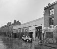
View attachment 183672View attachment 183673
nice map pen...ive just spotted another toll booth on the corner of new st and high st

lyn
 
Hello everyone, I am looking for the locations of the following photos to make a past present video. I hope you can help me find them.
The 1st photo is 78-76 High St Deritend.
Photo 2: 5/7 back of 61 High St Bordesley
Photo 3: the description says Tonks in Moseley St 10 June 1954
Photo 4: Bishop St is on the right (8 June 1951)
Photo 5: 137 Moseley St 19 Dec 1951

Thank you in advance. Have a lovely day!
 

Attachments

  • 76-78 High St Deritend.PNG
    76-78 High St Deritend.PNG
    628.3 KB · Views: 50
  • 5-7 Back_of_61HighStBordesley.JPG
    5-7 Back_of_61HighStBordesley.JPG
    433.6 KB · Views: 65
  • tonks moseley.jpg
    tonks moseley.jpg
    1.2 MB · Views: 59
  • Bishop St.jpg
    Bishop St.jpg
    1.2 MB · Views: 56
  • moseley st.jpg
    moseley st.jpg
    1.2 MB · Views: 58
Photo 2 - back of 61 appears to be court 14, this is listed before no. 61 on the 1891 census and the King's Head is the fourth listing after no. 61 which corresponds. Map is from 1890, the road opposite is Adderley St and the road on the left is Alcester St. If correct and looking at the photo 5 - 7 would seem to be the pink dot...

0 - High St Bordesley.jpg
 
Photo 2 - back of 61 appears to be court 14, this is listed before no. 61 on the 1891 census and the King's Head is the fourth listing after no. 61 which corresponds. Map is from 1890, the road opposite is Adderley St and the road on the left is Alcester St. If correct and looking at the photo 5 - 7 would seem to be the pink dot...

View attachment 184604
Thank you so much MWS
 
Photo 4 - guessing a bit but possibly corner of Bishop St and Moseley St. Shadow would seem to put it on the SE side and that could be piles of wood on the right edge. Map is from 1950 and there is a timber yard that may correspond...

0 - Bishop St.jpg
 
Hello everyone, I am looking for the locations of the following photos to make a past present video. I hope you can help me find them.
The 1st photo is 78-76 High St Deritend.
Photo 2: 5/7 back of 61 High St Bordesley
Photo 3: the description says Tonks in Moseley St 10 June 1954
Photo 4: Bishop St is on the right (8 June 1951)
Photo 5: 137 Moseley St 19 Dec 1951

Thank you in advance. Have a lovely day!
Photo 3:

WT&S, W. Tonks & Sons, 3, Hill Street, woodscrew maker (S1770) then 43 Deritend, steel toy maker (PR1780), Cheapside, Birmingham, then 201, Moseley Street, Birmingham making cast and wrought brass products. [from The Old Copper Website]

What an interesting photograph. Suspect site has been redeveloped as can't see it on Streetview.
 
Photo 5 - if it is the top of Moseley St taken from Moseley Road then the 1950 map that would show 137 is very poor but it doesn't seem to correspond with less detailed maps. This is from 1938, arrow points to no. 135 and no. 137 would've been to the left...

0 - Moseley St.jpg
 
Photo 3 - Wilkes & Godwin (metal finishers) are listed at various address - Charles Henry St, Bradford St and 62 Moseley St - and it would appear to be the latter. Map from 1950 seems to match the photo - Wilkes & Godwin, ruin then houses...

0 - Moseley St.jpg
 
Hi mikegee.

1. Always admire your brilliamt large scale maps. I wonder where you get them from? Is it a subscription site?

2. The Star Works [Tonks] is shown on the other side of Moseley Street from Barrel Plating Works [Wilkes & Godwin?] & on the other side of the junction with Birchall Street. It does make me wonder if the caption of phot 3 may be wrong as Tonks doesn't seem to be next to & to the left of Wilkes & the phot might be in Birchell Street? What do you think?
 
Photo 1 - is possibly High St city centre, not High St Deritend. So possobly here (1890)...

View attachment 184616
Mws is definitrly correct. In 1897 Kellys Richard Marsh is at 76 High St, Herbert George at 77 and Chas Britten at 78. March disappears from Kellys by 1899 edition (though his name might still be on building. The City Arcade (mentioned in placard on 76) appears in Kellys between the 1900 and 1903 editions. It is not present in th photographs there (would be where 76 is on th ephoto) so has not been built yet. So photo probably around 1900
 
Superdad
The 1880 maps are freely available on the National library of scotland website. They and others , including the numbered 1950s ones used to be available on the oldmaps website, but that closed. I and others were given some notice of the closure and saved some areas while they could.
As to the photo. I think you are correct , especially as there are no lines of houses to the left of Tonks in Moseley St, If the date is correct, the 1955 Kellys gives Wilkes & Godwin Barrel works as being 181-182 Charles Henry St., which agrees with the position on the map, but again, there are no line of hojuse type building to the left of the factory
 
Thank you so much MWS, Mikejee and superdad3. All the photos come from the Library of Bham Archives (apart from High St Bordesley) and they sometimes make mistake over there, that's why I came here for a more accurate eye. So thank you so much for your help, I really appreciate it. I will be in High Deritend & High St Bordesley tomorrow to film for my video
 
Back
Top