• Welcome to this forum . We are a worldwide group with a common interest in Birmingham and its history. While here, please follow a few simple rules. We ask that you respect other members, thank those who have helped you and please keep your contributions on-topic with the thread.

    We do hope you enjoy your visit. BHF Admin Team
  • HI folks the server that hosts the site completely died including the Hdd's and backups.
    Luckily i create an offsite backup once a week! this has now been restored so we have lost a few days posts.
    im still fixing things at the moment so bear with me and im still working on all images 90% are fine the others im working on now
    we are now using a backup solution

Help with understanding proximity

Ls48029

knowlegable brummie
Hi there, I found evidence of relatives having lived around 1900-1930 in Hurst St then in the Latimer Street back to backs, another reference to Irving Street. Were any of these locations anywhere near to Great King Street? It is hard to tell given many of the older locations no longer exist and I am not a local. Any help would be very much appreciated, maps particularly appreciated! thank you
Louise
 
Just under a couple of miles from Great King St to the other 3 roads. Great King St is to the north of the city centre, the others to the south.

Only Latimer St seems to have disappeared entirely, Hurst St is pretty much unchanged, whilst there's been a few changes to Great King St & Irving St but what's left is still where it used to be.
 
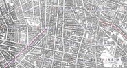
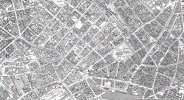
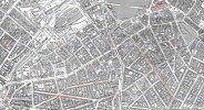
Not easy to show on a single map with any detail, these are from 1905 and give an outline. The beginning of Great King St (pink) is top left of the first map, Latimer St, Irving St & Hurst St (orange) are on the bottom map...

b0.jpg
b1.jpg
b2.jpg

b3.jpg
 
Last edited:
that is fascinating, thank you so much. Were these ostensibly separate areas or do you think there would have been people flowing to and form both areas? For example, are they both 'working class' areas 'everyday' people might have lived in or is one significantly more upper class than the other?
 
thinking around the first couple of decades of the 1900s. And in fact there is one other location I would like to understand the approximate location of - Phillips Street. Would you mind awfully pointing me towards that location? I am ever so grateful for the help.
 
I would think that they would have all pretty much been working class, around Hurst St there was a Jewish presence. If you check the censuses you will be able to see the range of occupations, which would give you an idea of the type of people residing there.

Phillips St is on the third map, it is the street that runs along the top of the Market Hall, which is to the right of New St Station, so in the general area.
 
Sincere thanks again, this is wonderful information and will really help me on the next steps. Have a lovely weekend.
 
we also have a thread for phillips st where i have posted lost of photos before demolision which you may find of interest click on the link below

 
There were (at least) two Phillips St in Birmingham at that time. The Phillips St in the link is in Aston which is not the one I've marked on the map.

Phillips St, Aston would have been closer to Great King St, off the top of the first map and to the far right.
 
I've added a fourth map above, showing the continuation of Great King St and Phillips St, Aston. As you can see if it is Phillips St, Aston your relatives lived they it is further away from the original three streets.
 
knowing the area well phillips st aston is only about a 10 min walk away from gt king st...maybe Ls48209 could let us know which phillips st is the correct one

lyn
 
Back
Top