Only the one image - problem with the scanner cable !
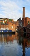
There were four black and white prints but one is the Paradise Branch photo above but fortunately noticed before I spent time scanning it .
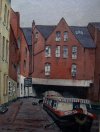
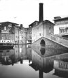
Not sure of the source, rescued from bin after some one was clearing out a filing cabinet, location is Gas Street but year is anyones guess, a posed image judging by all the people on the fronts of the boats. Other two are a more recent Gas Street and a turn of the century Lifford Lane photo.
View attachment 159795