Well that’s a surprise Mort. Thanks. Must have been well hidden. Viv
It was, a line of longish tunnels that I have walked throught many years ago.
Well that’s a surprise Mort. Thanks. Must have been well hidden. Viv
As I said, “I am not sure if it’s the same as the one that feed Witton Lakes.” I have never been able to find the name of the Witton Lakes Feed so this may confirm it, or not.
What I am unable to reconcile is The Birmingham Waterworks Company presented a bill to Parliament in 1821 to extract water from the Tame and Hawthorn Brook. It then goes on the say that the Hawthorn Brook was never used.
This effectively would have mad ethe Witton Lakes system redundant, yet we know that it was used up until the commissioning of the Elan Valley scheme. It in the back of my head somewhere that there may be another Hawthorn brook.
I remember that there was a problem with Hawthorn Brook, but can't find it at the moment.
")
There is a little about Hawthorn Brook and the proposal for the Witton Reservoirs on the thread below.
Also mentioned is Perry Brook...
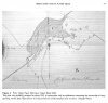
Upper, Middle And Lower Witton Reservoirs.
Somewhere on the Forum it was mentioned about a tragedy in this area at the sand pits near Witton Lakes, but I can’t as yet locate it. Any ideas?birminghamhistory.co.uk
Pedro,
On the definition of a stream, surely it is also reasonable to say that water that orignates from a spring, as many of them do, also becomes a stream before it is joined by other tributaries to become a river.
The difference a stream or is a brook is probably more difficult to define, but when I was young, a brook was just a stream that had enclarged, but not become big enough to be a river.
Maurice
I wonder if the Perry Brook is the one from Kings Vale and Lodge Pool?
My dad told me how he swam in the Swimming Bath that was on the brook between Witton Lodge Farm and St Marys College.
It would also be nice to know the name of the brook that ran form Station Road Erdington too.


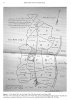
Hawthorn Brook seems to have its source somewhere near Powell's Pool in Sutton Park ? It runs to the Upper Witton Reservoir, on to the Lower Reservoir and then down to join the Tame at Salford Bridge.
wow!! our maurice very well putPedro,
On the definition of a stream, surely it is also reasonable to say that water that orignates from a spring, as many of them do, also becomes a stream before it is joined by other tributaries to become a river.
The difference a stream or is a brook is probably more difficult to define, but when I was young, a brook was just a stream that had enclarged, but not become big enough to be a river.
Maurice
I wonder if the Perry Brook is the one from Kings Vale and Lodge Pool?
My dad told me how he swam in the Swimming Bath that was on the brook between Witton Lodge Farm and St Marys College.
It would also be nice to know the name of the brook that ran form Station Road Erdington too.
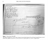
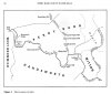
Map 2, what was a blade mill?If you haven’t already seen these, the maps below from a paper by Peter King may be of interest in looking at the brooks, streams and pools in the Perry Barr area. These are considered in relation to the various mills around that were once in the area.
Viv.
This seems to be the old fish pond from which one stream ran to join another from near the King’s Vale pumping station and form Hawthorn Brook on its way to the Upper Reservoir, Witton Lakes.
View attachment 150123