• Welcome to this forum . We are a worldwide group with a common interest in Birmingham and its history. While here, please follow a few simple rules. We ask that you respect other members, thank those who have helped you and please keep your contributions on-topic with the thread.

    We do hope you enjoy your visit. BHF Admin Team
  • HI folks the server that hosts the site completely died including the Hdd's and backups.
    Luckily i create an offsite backup once a week! this has now been restored so we have lost a few days posts.
    im still fixing things at the moment so bear with me and im still working on all images 90% are fine the others im working on now
    we are now using a backup solution

Electric Trams

As a child I remember watching the tram driver turning the pantograph (?) around for the return journey and this would've been at Pype Hayes terminus.
I can't help but think that this was later than '53 though. Could it be that trams carried on to Pype Hayes after the Erdington terminus closed ?
 
I have'nt got a clue, the newspaper artricle said 1953 but Lloyd will let us know as soon as he sees the post.
 
The system closed to public operation on 4th July 1953, although there were stock movements from Miller Street depot to Kyotts Lake Road works where the last trams were scrapped for a short time afteer that. Turning the pole at Pype Hayes would have ended at the closure, as it would at Erdington (the Yenton) and Short Heath terminus.
 
Thank you that Lloyd, I knew you would be able to verify if it was correct or not.
 
The system closed to public operation on 4th July 1953, although there were stock movements from Miller Street depot to Kyotts Lake Road works where the last trams were scrapped for a short time afteer that. Turning the pole at Pype Hayes would have ended at the closure, as it would at Erdington (the Yenton) and Short Heath terminus.

So it WAS that far back ?
Blimey, my memory's not as bad as I thought !
 
Interesting to see the alignment of the streets in those days. The 71 tram from Rubery on the left will go up Suffolk Street and into Navigation Street while the outbound tram in John Bright Street could be either a Bristol Road or a Pershore Road tram as I can't read the route number.
 
I put this street view in the 'Old street pics' thread - I remember the trams, but wonder what was the purpose of the post in the left foreground and similar posts near the tracks on the far side of the junction ?

index.php
[/URL]
 
Last edited:
Could the posts be a form of signalling system just for trams as the track has a turn as well as going straight on?
 
I remember the trams, but wonder what was the purpose of the post in the left foreground and similar posts near the tracks on the far side of the junction ?

They were cast iron posts with red lenses, lit by a bulb - to tell motorists there was no entry here. Used where trams entered a central reservation, or went through a traffic island. This view shows both uses, the photographer is standing on the start of a central reservation in the dual carriageway, and the far bollard is for the island at Holly Lane / Tyburn Rd junction.

The trams, track and island have gone but the scene is still recogniseable today - https://goo.gl/maps/eTM4v
 
Last edited:
Thanks Lloyd for that information. I'm now starting to wonder how a driver of a tram that has to turn right at that junction ensures that the tram does turn right, did they have to get out and alter the points ?
 
I'm now starting to wonder how a driver of a tram that has to turn right at that junction ensures that the tram does turn right, did they have to get out and alter the points ?
I've searched back in the forum and can see some discussion here about it from posts #53 to #59.
When I think back, I never went on a tram which needed points changing.
 
Yes, the driver had a 'point iron' to change the blade of the track pointfor whichever way he wanted to go. The conductor did likewise with the overhead wire - pulling a wire or rope attached to a nearby roadside pole changed the 'frog', a point in the overhead wire.

Changing the points, Christchurch New Zealand, 1927.

IMG0042.jpg
 
In June I was in Nordhausen in Germany and I watched a driver get out and change the points manually for a right turn. However other trams made the right turn without the driver having to get out. My understanding is that the system in Birmingham was that if the tram passed a contact point with power on the points were switched one way but if power was off the points were set the other way.

Wikipedia has a note about this on https://en.wikipedia.org/wiki/Tram_controls
 
Thanks David for the information and link.
Although I had said in #204 that I had never been on a tram that needed points change, I've since realised that the No 6 Perry Barr tram I mostly used would have gone through points at Lancaster Place and I now understand why I never saw a driver stop the tram and get off to change points.
 
Looking at some old tram pics, I noticed this scene in Hockley 1913 which shows that conduit current collection between the rails was initially used. These were presumably replaced by overhead lines which can be seen in the pic.
Hockley_Brook_1913.jpg
 
The Hockley trams were cable operated before overhead electrification. What you see in the centre of the tracks is the slot through which the gripper ran to grip the cable not a conduit for electric power collection.

This photo is taken from the Library of Birmingham website
Hockley Cable Tram.jpg
A Cable Tram stopped at Hockley Brook in July 1890.
Reference: WK-H10-2
 
Thanks David for that information, I had never thought of cable operation. I will have to look up some information to see how it worked, must have been interesting for the drivers.
Sent from my iPad
 
Bus for Harborne..jpgHello, I don't own the image I've uploaded and not sure if it belongs in this thread but thought some people on here might like to the bus !
 
Indeed Paul, I've not seen this one before - although I have seen the bus!
O9926, originally with the Midland Red company in 1913 soon passed with several others, their staff and depot in Tennant St, Ladywood, to the Birmingham Corporation Tramways in 1914 after an agreement by which the corporation owned and operated all routes which ran totally inside the city boundary, and the Midland Red ran further out from the city although retaining central terminus points. It much later became a shed on a freeholding in Nottinghamshire, and was rescued for eventual preservation at the Wythall Transport Museum.


1570633865_9ceca10f35_o.jpg
 
Try this site for more information - the Handsworth line used the same cable system as is still used in San Francisco. https://www.cablecarmuseum.org/heritage.html
Hi Lloyd - Thanks for the information. I have been studying the systems but still can't work out how the cables go round corners. Some sort of guidance would be needed and I would assume that the gripper has to push past any guidance devices. There is a slight curve on the hill in the photo.
oldmohawk

and in this photo linked to post#210
index.php


index.php
 
Last edited:
Indeed Paul, I've not seen this one before - although I have seen the bus!
O9926, originally with the Midland Red company in 1913 soon passed with several others, their staff and depot in Tennant St, Ladywood, to the Birmingham Corporation Tramways in 1914 after an agreement by which the corporation owned and operated all routes which ran totally inside the city boundary, and the Midland Red ran further out from the city although retaining central terminus points. It much later became a shed on a freeholding in Nottinghamshire, and was rescued for eventual preservation at the Wythall Transport Museum.


View attachment 95488

Glad you like my photo, I worked at a photo studio in Harborne many years ago when a customer brought in the original for me to copy on a 5X4 inch plate copy camera.
 
Hi paul
Here is a list of the old tram ways and there routes that was taken,
Service number
2.Erdington. And steel house lane
3witton and Martineau street via six ways.
3x within and Martineau street. Via Aston cross
5.Lozells and Slade road Gravelly hill
6 Perry Barr and Martineau Street
8 Alum rock and Martineau street
10.wash wood Heath fox and Goose and Martineau street
11. Bordeskey Green and Seymour street via,Fazely Street. ( Rush hour only )
23. Hands worth and Colmore row ( rush periods only )
24 Lozells and Col more row(via wheeler Street,
26Oxhill Road. (Hands worth ) Col more Row,
28 New Inns (Handsworth and Col more row (rush hour Periods only)
29 Bearwood and Edmond Street
30 Windmill Lane ( Cape hill) and Edmond Street rush hour only,
31 Heath street (Soho and Edmond street
32 Lodge Road ( Winson Green ) and Edmond street
33 Ladywood and Navigation street,
35 Selly Oak and Navigation Street( Rush Periods only)

The cable car was introduced in1886/1887,
Was so called because of the continuous moving cable, set in a slot on the road
To which the tram could be Attached and released by a claw gripper mechanism,
In 1888 Colmore row was linked with Shockley by this means and a year later the route was extended to new Inns
Handsworth, remaining in use until. 1911
The System was first tried in San Francisco in1873.
Early post card publishers were quick to realise the sales opportunities afforded by intresting Events
Whatever the merits of the poem
The top deck Advertisement provide a startling reminder of how efficient steam train services could be nearly
A century ago
And if I recall the west bromwich trolley bus which was after there tram came into service until the late 1950 s was still
Connected to over head cables coming down through Soho rd through the brook and to snow hill
Best wishes Alan,,,, Astonian,,,,
 
Thanks Alan for the list of tram routes

I can add 34 Navigation Street to Bearwood (via Holloway Head) which closed in 1930. Although this route ended just round the corner from the 29 there was never a connection between the two routes. The number 34 lived on for many years after the tram finished because as late as the 1960s I used to catch the 34 bus from Quinton to college in Gosta Green going via Holloway Head.

The 29 route still survives as the 82 previously a joint BCT/Midland Red route B82
 
Last edited:
Tram top Griffins hill.JPGDon't know if this has been posted before, but I thought a lovely picture of a tram climbing Griffins Hill on the Bristol Road probably pre WW2. Notice the lovely clear dual carriageway.
 
Learning how to drive the trams of their days ....
View attachment 98392

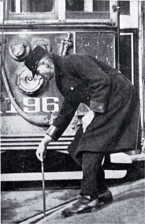
I believe these ladies are undergoing training in WW1, their attire suggests that.

This is more comprehensive list of Birmingham tram routes provided from this web site which I am sure many are familiar with.

https://www.robertdarlaston.co.uk/Trams.htm

A SUMMARY OF PRINCIPAL BIRMINGHAM TRAM ROUTES
In clockwise order around the city, starting in the north.

No.Destination (from City Centre)City centre terminusMain road taken out of cityMileageJourney Time (min)Closed
6Perry BarrMartineau StNewtown Row2.64181949
3Witton via Six WaysMartineau StNewtown Row2.50171939
3XWitton via Aston CrossMartineau StAston Road2.37181949
1 #Stockland GreenSteelhouse LaneLichfield Road3.64231953
78Short HeathSteelhouse LaneLichfield Road4.09251953
2ErdingtonSteelhouse LaneLichfield Road4.89301953
79Pype Hayes ParkSteelhouse LaneLichfield Road5.15301953
63Tyburn Road (i.e., Fort Dunlop)Steelhouse LaneLichfield Road4.38261953
7NechellsMartineau StGreat Lister Street2.3 (est)1922
10Washwood Heath (i.e., Fox & Goose)Martineau StAshted Row3.87231950
8Alum RockMartineau StAshted Row3.22191950
11 #Bordesley Green via Fazeley StAlbert StreetBordesley Green2.54201948
12 #Bordesley Green via DeritendAlbert StreetBordesley Green2.4 (est)191948
90Stechford via Fazeley StreetAlbert StreetBordesley Green3.86261948
84Stechford via DeritendAlbert StreetBordesley Green3.60251948
15Yardley and Albert StreetAlbert StreetCoventry Road3.8 (est)1934
16Yardley and Station StreetStation StCoventry Road3.9 (est)1934
22Bolton RoadHill StreetCoventry Road2.1 (est)1930
44Acocks GreenAlbert StreetWarwick Road4.2 (est)291937
17Hall Green and Albert StreetAlbert StreetStratford Road5.43321937
18Hall Green and Hill StreetHill StreetStratford Road5.45321937
4Stoney LaneHill StreetStratford Road2.76261937
42Alcester Lanes End and Albert StAlbert StreetMoseley Road4.9 (est)321949
39Alcester Lanes End via Balsall HeathHill Streetout via St Lukes Rd, in via Gooch St4.8 (est)311949
51Alcester Lanes End via Leopold StHill StreetMoseley Road5.0 (est)1949
37Cannon HillNavigation Stcircular route via Balsall Heath2.01161949
36Pershore Rd (i.e., Cotteridge)Navigation StPershore Road4.82281952
35 #Selly OakNavigation StBristol Road3.39191952
69 #NorthfieldNavigation StBristol Road5.56291952
70RednalNavigation StBristol Road8.19431952
71RuberyNavigation StBristol Road8.00431952
34Hagley Road (i.e., The King's Head)Navigation StHagley Road3.5 (est)1930
33LadywoodNavigation StLadywood Road2.38161947
29BearwoodEdmund StreetDudley Road3.63251939
87Oldbury and DudleyEdmund StreetDudley Road8.26521939
31SohoEdmund StreetDudley Road2.58201939
32Lodge RoadEdmund StreetFrederick Street2.44171947
74DudleySnow Hill stationSoho Road8.97541939
75WednesburySnow Hill stationSoho Road7.25471939
26Oxhill RoadSnow Hill stationSoho Road3.15201939
24Lozells via Wheeler StreetSnow Hill stationGt Hampton Row2.06171939
25Lozells via Hamstead RoadSnow Hill stationGt Hampton St2.06171933
Notes:
There was one inter-suburban route: 5 - Lozells to Gravelly Hill (closed 1950): 2.9 miles, 20 minutes
# - Route 1 became a short working of the 78 in 1926 on extension of the line to Short Heath.
Route 35 became a short working of the 69 in 1923 on extension of the line to Northfield.
Routes 35 and 69 became short workings of the 70 and 71 in 1924/26 on extension to Rednal and Rubery.
Routes 11 and 12 became shortworkings of 90 and 84 in 1928 on extension of the line to Stechford.
Routes 24 and 25 were operated as one continuous circular route until withdrawal of the 25 in 1933.
All numbers 1-91 were used for routes: those not listed above were mostly short workings turning back before the final terminus.

Notes:

Route 7 and the 15 and 16 were converted to trolley-bus operation in 1922 and 1934 respectively. The 7 was converted to motor-bus operation in 1940 and the remaining trolley-bus services ceased in 1951.

Except for those distances marked “est”, I am indebted to Geoffrey Skelsey for the mileage and timing details which he extracted from official Birmingham Corporation Tramways & Omnibus Department records published in the 1930s.

Route numbers in the list above may appear to have been allocated at random, but there was, in fact, a geographical pattern to the earlier numbers with one exception:
Routes 1 - 6 ran to the north and northeast of the city
(with the exception of route 4 which ran due south!)
Routes 7 - 12 ran to the east of the city
Routes 13 – 22 ran to the southeast of the city
Routes 23 – 28 ran to the north and northwest of the city
Routes 29 – 34 ran to the west of the city
Routes 35 – 54 ran to the south and southwest of the city
Routes numbered from 55 upwards were largely short workings introduced after 1915, with these exceptions:
73-77 and 80/85-88 were Black Country routes taken over by Birmingham Corporation in 1924 and 1928 respectively.
70-71, 78 and 84/90 were extensions of existing routes as shewn in the table above.
79 was a new route partially opened as the 63 in 1920 on construction of Tyburn Road and numbered 79 on completion of the route to Pype Hayes Park in 1927.

Actually many routes have other service numbers related to the route number they followed. They were used for short workings at rush periods. e.g. 19 was a part journey of route 17 and 20 part of route 18.
 
Back
Top