• Welcome to this forum . We are a worldwide group with a common interest in Birmingham and its history. While here, please follow a few simple rules. We ask that you respect other members, thank those who have helped you and please keep your contributions on-topic with the thread.

    We do hope you enjoy your visit. BHF Admin Team
  • HI folks the server that hosts the site completely died including the Hdd's and backups.
    Luckily i create an offsite backup once a week! this has now been restored so we have lost a few days posts.
    im still fixing things at the moment so bear with me and im still working on all images 90% are fine the others im working on now
    we are now using a backup solution

Clulee - Hampton Street

marandina2

knowlegable brummie
Hi, I have a number of Clulees in my family tree. A number of them lived at different addresses in Hampton Street (not Great Hampton Street). I have no idea whether this is the same place?
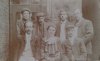
Unfortunately looking on Google Street Maps the buildings no longer exist. Would this area have been housing or business related? One piece of information I have details a shop in a house. If anyone has any old photos of the area that would be brilliant. Thank you :)
 
marandina 2...yes hampton st not to be confused with gt hampton st..hampton st started at tower st and ends at constitution hill..the street is still there expect for the bit from tower st to st georges st which is where the st now starts of course none of the old houses remain...pretty sure i have a couple of old photos of it before demo...will get back to you...click on the link below to take walk down hampton st

lyn

That would be amazing thank you! I clicked on your link and it seems they must have lived near to where the car park is now. Much appreciated :)
 
do you have the addresses for them as our map expert mikejee maybe able to provide a map highlighting where they were...in meantime here are a couple of photos...if you hover on the photos the dates taken will show

Newtown, Court in Hampton Street (Near St Georges Street), Front House Demolished. 14th May 19...jpgNewtown, Howard Street, Hampton Street (near St Georges) Courts and Back Houses. 14th May 1963.jpghoward st and hampton st 1963.jpgNewtown Hampton St 1957.jpgNewtown, Court in Hampton Street (Near St Georges Street), Front House Demolished. 14th May 1963.jpg
 
happy to help...as said in my last post if you have the numbers of where rellies lived in hampton st we maybe able to provide you with a map

lyn
 
ok hopefully mike can help with a map showing those numbers...would be interesting to see the location of them

lyn
 
I am not quite clear which numbers you are interested in. Below is a map c1951 which shows the numbers, though not that clearly. If you cannot read the ones in you are interested, then, if you let me know which numbers you want, I should be able to confirm them using directories

map c1951 showing hampton st.jpg
 
Lyn tells me she cannot see 39 and 40 on map. I am probably more used to deciphering these maps, so have marked 39 in red and 40 in blue with number given in same colour. To show the map in best detail you should save it and view saved version at maximum magnification

map c1951 showing nos 39 and 40 hampton st.jpg
 
great mike so if we go back to my post 6 my photo 4 we can see the factories to the right of what looks like brass something passage...again i cant make it out ? but its also showing on your map...so near and so far as no 39 and 40 are just out of shot on the left of the photo..pretty close though

lyn
 
Last edited:
Lyn tells me she cannot see 39 and 40 on map. I am probably more used to deciphering these maps, so have marked 39 in red and 40 in blue with number given in same colour. To show the map in best detail you should save it and view saved version at maximum magnification

View attachment 145723
I'm really pleased thank you so much. I shall go back and look at the link posted to find where they are
 
yes always best to read all the posts again just in case you miss something


lyn
 
how lovely thanks for sharing it with us...do you know how he was related to you and the year he may have written it...not being nosey just interested :)

lyn
 
Love the old maps from whatever era, especially as I live just up the road on Great Hampton St. As ever a good sprinkling of pubs, however if I’ve got it right the current Hen and Chickens at Constitution Hill/Henrietta St Junction isn’t marked as a pub. Any explanation? Cheers.
 
Love the old maps from whatever era, especially as I live just up the road on Great Hampton St. As ever a good sprinkling of pubs, however if I’ve got it right the current Hen and Chickens at Constitution Hill/Henrietta St Junction isn’t marked as a pub. Any explanation? Cheers.

well its certainly been there long enough..maybe they just omitted to mark it out unless only trading pubs were marked...not really sure

lyn
 
Yes I suspect same as the building is certainly quite old.
CONSTITUTION HILL 1. 5104 City Centre B19 Nos 27 and 29 (Hen and Chickens Public House) SP 0687 NE 25/7 II GV 2. Circa 1880 large corner public house with Italianate detailing relating to No 25. Tall 3 storeys yellow brick with ceramic, red brick and stone and terracotta dressings. Splayed corner. Upper floors articulated in coupled or single bays by giant banded ceramic brick pilasters, rising to spring of second floor window arches. Carved console brackets alternating with floral terracotta metopes support moulded stone cornice with yellow brick parapet above. Terracotta diaper panels and projecting heads in roundels are set above segmental arched first floor windows. Pilastered public house front including shop front No 29. The fascia with fretted valance to cornice.
 
Do you mean not marked on present maps? they very often do not show pubs. It is certainly marked on older large scale maps

map c 1889 lower constitution hill.jpg
 
Brian
Afraid I cannot offer an explanation. In earlier maps only pubs with full licenses were named and this sometimes carried on into post war maps, but this is obviously not the explanation here. I have noticed similar on the OS maps ofthat period, but am not sure why it happens
 
Brian
Afraid I cannot offer an explanation. In earlier maps only pubs with full licenses were named and this sometimes carried on into post war maps, but this is obviously not the explanation here. I have noticed similar on the OS maps ofthat period, but am not sure why it happens
Thanks as ever. Nothing major i had just briefly wondered if it hadn't always been a pub. I presume B H on some maps refers to a beer house i.e. not a full spirit licence? Cheers.
 
Yes, though . as often as not beerhouses were not marked at all, I did check the 1949 kellys in case briefly after the war it was not a pub, but it is listed as such there.
 
how lovely thanks for sharing it with us...do you know how he was related to you and the year he may have written it...not being nosey just interested :)

lyn
Hi Lyn, absolutely fine, happy to share. I am so lucky in that I have my Paternal Grandparent's photos and some family bits and pieces that came with them. The poem is in a book given to my GGrandfather's sister on her birthday which all the family wrote in for her. It was written in 1877. The writer is my GGrandfather's elder half brother who I believe is in the attached photo front row left. My GGrandfather is definitely back row right. I believe the elder man is my GGGrandfather. As they are wearing work aprons I wonder if this was taken at 39 or 40 Hampton Street as on census they are printers working from home.
 

Attachments

  • Clulees.jpg
    Clulees.jpg
    47.4 KB · Views: 5
Back
Top