• Welcome to this forum . We are a worldwide group with a common interest in Birmingham and its history. While here, please follow a few simple rules. We ask that you respect other members, thank those who have helped you and please keep your contributions on-topic with the thread.

    We do hope you enjoy your visit. BHF Admin Team
  • HI folks the server that hosts the site completely died including the Hdd's and backups.
    Luckily i create an offsite backup once a week! this has now been restored so we have lost a few days posts.
    im still fixing things at the moment so bear with me and im still working on all images 90% are fine the others im working on now
    we are now using a backup solution

Bomb damage in unidentified streets

Vivienne14

Kentish Brummie Moderator
Staff member
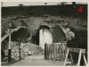
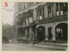
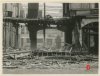
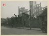
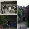
The Shoothill collection of photos contains many photos of bomb damaged streets which don't seem to have been identified. This first set #1 -#12 shows damage to non-residential properties. I've numbered each photo so that if you wish to comment it would be helpful to quote the number of the photo. Many thanks. Viv.

Photos #1 -#4
 

Attachments

  • image.jpg
    image.jpg
    62.4 KB · Views: 222
  • image.jpg
    image.jpg
    68.9 KB · Views: 201
  • image.jpg
    image.jpg
    67.9 KB · Views: 219
  • image.jpg
    image.jpg
    119.4 KB · Views: 211
Photo's #5 - #8
 

Attachments

  • image.jpg
    image.jpg
    97 KB · Views: 985
  • image.jpg
    image.jpg
    101.4 KB · Views: 621
  • image.jpg
    image.jpg
    66.4 KB · Views: 129
  • image.jpg
    image.jpg
    93.6 KB · Views: 133
Photo's #9 - #12
 

Attachments

  • image.jpg
    image.jpg
    89.5 KB · Views: 130
  • image.jpg
    image.jpg
    75.8 KB · Views: 627
  • image.jpg
    image.jpg
    58.7 KB · Views: 129
  • image.jpg
    image.jpg
    115.4 KB · Views: 372
The overhead tram lines may help identify some of them Viv - great idea.

4. Looks as if it may be the tunnel that was used as a shelter around Kings Heath/Stirchley way?
 
From Colin's B14 site

The raid of 9th. April 1941 on Fawley Grove resulted in the death of 11 people, some of whom were sheltering in the tunnel under the railway line.
 
great idea viv...bomb damage photos have always got to me...i was not even born when the 2nd world war broke out so have no idea of how terrifying it must have been...i have read a lot and can only imagine...photos like this will also serve as a reminder of the devastation..hardships and loss of life this country had to cope with for 6 long years..
 
From Colin's B14 site

The raid of 9th. April 1941 on Fawley Grove resulted in the death of 11 people, some of whom were sheltering in the tunnel under the railway line.

Re. #4 that looks spot on Bernard. Thanks. You can't see the tunnel from Fawley Grove, but you can see it from The Worthings on the other side of the railway tracks. The two modern views below from Streetview look different as the Google camera must have taken photos at different angles at different times! But they're both taken from The Worthings. Viv.
 

Attachments

  • image.jpg
    image.jpg
    409.3 KB · Views: 83
Last edited:
Looking at Image 5 in the forum linked pic below I notice there are trolley bus cables and trolley buses only ran on certain roads in Bham.
index.php
 
Last edited:
Although there are tram lines in the road, the overhead cable look close together so trolley buses might have run along the road in Image10 also.
index.php
 
Last edited:
Looking at Image 5 in the forum linked pic below I notice there are trolley bus cables and trolley buses only ran on certain roads in Bham.
attachment.php

Thanks Phil. re. #5 on the first floor the room has girders which look ornate/decorative. Wondering if these were found in particular buildings. (Reminds me of the girders of the interior of the Exchange - but it's not the Exchange building of course). Also there are shelves on the wall in ground floor room. Think there are items on the shelves but can't make them out. Viv.
 

Attachments

  • image.jpg
    image.jpg
    166.7 KB · Views: 32
Hi Viv - I am trying to find a map of trolleybus routes but have not found one yet. I remember seeing them in a road off High St by the Beehive shop and I think they ran along Digbeth and there may have been a terminus in Station St. They also ran to Nechells and maybe Washwood Heath.
Phil
 
I notice some radiators in image 6 look the same as those in image 5. Not that this helps much ....:)
index.php

ps. When I looked at these pics with a photo editor, negative images etc, I have the impression that some business names have been smudged out on this pic and on image 5. Perhaps it was wartime secrecy !
 
Last edited:
old Mohawk, I lived in Sheldon 1935 to 1939 and that was a trolley bus route, following the Coventry Rd to the Birmingham boundary, cannot remember where in City centre they terminated though. Eric
 
I don't say this with any great certainty, but I think the only trolleybus routes in Birmingham were Sheldon via Coventry Rd and Nechells Green Via Great Lister St & Bloomsbury St.
 
I notice some radiators in image 6 look the same as those in image 5. Not that this helps much ....
friendly_wink.png

attachment.php

ps. When I looked at these pics with a photo editor, negative images etc, I have the impression that some business names have been smudged out on this pic and on image 5. Perhaps it was wartime secrecy !


Agree Phil it was most probably wartime secrecy. There's another of those ornate girders/pillars to the left in this image too. Actually just realised #5 and #6 are the same building! Viv.
 

Attachments

  • image.jpg
    image.jpg
    334.2 KB · Views: 34
Last edited:
Without too much info the Birmingham trolleybuses had two principal routes. The Nechells 7 ran from Old Square and replaced tram 7 in 1922 and ceased in 1940 due to arcing of the wires and the possibility of the Luftwaffe making use of it. Bus route 43 took its place.

The other areas served commenced in January 1934 and all routes ceased in June 1951 being replaced by buses.

TB 56 Albert Street to Hay Mills and 57 Station Street to Hay Mills.

TB routes 92/93 (started 1934) went to Yardley from the two city terminii, which as mentioned, were Albert Street and Station Street respectively. 94/95 went to Sheldon from the two city terminii, (started 1936) and 96/97 went to Lode Lane (Rover complex) (started 1941). There was a 98/99 both only going part way from the city at the rush hour.

The Lode Lane services went, unusually, beyond the city boundary into Solihull UDC (called that at that time). This was because of motor fuel shortages whereas electricity was already generated by the Corporation for the existing tramway system.

The trolley, although I was not a frequent traveler on them were a smooth ride (usually) and of course much quieter than petrol and diesel motor buses. Many continental towns have, sensibly in my view, retained them.

However, in fairness to the City fathers the tramway system was old and worn out was restricted to its tracks and the trolleys just a small cog in a very large bus undertaking. The highest fleet numbered trolley was 90 but the first operational vehicle post WW2 was no 17. The earlier Nechells vehicles were stored during WW2 and then sold off.
 
Well none of us have actually seen the building in images 5 and 6 before the Luftwaffe had a go at it and maybe it was not rebuilt in the same style so we have to look through all the forum's pre-war City Centre and Old Street pics that were on trolley bus routes ....
encouragement.png
 
Without too much info the Birmingham trolleybuses had two principal routes. The Nechells 7 ran from Old Square and replaced tram 7 in 1922 and ceased in 1940 due to arcing of the wires and the possibility of the Luftwaffe making use of it. Bus route 43 took its place. The other areas served commenced in January 1934 and all routes ceased in June 1951 being replaced by buses. TB 56 Albert Street to Hay Mills and 57 Station Street to Hay Mills.
I've just had a quick look through Albert St and Old Square pics but seen nothing, but spotted this nice existing trolley bus pic on the forum and made it pop up here. Notice the overhead cables same as the bomb damage pic and they are on one side of the street.
index.php
 
Last edited:
There seems to be different building in the background suggesting another, parallel road. It is difficult to relate the central area to older periods in time as so much seems to have changed. However, the trolley buses used Carrs Lane (there was a large bomb site near the Moor Street junction), Moor Street, High Street and the way out, Digbeth, Deritend, Bordesley and the Coventry Road, They also used Hurst Street and Rea Street. I feel that the buildings are/were in the city centre and I believe they would have been demolished, probably being unsafe, rather than rebuilt at a later date. I do not know the Nechells route and roads but, for better or for worse, I am putting my money on Carrs Lane/Moor Street. But as Truly of the Yard might say - "he could be lying". :D
 
Looking at the left side of image 5 past the spiral fire-escape, the view seems planned as open (not done by the Luftwaffe) with factory-like buildings which leads me to think that it is not in the city centre but maybe not too far away. The trolleybus route may be on the same route going past the building in image 10. Probably an area that took heavy bombing on a particular night.
 
Radiorails. I must correct your attibution of the the bus/trolleybus thread to me. I only reposted a photo. The thread was the product, as were many others, of Peter Walker, unfortunately no longer with us.
 
Well, Mike, I don't know whether to say sorry or suggest you just keep the 'brownie points'.

I am sure Peter keeps a watchful eye on us and would be delighted to know his efforts those years ago are still put to good use.
 
Based purely on a hunch - just by the look of the two photos and known City bomb damage - could #5 and #6 be Martineau Street or thereabouts ? Viv.
 
We haven't much to go on with these pics and the trolley bus overhead lines in image 5 should have given us a chance with this one but I have yet to find a map of trolley bus routes in the city centre. I can find maps for Hull, Bradford, and Huddersfield, but not Brum. The post supporting the overhead lines is on the opposite side to the building on what could be a narrow street, so the trolley bus route was possibly one way as was common with some tram routes in the city centre. Could the building in image 5 be a hotel looking at the fire escape and ornate windows even on the 3rd floor ? There is a hint of a single track tram line in the street. The building is severely damaged so we would only find it in pre-war photos.

Perhaps I have looked at this pic too long but I can see two birds on a sign in the doorway. Either a penguin or puffin on the left and a pigeon on the right ....
smile-new.png

birds.jpg
 
Maybe I'm miles behind on this one, but the National Archives does have on-line resources regarding the spread of WW2 damage for each major city in England and Wales.

https://www.nationalarchives.gov.uk/records/research-guides/maps-bomb-census-survey.htm

As far as mapping is concerned there appears to be only a London-based enterprise which has converted the facts and figures to proper visual information

https://bombsight.org/#15/51.5050/-0.0900

but going back to the National Archives they do have lists of Birmingham detailing the names and addresses of premises hit with certain casualty numbers and exact dates

https://discovery.nationalarchives....92&_hb=tna&id=C9056&_q=Birmingham&name=Search

You can only go so far with the exact figures when you get to that stage.
 
Last edited:
If you read my post (No.8) Old Mohawk, you will see I list most of the streets that were used by the trolleybuses in the central area of the city. Maybe not every street, such as Rea Street, is listed bit if you know the city you should be able to work out the routes.
The reason I made mention of some streets was because I could not find a suitable map to post.
 
Re. Birds in post #26. The only thing I could think of was the Guiness toucan, but that's not a puffin! Viv.
 
Back
Top