• Welcome to this forum . We are a worldwide group with a common interest in Birmingham and its history. While here, please follow a few simple rules. We ask that you respect other members, thank those who have helped you and please keep your contributions on-topic with the thread.

    We do hope you enjoy your visit. BHF Admin Team
  • HI folks the server that hosts the site completely died including the Hdd's and backups.
    Luckily i create an offsite backup once a week! this has now been restored so we have lost a few days posts.
    im still fixing things at the moment so bear with me and im still working on all images 90% are fine the others im working on now
    we are now using a backup solution

Boars Head Inn

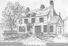
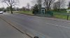
Hi Viv - the trees each side of the gate look the same and there is a low metal fence on the right in both photos. I think there is quite a time difference between the two photos ... so maybe both could be the same location !
Panning the map there are some buildings around the 'Perry Barr Wharf' which might be the buildings seen through the trees on the right.
 
Thanks Phil. I too think it looks pretty convincing. I'm beginning to think a large part of this - the old pub, the smithy and the pound would now be under the M6 raised road. And it's also occurred to me that the pound may well have been owned by the Boar's Head perhaps. In that field where we think the pound once was is where the 'new' 1930s Boars Head would have been built. It's probably some way into the field as there's a large forecourt in front of the 1930s BH. The problem with this location is the changing roads; the widening of Aldridge Road and the building of the M6 overhead. All very interesting and a little piece of history that's now hidden, but not forgotten. Viv.
 
A short distance from the Boar's Head along the College Rd behind the Canal Bridge is a tall chimney and on the road 14 bar telephone poles. Date c1931.
CollegeRdCanalBridge.JPG
 
Yes Phil. Very distinctive telegraph poles. Aldridge Road still has them on both sides of the road (albeit not as tall) and there's one alongside the 1930's Boars Head building. Viv.
 
According to Streetview this is where College Road and Aldridge Road meet - under the M6. College Road to the right must have been widened after the old Boars Head photos posted so far. At this point College Road now becomes a dual carriageway. There's a telegraph pole alongside the Boars Head just where the side extension to the pub ends on College Road. This may or may not tell us something !!! Viv.

image.png
 
Last edited:
hi viv i am sure i posted a photo of the old smithy some years back now..cant find it in my files will keep looking..

would imagine you have seen this link that OM posted on the christ church thread...its amazing and can pinpoint what was there back in the day to a side by side todays map...its very adictive and ive been all over brum this weekend lol so just in case here it is...all you do is move the arrow around on the old map and it follows around on the today map


https://maps.nls.uk/geo/explore/sid...at=52.5177&lon=-1.9004&layers=6&right=BingHyb
 
Thanks Lyn, shall have a play this evening. Be nice if you can find the photo of the Smithy, all adds to our understanding. Viv.
 
will keep looking for it viv...enjoy the maps site..may not see you for a few days now lol

lyn
 
A description of the Smithy and cottage opposite the Boar's Head. From the Perrybarrbeyond site Viv.

image.jpeg
 
Last edited:
viv i think i made a mistake in thinking i had a photo of that smithy..i was thinking of another one...one may turn up though

lyn
 
I used to catch the 113 bus out of Birmingham c.1962, and when it reached the Boar's Head it forked right and ran along College Road. You then had a good view of a bungalow which had a front garden full of gnomes! I'd love to see a photo of it but of course at the time it never occurred to me to take a camera with me.
 
I remember those gnomes very well, Paula! The Mail did an article on them years ago. Not there now, sad to say. Real eccentrics are few and far between these days, unfortunately.

Close by was a chap who printed and enlarged technical drawings in his front room (another bungalow) and I went there quite a few times for my then-employer.

G
 
I forgot to mention that back in I think the late 1960's The Boar's Head was managed by Jimmy Dugdale, former Villa player and member of the 1957 FA Cup Final winning team. My dad knew him vaguely, as at one time he lived in The Broadway, where we did. I can't recall ever going into The Boar's Head, but may well have done. As far as I'm aware it's still open.

G
 
My nan had one of those bungalows near the raised motorway flyover, but before the motorway was built. She would have been there in the 1920s/30s, presumably when they were first built. I've seen pictures of them virtually surrounded by fields.

She later moved to a house in nearby Blakeland Road, again probably when they were first built. The 'gnome' bungalow must have been after her time otherwise I'd have 'gnomed' about it. Ha ha. I should remember it as I went past on the bus every day in the early 1970s, but don't recall it. So maybe the gnomes had moved on to wherever gnomes move on to by the 70s. Viv.
 
There's a fenced off area if you zoom in on Mike's satellite views - I've zoomed in below, the early BH site would be to the left of the M6. Perhaps this is the place. It would definitely have to be left of the M6 near the start of the Aldridge Road. Is there an easy way of estimating the distance from the current Boar's Head (junction of College Road and Walsall Road - noting that the buildings are set back with a large frontage area) to the possible position on the Aldridge Road? Is that 100 yards?

I wonder if the early Boars Head was demolished as part of the development of the Walsall Road? (Walsall Road is just above the M6 veering off to left, whilst College Road veers off to the right). Just a thought. Viv.

View attachment 103029
Both the 1758 building and the 1902 buildings were demolished, the latter in 1936. The substation was built on the site. the 1937 building is now what is Wold Buffet.
 

Attachments

  • Boar's Head (Original).jpg
    Boar's Head (Original).jpg
    334.6 KB · Views: 28
  • Boar's Head  (Very Early).jpg
    Boar's Head (Very Early).jpg
    100.2 KB · Views: 34
  • Boar's Head (New).jpg
    Boar's Head (New).jpg
    95.1 KB · Views: 34
  • Boar's Head (Borded Up, March 2007).jpg
    Boar's Head (Borded Up, March 2007).jpg
    183.4 KB · Views: 33
Welcome Keith and thank you for the info. So presumably both of the earlier buildings were on Perry Hall land. The earlier two buildings would have effectively backed onto what is now the park. How interesting. I remember the sub-station, and I see it’s still there.

And all the shenanigans tracking down Booth (forger) would have happened in a different spot to where I’d imagined.

Viv.
 

Attachments

  • 52F2EE6A-3B0C-4290-86D3-60CB45FA5930.jpeg
    52F2EE6A-3B0C-4290-86D3-60CB45FA5930.jpeg
    466.3 KB · Views: 25
It's interesting how the second pub imitates the style of Perry Hall. The Gough's are everywhere! When they were refurbishing St Philip's they re-gilded the weathervane (real gold leaf and scaffolding up for months). It was only then that we found out that a boar's head sits on top of the orb.
 
Welcome Keith and thank you for the info. So presumably both of the earlier buildings were on Perry Hall land. The earlier two buildings would have effectively backed onto what is now the park. How interesting. I remember the sub-station, and I see it’s still there.

And all the shenanigans tracking down Booth (forger) would have happened in a different spot to where I’d imagined.

Viv.
Hi, other side, it faced the park. College Road was made wider, so the original site is much smaller than it was.

Just Perry Barr side of the M6, facing the Park, more or less where the bus stop from Perry Barr is now, there are some green gates, with an electricity substation behind. That is where the first two buildings of the Boar's Head Inn were (100yards SW to the current building). I found a photo of the current site, before the present Boar's Head was built, but I can't remember where I found it. If I can find it, again, I'll share it.
 
Both the 1758 building and the 1902 buildings were demolished, the latter in 1936. The substation was built on the site. the 1937 building is now what is Wold Buffet.
I found it ! Boar's Head Inn is on the far left. In the centre is a tree, to right of that is a signpost. The site of the new build (1937) is between them. I belong to a Facebook Group of old pictures. It was on there.
 

Attachments

  • Boar's Head (& New Site, 30.3.31).jpg
    Boar's Head (& New Site, 30.3.31).jpg
    47.8 KB · Views: 24
Going through these posts(only just found this thread) saw about Jimmy Dugdale.When I worked behind the bar at the Villa Supporters Club in the late50/60s Jimmy used to come into the back room for a quicky before the matches on a Saturday.Great Laugh him and his good lady.
 
Last edited:
I found it ! Boar's Head Inn is on the far left. In the centre is a tree, to right of that is a signpost. The site of the new build (1937) is between them. I belong to a Facebook Group of old pictures. It was on there.

thanks keith that photo is already on this thread...post 52 but better to have it twice than not at all

lyn
 
Reading these posts are fantastic. Does anyone remember the licensee Fred Reid he was there mid to late 1970s. He then moved to manage the Wylde Green pub in the 1980s. A charming quietly spoken man. I wonder where he went after the Wylde Green. Drank regularly in both.
 
Re post #91. Still can’t see how it’s on that side of the road, surely it must have been on the left looking towards Kingstanding. Hence th3 parkland behind it. The map seems to show it on the left. On the other side of the road were/still are th3 old row of cottages. Viv.
 
Re post #91. Still can’t see how it’s on that side of the road, surely it must have been on the left looking towards Kingstanding. Hence th3 parkland behind it. The map seems to show it on the left. On the other side of the road were/still are th3 old row of cottages. Viv.
No, on the left, facing the park. The other side of the M6, there are some green gates, behind which is an electricity substation. That is the site of the Boars Head Inn. College Road was widened, so the site is not as big as it once was. The houses are still there, but the front gardens went, most are shops, now - fish & chips, pizza. The electricity substation has become a huge bin. There is so much rubbish thrown over the gates - a shame, if we consider what was once there. I'll take some pictures.
 
No, on the left, facing the park. The other side of the M6, there are some green gates, behind which is an electricity substation. That is the site of the Boars Head Inn. College Road was widened, so the site is not as big as it once was. The houses are still there, but the front gardens went, most are shops, now - fish & chips, pizza. The electricity substation has become a huge bin. There is so much rubbish thrown over the gates - a shame, if we consider what was once there. I'll take some pictures.
I said I would take some pictures; the green gates are now grey ! The Fish & Chips is now a Chinese.
 

Attachments

  • Boar's Head  (Very Early , 1893 ).jpg
    Boar's Head (Very Early , 1893 ).jpg
    100.2 KB · Views: 16
  • Present 1.jpg
    Present 1.jpg
    369.5 KB · Views: 16
  • Present 2.jpg
    Present 2.jpg
    367 KB · Views: 13
  • Present 3.jpg
    Present 3.jpg
    96.5 KB · Views: 13
  • Present 4.jpg
    Present 4.jpg
    213.2 KB · Views: 13
  • Present 5.jpg
    Present 5.jpg
    212.7 KB · Views: 14
Re post #91. Still can’t see how it’s on that side of the road, surely it must have been on the left looking towards Kingstanding. Hence th3 parkland behind it. The map seems to show it on the left. On the other side of the road were/still are th3 old row of cottages. Viv.

yes i agree with you viv...keith did you check out that map site i posted a link to on post 92 it takes all the guessing work out for us..

lyn
 
The Boars Head, Aldridge Road, Perry Barr. This pub was named the Boar's Head after the Gough family coat of arms which shows a boars head. It was built in 1758 and demolished in 1936. The present Boar's Head is on a slightly different site.

This watercolour is by Warren Blackham who was working between 1870 and 1900. He was a member of the Royal Birmingham Society of Artists and exhibited 41 paintings.


The Boars Head, Aldridge Road, Perry Barr. This pub was named the Boar's Head after the Gough ...jpg
 
Back
Top