DerekThe pattern of entrances and the apparent end of the row of buildings at the corner with Hockley St fits the photo being Barr St.. Also around 1900 no 65 is lsited as a shopkeeper, which usually means general provisions and this would fit with tea and coffee sign. No 63 on the edge of the photo wasa pearl button works
Sorry my choice of colour for numbers hasn't shown up too well
View attachment 134911New member, first post. Been looking everywhere for pics of Barr st, I lived at 8/53 from 1950-57 Deuch & Brenna ( scrap metal works ) was on the corner of Harford st & Barr St just to the left of this pic, thanks again it’s made my day
-
Welcome to this forum . We are a worldwide group with a common interest in Birmingham and its history. While here, please follow a few simple rules. We ask that you respect other members, thank those who have helped you and please keep your contributions on-topic with the thread.
We do hope you enjoy your visit. BHF Admin Team -
HI folks the server that hosts the site completely died including the Hdd's and backups.
Luckily i create an offsite backup once a week! this has now been restored so we have lost a few days posts.
im still fixing things at the moment so bear with me and im still working on all images 90% are fine the others im working on now
we are now using a backup solution
You are using an out of date browser. It may not display this or other websites correctly.
You should upgrade or use an alternative browser.
You should upgrade or use an alternative browser.
Old street pics..
- Thread starter Astoness
- Start date
Yes it is the Star, I lived opposite from 1957 to 63, when the whole area was demolishe, it was the corner of Well st and bows, the shop opposite was Brooks grocers I lived two doors away at 112, so pleased to find this on my first couple of days on the site, thank youcracking photo of bsw...wonder what the name of the ansells pub is on the left corner
lyn
Derek Knowles
MikeHughes
Brummie babby
We lived at number 21 Lozells St between 1957 and 1968. I was only 11 years old when we left so my memory is quite sketchy, to be honest. The people who lived at number 23 when we were there were only known to me as Uncle Arthur and Aunty Blanche. Not sure if these are the people in question and probably useless information but it's just my two penneth worth.I know Lozells Street quite well, my family coming from Lozells. I would therefore assume it was the Registrar himself who lived at number 23. Co-incidence or what a relative of mine according to the Electoral Rolls was living at 23 Lozells Street, in 1955.
MikeHughes
Brummie babby
They may well have done then. We used to walk to school every day from Lozells St via Wills St and then Church St. I remember the "pea-soupers" - do you? Used to wind my mom up by stepping just out of sight in the fog. She wasn't impressed 
We used to go to the Villa Cross every Saturday morning without fail for the Saturday morning matinee. I went to Sunday school and boy scouts in Lozells St Hall.
We used to go to the Villa Cross every Saturday morning without fail for the Saturday morning matinee. I went to Sunday school and boy scouts in Lozells St Hall.
oh crikey mike those pea soupers were great for playing tracking around the streetsThey may well have done then. We used to walk to school every day from Lozells St via Wills St and then Church St. I remember the "pea-soupers" - do you? Used to wind my mom up by stepping just out of sight in the fog. She wasn't impressed
We used to go to the Villa Cross every Saturday morning without fail for the Saturday morning matinee. I went to Sunday school and boy scouts in Lozells St Hall.
lyn
Lloyd
master brummie
The 1955 electoral roll has Arthur W. and Blanche E Davis at 23 Lozells Street, along with William J. and Florence M. Heslington.We lived at number 21 Lozells St between 1957 and 1968. I was only 11 years old when we left so my memory is quite sketchy, to be honest. The people who lived at number 23 when we were there were only known to me as Uncle Arthur and Aunty Blanche. Not sure if these are the people in question and probably useless information but it's just my two penneth worth.
MikeHughes
Brummie babby
What service did you use to search for that information, was it Ancestry or Find My Past or something else?The 1955 electoral roll has Arthur W. and Blanche E Davis at 23 Lozells Street, along with William J. and Florence M. Heslington.
Lloyd
master brummie
What service did you use to search for that information, was it Ancestry or Find My Past or something else?
Welcome to Midlands Historical Data - MHD Digital Library
Country Road
knowlegable brummie
Sorry no, our street party was of Lee Bank, it was on Elvetham Rd, small Rd Island at the bottom and Bell Barn Rd ran across, we had a tin with chocolates in I believe, shame no pictures took, none I knew of anyway.Hi Does anyone have a photo of the Bankes Road party for the Coronation?.
Regards
RosieT
Lorraine Webster
New Member
Hi any idea where this was as I note the cafe is called The Boulevard - might it be in Quinton?gooch st highgate dated 1967
View attachment 117391
rear of st martins st edgbaston dated 1967
View attachment 117392
stechford road yardley dated 1928
View attachment 117393
shaftsmoor lane dated 1962
View attachment 117394
A Sparks
master brummie
I think the Editions B42 relates to the publisher, they are a French Publisher.The area B42 is shown on the map here View attachment 173505
RobT
Acemeccanoman
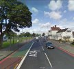
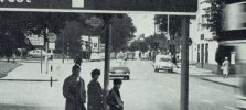
Yes looks like Stratford rd junction with School Road/Colebank rd, Hall Green College on left, The Horseshoe Pub on right,Had second thoughts, Stratford Road is the A34 so coming up to the ringway along there maybe
No.11 Outer Circle bus crossing
Last edited:
A Sparks
master brummie
I did wonder that?Scott Arms perhaps.
oldMohawk
gone but not forgotten
Yes I agree although I have a slight problem with the Horseshoe Pub although it has changed a lot over the years. The website from the link below is interesting .... click on the pic to see written contentYes looks like Stratford rd junction with School Road/Colebank rd, Hall Green College on left, The Horseshoe Pub on right,
No.11 Outer Circle bus crossing
farmerdave
master brummie
The present road sign approaching the Stratford Road - Cole Bank Road junction indicates A34 to City Centre straight on: Kings Heath and Stirchley to the left on B4146: and Acocks Green and Yardley to the right on B4146 (A4040). These are far more local destinations compared to Walsall, Dudley and Nuneaton on the road sign under discussion. Could have just been a change of procedure because the original photograph does look like what I remember of that junction.
RobT
Acemeccanoman
This is a shot from 2009, just past a bus stop on left (yellow dotted lines), note large tree branches on left as in photoYes I agree although I have a slight problem with the Horseshoe Pub although it has changed a lot over the years. The website from the link below is interesting .... click on the pic to see written content
middle left: same slip road from Hall Green Library & Telephone Exchange

Last edited:
RobT
Acemeccanoman
The excellent link shown by oldMohawk has the photo in very high resolution.Yes I agree although I have a slight problem with the Horseshoe Pub although it has changed a lot over the years. The website from the link below is interesting .... click on the pic to see written content
The sign further on the left does say Kings Heath is 2 1/2 miles to the left, but I agree I do not recognise the front of the Horseshoe as it is seen here.

RobT
Acemeccanoman
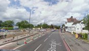
Would you believe this was the same view in 2011, although it went back to the 2009 view later. Large tree removed.This is a shot from 2009, just past a bus stop on left (yellow dotted lines), note large tree branches on left as in photo
middle left: same slip road from Hall Green Library & Telephone Exchange
View attachment 173515

A Sparks
master brummie
Thanks!Yes I agree although I have a slight problem with the Horseshoe Pub although it has changed a lot over the years. The website from the link below is interesting .... click on the pic to see written content
Interesting comments.


