• Welcome to this forum . We are a worldwide group with a common interest in Birmingham and its history. While here, please follow a few simple rules. We ask that you respect other members, thank those who have helped you and please keep your contributions on-topic with the thread.

    We do hope you enjoy your visit. BHF Admin Team
  • HI folks the server that hosts the site completely died including the Hdd's and backups.
    Luckily i create an offsite backup once a week! this has now been restored so we have lost a few days posts.
    im still fixing things at the moment so bear with me and im still working on all images 90% are fine the others im working on now
    we are now using a backup solution

Aston Interactive Map

brummy-lad

master brummie
www.leroux.co.uk/aston

A couple of years ago I posted a link to an interactive map of Aston, the idea being that you would be able to 'take a walk' along various Aston Streets. I was never happy with this, my programming skills were very basic and each point had to be clicked to display the image.
Now, thanks to having plenty of time as a result of lockdowns, I have been able to improve the map so that on hovering over the blue spots the image is displayed. The image can be opened in a new window by clicking, if you wish to copy it.

Please test it out and let me know if you have any issues or suggestions. A few images are very poor quality but have been included because perhaps that is all we have (or will ever have).

I have been 'stunned' by the quality and content of many of the images used (virtually all off BHF), In particular my favourites are:
Avenue Road
Work on Hockley Brook, High Street
Colour image of Aston Cross looking up Park Lane (with Scrivens camera shop)

If it proves useful I will add more streets in the future, eventually I would like to cover Nechells and later the city centre (although that may be a bit ambitious).

The site may be displayed as 'not secure' but there is no personal data being collected and you don't have to enter any details to view the site.

Googling 'not secure' gives the following statement: 'The notification does not mean that the site is compromised or not functioning correctly'.
 
Brummy-lad that's brilliant! The redevelopment of most of the area happened before I was a teenager so my memory of it isn't that good, but this really helps me get my bearings.
The only problem for me will be to try and not spend too much time on it! Thanks very much for this.
 
John,

That's an excellent piece of work. One which appears to be missing is the Traveller's Rest on the corner of Bartons Bank and Whitehead Road and there is a picture in post #11 here:-
https://birminghamhistory.co.uk/for...maltsters-aston-birchfield.14098/#post-696328 or maybe you haven't got around to that section yet.

Maurice :cool:
Thanks Maurice, just the feedback I need, I will add that to the map. I did trawl through lots of threads on BHF but I'm sure I've missed some important images.
 
John

That is an excellent piece of work I am well impressed. Have you thought about applying for a grant to pay the hosting costs and to help you develop the project further? I certainly think it has a lot of potential.
 
John

That is an excellent piece of work I am well impressed. Have you thought about applying for a grant to pay the hosting costs and to help you develop the project further? I certainly think it has a lot of potential.
Thanks for those words of encouragement, I have really enjoyed doing the research on the locations and businesses.
In reality it is only the lockdown that has given me the time to push this project on, but yes it would be good to extend it further. I'm fortunate that there is no hosting cost to me as I am doing it through a business I have now retired from which my son has taken over. Thanks again.
 
John,

Thanks for that. Eric Gibson and I can now see the entrance that led to our grandmother's houses in what used to be called Barton's Place way back when the houses were built. We were more often known as back of 15. Cheers.

Maurice :cool:
 
John,

Thanks for that. Eric Gibson and I can now see the entrance that led to our grandmother's houses in what used to be called Barton's Place way back when the houses were built. Cheers.

Maurice :cool:
What is amazing is that although there are only 2 images of Barton's Bank, those 2 images cover all of the houses on the north side of the street.
 
Hi Dennis, thanks for your kind description of the website. I have no problem whatsoever with this being displayed on another site. I hope viewers get as much enjoyment from it as I did creating it.
 
Wow, you are a star! I am an admin on Up Yer Brum on the dreaded FB......But have been a member here since 2010....

Shall I bill you as Brummy Lad, John, or whatever suits you? Once again...many many thanks.......
 
This is really fantastic!!!!!!!!!!! It really brings to life what the real view is of life behind just names of streets. Thanks so much for the hard work put into this :) it's really appreciated.
 
Wow, you are a star! I am an admin on Up Yer Brum on the dreaded FB......But have been a member here since 2010....

Shall I bill you as Brummy Lad, John, or whatever suits you? Once again...many many thanks.......
Hi Dennis, John will do fine, I don't use FB very much,when I do it's mainly to check where my sons are holidaying in the world (so obviously at the moment that's nowhere). I have seen some amazing pics of B'ham on there when I take the time to look.
 
Thank-you all for the appreciates. The streets I have added so far have rekindled fond memories, I will be adding Phillips Street soon but after that if you have any streets you would like me to add please let me know (assuming of course that enough quality images can be found and that the map covers it). Also, if you could let me know if you have any problems with slow loading of the website, I have taken some steps to speed it up but can only test it on my PC and laptop and would like to know how it performs on different set-ups.
 
Porchester Street will be added in the next week or so (as my dad and brother worked at J. R. Pearson), after that I am open to suggestions (subject to having suitable images of course).
 
Hi and thank you to all for your help. Does anyone know if the "motor accessories works" nearly opposite Shefford Road on the interactive map is no. 159-165 Aston Brook Street. I remember getting off the bus and walking up ASB and F Prime and Son was on the right hand side. As it was very close to Norton Motor cycles my dad would get a call, usually in person, from them to make a tool or something to get them "out of a hole" as they knew he could and would make it within a few hours. F Prime & son were there between 1930 & 1970. Are there any photos of that end of the road? Thanks Jen
 
Hi and thank you to all for your help. Does anyone know if the "motor accessories works" nearly opposite Shefford Road on the interactive map is no. 159-165 Aston Brook Street. I remember getting off the bus and walking up ASB and F Prime and Son was on the right hand side. As it was very close to Norton Motor cycles my dad would get a call, usually in person, from them to make a tool or something to get them "out of a hole" as they knew he could and would make it within a few hours. F Prime & son were there between 1930 & 1970. Are there any photos of that end of the road? Thanks Jen
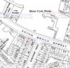
This map should answer your question
aston brook st.JPG
 
Hi and thank you to all for your help. Does anyone know if the "motor accessories works" nearly opposite Shefford Road on the interactive map is no. 159-165 Aston Brook Street. I remember getting off the bus and walking up ASB and F Prime and Son was on the right hand side. As it was very close to Norton Motor cycles my dad would get a call, usually in person, from them to make a tool or something to get them "out of a hole" as they knew he could and would make it within a few hours. F Prime & son were there between 1930 & 1970. Are there any photos of that end of the road? Thanks Jen
Hi Jen,

Did you see this, showing the location? Post #55

 
The following images have been added to the map:

www.leroux.co.uk/aston

Guildford St. (30), Porchester St. (9), Gt. Russell St. (2), Clifford St. (1), Lennox St. (1), Geach St. (1), Farm St. (1).

It may take a while to load all the images after the map has appeared but normally less than 30 seconds.
If you have any issues with the website or content please let me know.
Most images are excellent, a few are poor quality, if any member thinks they have a better quality copy than those used please get in touch.
 
Back
Top