• Welcome to this forum . We are a worldwide group with a common interest in Birmingham and its history. While here, please follow a few simple rules. We ask that you respect other members, thank those who have helped you and please keep your contributions on-topic with the thread.

    We do hope you enjoy your visit. BHF Admin Team

New unseen photos with no locations

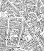
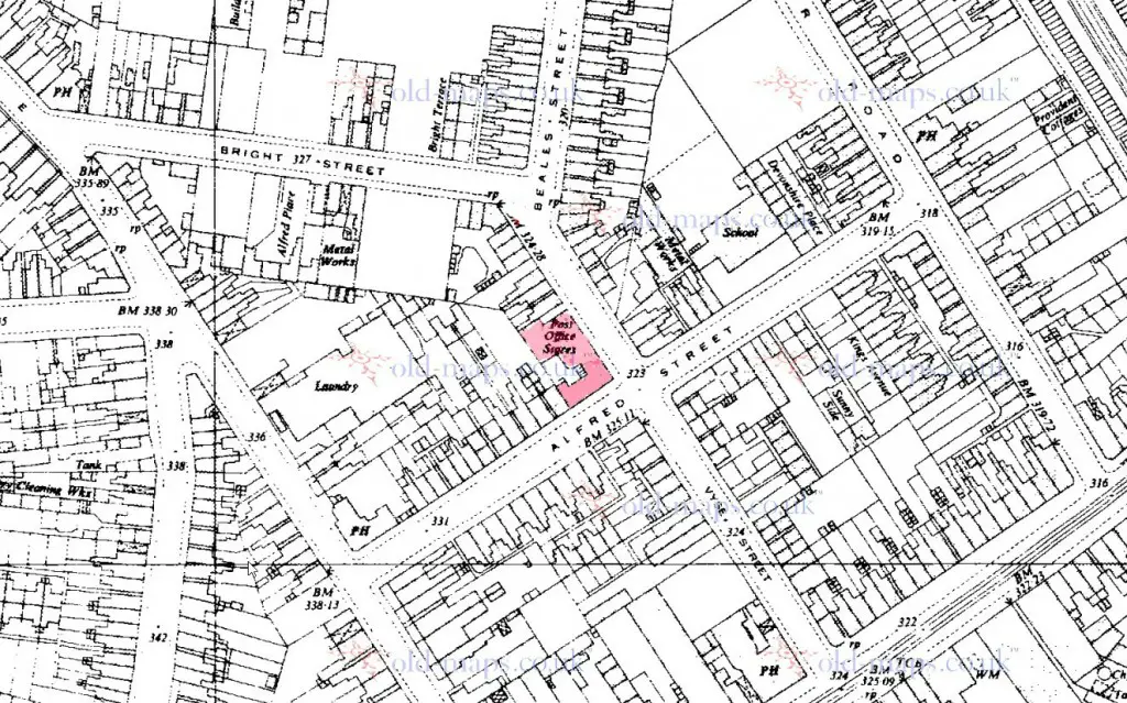
The snip below dated 1946 from https://www.britainfromabove.org.uk/image/eaw002836?x=408698&y=289610&extent=1000&ref=70 shows Atkinsons Brewery which was in Queen St. Some interesting views of the area on the website and some curved roofs visible in other views but not 'our' curved roof seen yet.
View attachment 98013
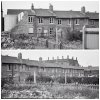
There is a curved roof to the right of the brewery but does not look like the roof we are interested in.

Interesting picture. Note how the spire of St Peter & St Paul soars over the surrounding terraced streets and even the tall brewery; most impressive.
 
Interesting picture. Note how the spire of St Peter & St Paul soars over the surrounding terraced streets and even the tall brewery; most impressive.
The Atkinsons Brewery did standout and in post #145 Eric mentioned the following
Referring to post #129 I was born in Queens Rd in 1930 next door to Atkinsons brewery (they owned the houses)Eric
The Atkinsons Brewery can be seen in some photos in this forum post https://birminghamhistory.co.uk/forum/showthread.php?t=38980&p=435938#post435938
 
Aston Lad. I honestly do not know myself as to the Church Road/Bright St pub. I never lived round there and am only going by maps and directories. I did not think that the pub looked as if it was on a corner, but now some seem to think it was, So i don't really know.

I have just been contacted by the publisher and writer of books on pubs, Andy Maxam who says the pub is The Crown, corner of Church Rd and Alfred St Aston.
 
The first of Mike's photos n post #193 has an unusual architectural feature. There's a fascia (which looks like a horizontal barge board) running along the lower edge of the roof. The house would once have adjoined another house to the right. Wonder why it had that extra decoration. Does it indicate it's a pub? (To me it's very reminiscent of the boards decorating roofs at railway stations). If it's a pub, would it have been slightly odd to have the decoration on the rear of the building? It certainly looks like it was an added decorative feature to make the building stand out. Or maybe this isn't the rear of the building? Maybe this is a front view with the houses having extra fascia decoration because they formed the centre of a symmetrical row of cottages with the right-hand side of the row reflecting what we can still see on the left side.Viv.

image.jpg
 
Last edited:
Happyguy

The photo seems to match up with the map pretty well, any chance of Mr Maxam providing a photo as I understad he has access to M & B's photo archives that would be the icing on the cake.

Didn't someone suggest this pub earlier, I'll have to go back and have a look if only to satisfy my curiosity.
 

Attachments

  • crown.JPG
    crown.JPG
    224.7 KB · Views: 28
I have just been contacted by the publisher and writer of books on pubs, Andy Maxam who says the pub is The Crown, corner of Church Rd and Alfred St Aston.
Hi Happyguy - That is interesting, so if his information is correct and looking at Mike's map in post #163 which shows the position of the Crown, it would suggest that the photo was taken from Church Road/Lane and the road we can see to the right of the building in Mike's photo is Alfred Street.
 
pub.jpg
Hi Happyguy - That is interesting, so if his information is correct and looking at Mike's map in post #163 which shows the position of the Crown, it would suggest that the photo was taken from Church Road and the road we can see to the right of the building in Mike's photo is Alfred Street.

Well with considerable thanks to Andy Maxam, we can confirm by the photograph he has kindly supplied from his collection that it is indeed The Crown.
The Pub closed down in 1974, and this photo was taken in 1965.
 
excellent happyguy thank you for your efforts and please pass on thanks to andy maxam as well..no doubt about it being right..lovely to see the old houses to the left of the pub as well....so at long last we all know where mike was standing all those years ago lol

lyn
 
Thanks happyguy for your efforts and not forgetting aston lad's brother who thought it was the Crown in post #161 ....
encouragement.png
 
Happyguy

The photo seems to match up with the map pretty well, any chance of Mr Maxam providing a photo as I understad he has access to M & B's photo archives that would be the icing on the cake.

Didn't someone suggest this pub earlier, I'll have to go back and have a look if only to satisfy my curiosity.

phil post 119 paulyx suggested it was the castle on the corner of church road and alfred road so he got the position correct but not the name of the pub unless of course it changed names at some point...but aston lads bro got the name right...well done to everyone..good team effort and we got there in the end..

lyn
 
Last edited:
Mikes two photos from post # 193 are a similar view but panned to the left to show demolition in progress. If you line up the first lamp post, you'll get my drift. The top view excludes the unusual factory because the camera position has moved across to the left. It looks like this was a court or square with perhaps a play area in the middle. On the very edge (top left) of the top photo is the side of a tall building or structure. Viv.
 

Attachments

  • image.jpg
    image.jpg
    428.5 KB · Views: 54
Last edited:
the structure is the post office stores on the corner of bright st / beales st. the picture is taken from the back yards of church lane, with frank grounds to the left
 
Many thanks. Paulyx. Do you mean the photo of the cottages; one with white fascia being the Post Office? Viv.
 
the structure is the post office stores on the corner of bright st / beales st. the picture is taken from the back yards of church lane, with frank grounds to the left

thanks paulyx....this is not my neck o the woods so could you tell me what is frank grounds please..

lyn
 
Well that seems to identify the peculiar building, and I suppose a lot of soldering (which I think was mentioned ) might have gone on there. Here is a map of the surrounding area c 1952. Perhaps we can identify the possible court.

map_c_1952_showing_area_around_post_office_stores_beales_st.jpg
 
My guess would be the court to the south-east of the building with "Sunny side" in it
 
time for another one from me folks...hoping someone may recognise the frontage of this pub...
 

Attachments

  • img941.jpg
    img941.jpg
    460.2 KB · Views: 117
hi jim sorry im not with you...there was never a pub called the trees in anglesey st and the above photo has never been seen before..just wondering if you have posted on the wrong thread

lyn
 
In the 1962 Kellys there is The Trees Inn 11-13 Bristol Road. the map below shows the position.I can remember a modern pub about there, though can't remember the name. The position is shown on the c1955 map below

map_c_1955_showing_the_trees_inn_11-13__bristol_road.jpg
 
The only Trees I know was on the Bristol Road.
There is an image which Google finds, of a Trees Pub on Bristol Rd and it's windows and doorway look the same but the sign has changed, but it is the same pub. No doubt someone will be along soon to upload a pic of it ...
friendly_wink.png
 
hi jim sorry im not with you...there was never a pub called the trees in anglesey st and the above photo has never been seen before..just wondering if you have posted on the wrong thread

lyn

Hi Lyn
Found this on a 2013 thread "The Trees, Hockley Brook" But I do remember the pub on the Bristol Rd just out of town from the Bristol cinema


Screenshot (141).jpg
 
Back
Top