Phil
Gone, but not forgotten.
Macca
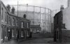
I thought the Railway Station was higher up on the bridge, the workmen look as if they are just turning out of Metropolitan Rd (now a trading estate). There were several large factories down there but I wouldn't mind betting they were turning out of the Metropolitan Railway Carriage & Waggon Co Ltd, forerunner of Metropolitan Cammel Works.
Phil

.JPG")